Telida, Alaska
| Telida | |
|---|---|
| Unincorporated community village | |
| Tilaya-di, Tilayadi’ | |
 Telida Location within the state of Alaska | |
| Coordinates: 63°38′N 153°28′W / 63.633°N 153.467°WCoordinates: 63°38′N 153°28′W / 63.633°N 153.467°W | |
| Country | United States |
| State | Alaska |
| Census area | Yukon-Koyukuk |
| Government | |
| • State senator | Lyman Hoffman (D) |
| • State rep. | Bryce Edgmon (D) |
| Elevation[1] | 617 ft (188 m) |
| Time zone | Alaska (AKST) (UTC-9) |
| • Summer (DST) | AKDT (UTC-8) |
| FIPS code[1] | 02-75800 |
| GNIS ID[1] | 1410727 |
Telida (Tilaya-di[2] or Tilayadi’[3] in Upper Kuskokwim) is an unincorporated community located in the Yukon-Koyukuk Census Area in the U.S. state of Alaska.[1]
Geography
Telida is located at 63.3832623N, 153.2803835W,[4] on the south side of the Swift Fork (McKinley Fork) of the Kuskokwim River, about 40 km (25 mi) by air northeast of McGrath.
The word Telida means 'whitefish' in the Upper Kuskokwim Athabaskan language.
History
Athabascan folklore says that Telida's residents are descended from two sisters, survivors of an attack by another Athabascan group, who fled from the McKinley area to Telida Lake where they discovered whitefish at its outlet. The women were later discovered by stragglers from the attacking party, who married the women and settled at the lake. The village of Telida is named after the lake.
The village has been located in three different places. The first village was located about 2 km (1.2 mi) upstream from present-day Telida. It was first visited by United States army explorers in 1899. When the Swift Fork changed course, the village was moved what is now called "Old Telida." In 1916, some residents moved to the present day site, "New Telida," about 7 km (4.3 mi) downstream from Old Telida. A Russian Orthodox church, St. Basil the Great, was built in Old Telida in 1918. A roadhouse was also built during this period. In 1920-21, Old Telida was a stopping point on the trail between McGrath and Nenana and hundreds of people used the roadhouse. In 1935, Old Telida flooded and the remaining residents relocated to New Telida.
In 1958, a fire burned an area in which the villagers constructed an airstrip. Many families moved to Takotna during the school year and lived in Telida only during summer months. A school was built in Telida in the 1970s, but the population has declined to almost nothing since.
Transportation
Telida Airport (IATA: TLF, FAA: 2K5) is a public use airport serving Telida.[5][6]
References
- 1 2 3 4 "Feature Detail Report for: Telida (populated place)". Geographic Names Information System. United States Geological Survey. March 31, 1981.
- ↑ ANLC : Alaska Native Place Names
- ↑ Telida Village Founding by Raymond L. Collins
- ↑ "US Gazetteer files: 2010, 2000, and 1990". United States Census Bureau. 2011-02-12. Retrieved 2011-04-23.
- ↑ FAA Airport Master Record for 2K5 (Form 5010 PDF). Federal Aviation Administration. Effective November 15, 2012.
- ↑ "IATA Airport Code Search (TLF: Telida)". International Air Transport Association. Retrieved June 12, 2014.
Municipalities and communities of Yukon–Koyukuk Census Area, Alaska, United States | ||
|---|---|---|
| Cities | 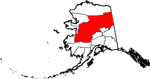 | |
| CDPs | ||
| Unincorporated communities | ||
| Ghost towns | ||