Huslia, Alaska
| Huslia Ts’aateyhdenaade kk’onh Denh | |
|---|---|
| City | |
 Huslia Location in Alaska | |
| Coordinates: 65°42′07″N 156°23′14″W / 65.70194°N 156.38722°WCoordinates: 65°42′07″N 156°23′14″W / 65.70194°N 156.38722°W | |
| Country | United States |
| State | Alaska |
| Census Area | Yukon-Koyukuk |
| Incorporated | June 9, 1969[1] |
| Government | |
| • Mayor | S. Joyce Sam[2] |
| • State senator | Donald Olson (D) |
| • State rep. | Neal Foster (D) |
| Area | |
| • Total | 17.2 sq mi (44.5 km2) |
| • Land | 16.4 sq mi (42.6 km2) |
| • Water | 0.7 sq mi (1.9 km2) |
| Elevation | 157 ft (48 m) |
| Population (2010)[3] | |
| • Total | 275 |
| • Density | 16/sq mi (6.2/km2) |
| Time zone | Alaska (AKST) (UTC-9) |
| • Summer (DST) | AKDT (UTC-8) |
| ZIP code | 99746 |
| Area code(s) | 907 |
| FIPS code | 02-34350 |
| GNIS feature ID | 1403644, 2419400 |
Huslia (HOOS-lee-uh)[4] (Ts’aateyhdenaade kk’onh Denh in Koyukon) is a city[3] in Yukon-Koyukuk Census Area, Alaska, United States. Rarely known as Hussliakatna, it is inhabited by Koyukuk-hotana Athabascans. The population was 293 at the 2000 census and 275 as of the 2010 census.[3]
Geography
Huslia is located at 65°42′7″N 156°23′14″W / 65.70194°N 156.38722°W (65.701858, -156.387134).[5]
According to the United States Census Bureau, the city has a total area of 17.2 square miles (45 km2), of which, 16.4 square miles (42 km2) of it is land and 0.7 square miles (1.8 km2) of it (4.25%) is water.
Demographics
| Historical population | |||
|---|---|---|---|
| Census | Pop. | %± | |
| 1950 | 65 | — | |
| 1960 | 168 | 158.5% | |
| 1970 | 159 | −5.4% | |
| 1980 | 188 | 18.2% | |
| 1990 | 207 | 10.1% | |
| 2000 | 293 | 41.5% | |
| 2010 | 275 | −6.1% | |
| Est. 2015 | 273 | [6] | −0.7% |
As of the census[8] of 2000, there were 293 people, 88 households, and 63 families residing in the city. The population density was 17.8 inhabitants per square mile (6.9/km2). There were 111 housing units at an average density of 6.8 per square mile (2.6/km2). The racial makeup of the city was 4.44% White, 93.52% Native American, 0.34% Pacific Islander, and 1.71% from two or more races. 1.37% of the population were Hispanic or Latino of any race.
There were 88 households out of which 56.8% had children under the age of 18 living with them, 39.8% were married couples living together, 26.1% had a female householder with no husband present, and 27.3% were non-families. 22.7% of all households were made up of individuals and 3.4% had someone living alone who was 65 years of age or older. The average household size was 3.33 and the average family size was 3.83.
In the city the population was spread out with 43.0% under the age of 18, 8.5% from 18 to 24, 25.9% from 25 to 44, 15.7% from 45 to 64, and 6.8% who were 65 years of age or older. The median age was 24 years. For every 100 females there were 110.8 males. For every 100 females age 18 and over, there were 108.8 males.
The median income for a household in the city was $27,000, and the median income for a family was $31,000. Males had a median income of $52,500 versus $30,313 for females. The per capita income for the city was $10,983. About 22.9% of families and 28.1% of the population were below the poverty line, including 37.9% of those under the age of eighteen and none of those sixty five or over.
Education
The Yukon-Koyukuk School District operates the Jimmy Huntington School in Huslia.[9]
Language revitalization
In 2012, Susan Pavskan reported:
On Thursday evenings Denaakk’e (Koyukon Athabascan) classes are held at Yukon-Koyukuk School District offices in Fairbanks and Huslia. About 18 people from four generations attended Thursday over video-conference. At the end of class, I demonstrated how MP3 sound files can be imported into iTunes then synced with iPads or iPods. The students demonstrated these to their parents and grandparents.
See also
References
- ↑ 1996 Alaska Municipal Officials Directory. Juneau: Alaska Municipal League/Alaska Department of Community and Regional Affairs. January 1996. p. 70.
- ↑ 2015 Alaska Municipal Officials Directory. Juneau: Alaska Municipal League. 2015. p. 76.
- 1 2 3 "Huslia city, Alaska". Profile of General Population and Housing Characteristics: 2010 Demographic Profile Data. United States Census Bureau. Retrieved January 23, 2013.
- ↑ "Huslia". Division of Community and Regional Affairs, Alaska Department of Commerce, Community and Economic Development. Retrieved January 24, 2013.
- ↑ "US Gazetteer files: 2010, 2000, and 1990". United States Census Bureau. 2011-02-12. Retrieved 2011-04-23.
- ↑ "Annual Estimates of the Resident Population for Incorporated Places: April 1, 2010 to July 1, 2015". Retrieved July 2, 2016.
- ↑ "Census of Population and Housing". Census.gov. Retrieved June 4, 2015.
- ↑ "American FactFinder". United States Census Bureau. Retrieved 2008-01-31.
- ↑ "Jimmy Huntington School, Huslia." Yukon-Koyukuk School District. Retrieved on June 16, 2016.
External links
- Alaska Division of Community and Regional Affairs: Huslia
- Constitution of the Native Tribe of Huslia, Alaska
Municipalities and communities of Yukon–Koyukuk Census Area, Alaska, United States | ||
|---|---|---|
| Cities | 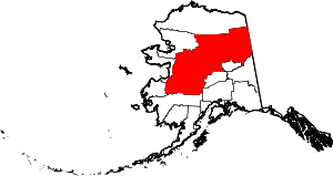 | |
| CDPs | ||
| Unincorporated communities | ||
| Ghost towns | ||