Coldfoot, Alaska
| Coldfoot, Alaska | |
|---|---|
| CDP | |
|
World's northernmost truck stop. | |
 Coldfoot, Alaska Location within the state of Alaska | |
| Coordinates: 67°15′5″N 150°10′34″W / 67.25139°N 150.17611°WCoordinates: 67°15′5″N 150°10′34″W / 67.25139°N 150.17611°W | |
| Country | United States |
| State | Alaska |
| Census Area | Yukon-Koyukuk |
| Government | |
| • State senator | Donald Olson (D) |
| • State rep. | Benjamin Nageak (D) |
| Area | |
| • Total | 37 sq mi (95.9 km2) |
| • Land | 37 sq mi (95.9 km2) |
| • Water | 0 sq mi (0 km2) |
| Elevation | 1,014 ft (309 m) |
| Population (2010) | |
| • Total | 10 |
| Time zone | Alaska (AKST) (UTC-9) |
| • Summer (DST) | AKDT (UTC-8) |
| Area code(s) | 907 |
| FIPS code | 02-16630 |
| GNIS feature ID | 1412829 |

Coldfoot is a census-designated place (CDP) in Yukon-Koyukuk Census Area in the U.S. state of Alaska. The population was 10 at the 2010 census.
Coldfoot primarily serves as a truck stop on the Dalton Highway from Fairbanks to Prudhoe Bay. North of Coldfoot, there are no services for 240 miles (400 km), until Deadhorse. It has a restaurant and a small number of overnight accommodations (converted pipeline construction camp quarters). Bus tours along the highway typically take two days with passengers spending the night in Coldfoot. The BLM, USFWS, and NPS jointly staff a small visitor center during the summer. The Coldfoot truck stop was founded by Iditarod champion Dick Mackey who started his operation by selling hamburgers out of a converted school bus. Truckers helped build the existing truck stop and cafe. The Alaska Department of Transportation (DOT) has a Camp (Maintenance Station) in Coldfoot.
The town was originally a mining camp named Slate Creek, and around 1900 got its present name when prospectors going up the nearby Middle Fork Koyukuk River would get "cold feet" and turn around. In 1902 Coldfoot had two roadhouses, two stores, seven saloons, and a gambling house. A post office operated from 1902 to 1912, then reopened in 1984.
Coldfoot Airport, on the west side of the Dalton Highway, consists of a 4,000-foot (1220 m) gravel strip.
Coldfoot has been featured on the third and fourth seasons of Ice Road Truckers, a Canadian reality television series airing on the History Channel.[1] The show, which dramatizes trucking on the Dalton Highway, often features truckers transporting equipment to the oil companies located in or around the Prudhoe Bay area.[1]
Geography
According to the United States Census Bureau, the CDP has a total area of 37.0 square miles (96 km2), all land.
Demographics
As of the census[2] of 2000, there were 13 people, 6 households, and 1 family residing in the CDP. The population density was 0.4 people per square mile (0.1/km²). There were 12 housing units at an average density of 0.3 per square mile (0.1/km²). The racial makeup of the CDP was 100% White.
There were 6 households out of which 2 had children under the age of 18 living with them, 2 were married couples living together, and 4 were non-families. 3 households were made up of individuals. The average household size was 2.17 and the average family size was 4.00.
In the CDP the population was spread out with 3 under the age of 18, 1 from 18 to 24, 5 from 25 to 44, and 4 from 45 to 64. The median age was 40 years. There were 4 females and 9 males, including 3 females and 7 males age 18 and over.
The median income for a household in the CDP was $61,250 and the per capita income was $42,620. None of the population was living below the poverty line.
References
- 1 2 http://www.history.com/content/iceroadtruckers-season-three
- ↑ "American FactFinder". United States Census Bureau. Archived from the original on 2013-09-11. Retrieved 2008-01-31.
External links
![]() Media related to Coldfoot, Alaska at Wikimedia Commons
Media related to Coldfoot, Alaska at Wikimedia Commons
-
 Coldfoot travel guide from Wikivoyage
 - Coldfoot Camp
Municipalities and communities of Yukon–Koyukuk Census Area, Alaska, United States | ||
|---|---|---|
| Cities | 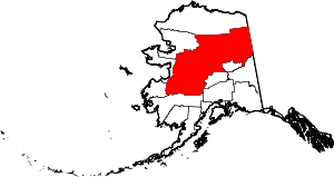 | |
| CDPs | ||
| Unincorporated communities | ||
| Ghost towns | ||