Poorman, Alaska
| Poorman | |
|---|---|
| Unincorporated community | |
 Poorman Location within the state of Alaska | |
| Coordinates: 64°5′58″N 155°32′38″W / 64.09944°N 155.54389°WCoordinates: 64°5′58″N 155°32′38″W / 64.09944°N 155.54389°W | |
| Country | United States |
| State | Alaska |
| Census area | Yukon-Koyukuk |
| Government | |
| • State senator | Donald Olson (D) |
| • State rep. | Neal Foster (R) |
| Elevation | 502 ft (153 m) |
| Time zone | Alaska (AKST) (UTC-9) |
| • Summer (DST) | AKDT (UTC-8) |
| GNIS feature ID | 1408178[1] |
Poorman is an unincorporated community in the Yukon-Koyukuk Census Area of the Unorganized Borough of the U.S. state of Alaska, in the Kilbuck-Kuskokwin Mountains. It lies along the left bank of Poorman Creek on an unpaved road 44 miles (71 km) south of the city of Ruby on the Yukon River.[2] Its elevation is 502 feet (153 m). Founded as a gold mining camp in 1913, Poorman possessed a post office from 1915 to 1932. The community's name (given for the nearby Poorman Creek) was officially decided by the Board on Geographic Names in 1944.[1]
References
- 1 2 "Poorman, Alaska". Geographic Names Information System. United States Geological Survey.
- ↑ Rand McNally. The Road Atlas '08. Chicago: Rand McNally, 2008, p. 6.
Municipalities and communities of Yukon–Koyukuk Census Area, Alaska, United States | ||
|---|---|---|
| Cities | 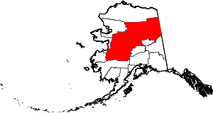 | |
| CDPs | ||
| Unincorporated communities | ||
| Ghost towns | ||
This article is issued from Wikipedia - version of the 11/12/2015. The text is available under the Creative Commons Attribution/Share Alike but additional terms may apply for the media files.