Tamarack, California
| Tamarack | |
|---|---|
| Unincorporated community | |
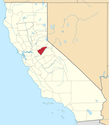
 Tamarack  Tamarack Location in California | |
| Coordinates: 38°26′20″N 120°04′34″W / 38.43889°N 120.07611°W | |
| Country | United States |
| State | California |
| County | Calaveras County |
| Elevation[1] | 6,913 ft (2,107 m) |
Tamarack, formerly known as Camp Tamarack,[2] is an unincorporated community in Calaveras County, California, in the United States. It was founded in the 1920s.[2] A nearby weather station, located across the Alpine County line, has been the site of several United States meteorological records.
Tamarack is located at an elevation of 6,913 feet (2,107 m),[1] on the west slope of the Sierra Nevada near Bear Valley and south of South Lake Tahoe.
Climate
The greatest snow depth ever recorded in North America was recorded in Tamarack: in January 1911, 390 inches (990.6 cm) of snow fell, leading to a snow depth in March of 451 inches (1,145.5 cm).[3][4] Tamarack also holds the record for greatest seasonal snowfall in California: during the winter of 1906−1907, it received 883 or 884 inches (2,242.8 or 2,245.4 cm) of snow.[3][4][5]
| Climate data for Tamarack, California | |||||||||||||
|---|---|---|---|---|---|---|---|---|---|---|---|---|---|
| Month | Jan | Feb | Mar | Apr | May | Jun | Jul | Aug | Sep | Oct | Nov | Dec | Year |
| Record high °F (°C) | 65 (18) |
70 (21) |
68 (20) |
76 (24) |
82 (28) |
88 (31) |
90 (32) |
88 (31) |
85 (29) |
86 (30) |
70 (21) |
65 (18) |
90 (32) |
| Average high °F (°C) | 38.4 (3.6) |
40.4 (4.7) |
44.2 (6.8) |
49.2 (9.6) |
55.9 (13.3) |
63.2 (17.3) |
72.5 (22.5) |
72.5 (22.5) |
65.1 (18.4) |
55.0 (12.8) |
44.9 (7.2) |
39.1 (3.9) |
53.37 (11.88) |
| Average low °F (°C) | 11.4 (−11.4) |
13.6 (−10.2) |
16.3 (−8.7) |
20.7 (−6.3) |
26.1 (−3.3) |
33.3 (0.7) |
41.9 (5.5) |
40.9 (4.9) |
35.0 (1.7) |
27.6 (−2.4) |
20.4 (−6.4) |
13.2 (−10.4) |
25.03 (−3.86) |
| Record low °F (°C) | −45 (−43) |
−26 (−32) |
−17 (−27) |
−8 (−22) |
0 (−18) |
2 (−17) |
24 (−4) |
14 (−10) |
14 (−10) |
−1 (−18) |
−12 (−24) |
−26 (−32) |
−45 (−43) |
| Average precipitation inches (mm) | 8.88 (225.6) |
8.47 (215.1) |
8.06 (204.7) |
3.10 (78.7) |
2.34 (59.4) |
1.47 (37.3) |
0.76 (19.3) |
0.43 (10.9) |
1.17 (29.7) |
2.46 (62.5) |
4.81 (122.2) |
6.45 (163.8) |
52.78 (1,340.6) |
| Average snowfall inches (cm) | 87.7 (222.8) |
87.5 (222.3) |
79.3 (201.4) |
28.9 (73.4) |
20.0 (50.8) |
6.7 (17) |
0.0 (0) |
0.0 (0) |
5.5 (14) |
16.0 (40.6) |
42.6 (108.2) |
69.5 (176.5) |
443.7 (1,127) |
| Source: [6] | |||||||||||||
References
- 1 2 U.S. Geological Survey Geographic Names Information System: Tamarack, California
- 1 2 Durham, David L. (1998). California's Geographic Names: A Gazetteer of Historic and Modern Names of the State. Clovis, Calif.: Word Dancer Press. p. 835. ISBN 1-884995-14-4.
- 1 2 Christopher C. Burt, Extreme Weather: A Guide & Record Book, page 77: "...the deepest snow depth ever recorded in North America, belongs to Tamarack, California. Here, near Yosemite's Tuolumne Meadows, 390ʺ fell in January 1911. This led to a level snow depth of 451ʺ (37.5 feet) by March of that year. Tamarack also holds California's greatest seasonal catch on 884ʺ in the notoriously wet winter of 1906-1907."
- 1 2 Sierra Nevada Virtual Museum
- ↑ Charles Nevers Holmes, In New York City Were the Snowiest Place, in Tychos (1920), page 20: "And, at Tamarack, California, about a mile and one-half above sea level, there was a record of a snowfall of 73 1/2 feet which fell during the winter of 1906-1907. Now, a snowfall of 73 1/2 feet, of 883 inches, is certainly considerable..."
- ↑ "TAMARACK, CALIFORNIA (048781)". Western Regional Climate Center. Retrieved June 1, 2016.
Coordinates: 38°26′20″N 120°04′34″W / 38.43889°N 120.07611°W