Camanche, California
| Camanche | |
|---|---|
| Former settlement | |
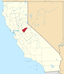
 Camanche Location in California | |
| Coordinates: 38°12′48″N 120°56′07″W / 38.21333°N 120.93528°W | |
| Country | United States |
| State | California |
| County | Calaveras County |
| Elevation[1] | 220 ft (67 m) |
| Reference no. | 254[2] |
Camanche (originally, Limerick; also, Clay's Bar)[3] is a former settlement in Calaveras County, California. It lay at an elevation of 220 feet (67 m). Once called Limerick, the town became Camanche (after Camanche, Iowa) in 1849. Gold mining at nearby Cat Camp, Poverty Bar, and Sand Hill brought its population to a peak of 1,500. Mokelumne River water was brought in by Lancha Plana and Poverty Bar Ditch. A fire on June 21, 1873, destroyed Camanche's large Chinatown. Buhach, an insect powder made from a plant, was manufactured on the nearby Hill Ranch. Camanche is now inundated by Camanche Reservoir.
The settlement is registered as California Historical Landmark #254.[2]
Its location is at 38°12′48″N 120°56′07″W / 38.21333°N 120.93528°WCoordinates: 38°12′48″N 120°56′07″W / 38.21333°N 120.93528°W[4]
A post office was opened in Clay's Bar in 1861 and renamed Camanche in 1864 before closing in 1886; it was re-established in 1887 and closed for good in 1962.[3]
References
- ↑ U.S. Geological Survey Geographic Names Information System: Camanche, California
- 1 2 "Camanche". Office of Historic Preservation, California State Parks. Retrieved 2012-10-06.
- 1 2 Durham, David L. (1998). California's Geographic Names: A Gazetteer of Historic and Modern Names of the State. Clovis, Calif.: Word Dancer Press. p. 753. ISBN 1-884995-14-4.
- ↑ U.S. Geological Survey Geographic Names Information System: Camanche