Milton, California
Coordinates: 38°01′55″N 120°51′08″W / 38.03194°N 120.85222°W
| Milton | |
|---|---|
| Unincorporated community | |
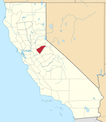
 Milton  Milton Location in California | |
| Coordinates: 38°01′55″N 120°51′08″W / 38.03194°N 120.85222°W | |
| Country | United States |
| State | California |
| County | Calaveras County |
| Elevation[1] | 394 ft (120 m) |
| Reference no. | 262 |
Milton is an unincorporated community in Calaveras County, California. It lies at an elevation of 394 feet (120 m) and is located at 38°01′55″N 120°51′08″W / 38.03194°N 120.85222°W. The community is in ZIP code 95684 and area code 209.
Completion of the Southern Pacific Railroad in 1871 marked the birth of the town of Milton. Named after Milton Latham, one of the railroad construction engineers, this town was the first in Calaveras County to have a railroad. Freight and passengers continued their journeys to other parts of Calaveras County by wagon and stagecoach. The town was also the terminus of the Stockton and Copperopolis Railroad.[2]
The town today is registered as California Historical Landmark #262.[3]
A post office was established in 1871 and closed in 1942.[2]
Politics
In the state legislature, Milton is in the 8th Senate District, represented by Republican Tom Berryhill,[4] and the 5th Assembly District, represented by Republican Frank Bigelow.[5] Federally, Milton is in California's 4th congressional district, represented by Republican Tom McClintock.[6]
References
- ↑ U.S. Geological Survey Geographic Names Information System: Milton, California
- 1 2 Durham, David L. (1998). California's Geographic Names: A Gazetteer of Historic and Modern Names of the State. Clovis, Calif.: Word Dancer Press. p. 803. ISBN 1-884995-14-4.
- ↑ "Milton". Office of Historic Preservation, California State Parks. Retrieved 2012-10-06.
- ↑ "Senators". State of California. Retrieved March 21, 2013.
- ↑ "Members Assembly". State of California. Retrieved March 21, 2013.
- ↑ "California's 4th Congressional District - Representatives & District Map". Civic Impulse, LLC. Retrieved March 1, 2013.