Douglas Flat, California
Coordinates: 38°06′52″N 120°27′18″W / 38.11444°N 120.45500°W
| Douglas Flat | |
|---|---|
| Unincorporated community | |
|
The Douglas Flat School, built in 1854. | |
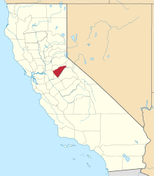
 Douglas Flat  Douglas Flat Location in California | |
| Coordinates: 38°06′52″N 120°27′18″W / 38.11444°N 120.45500°W | |
| Country | United States |
| State | California |
| County | Calaveras County |
| Elevation[1] | 1,965 ft (599 m) |
| Reference no. | 272 |

Douglas Flat (formerly, Douglasflat and Douglass Flat) is an unincorporated community in Calaveras County, California. It lies at an elevation of 1965 feet (599 m) and is located at 38°06′52″N 120°27′18″W / 38.11444°N 120.45500°W. The community is in ZIP code 95229 and area code 209.
Douglas Flat was a roaring mining camp of the early 1850s. In 1857 the Harper and Lone Star Claims produced $130,000 worth of gold. The so-called Central Hill Channel, an ancient river deposit from which vast quantities of gold have been taken, is located here.
The town today is registered as California Historical Landmark #272.[2]
The first post office opened in 1879, and was closed for a time in 1891 before reopening.[3] The town's name honors Tom Douglas, an 1850s merchant.[3]
Politics
In the state legislature, Douglas Flat is in the 8th Senate District, represented by Republican Tom Berryhill,[4] and the 5th Assembly District, represented by Republican Frank Bigelow.[5] Federally, Douglas Flat is in California's 4th congressional district, represented by Republican Tom McClintock.[6]
References
- ↑ U.S. Geological Survey Geographic Names Information System: Douglas Flat, California
- ↑ "Douglas Flat". Office of Historic Preservation, California State Parks. Retrieved 2012-10-06.
- 1 2 Durham, David L. (1998). California's Geographic Names: A Gazetteer of Historic and Modern Names of the State. Clovis, Calif.: Word Dancer Press. p. 767. ISBN 1-884995-14-4.
- ↑ "Senators". State of California. Retrieved March 21, 2013.
- ↑ "Members Assembly". State of California. Retrieved March 21, 2013.
- ↑ "California's 4th Congressional District - Representatives & District Map". Civic Impulse, LLC. Retrieved March 1, 2013.