Stratford, New Hampshire
| Stratford, New Hampshire | |
|---|---|
| Town | |
|
North Stratford village | |
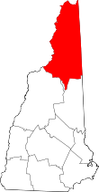
 Location in Coos County, New Hampshire | |
| Coordinates: 44°39′15″N 71°33′31″W / 44.65417°N 71.55861°WCoordinates: 44°39′15″N 71°33′31″W / 44.65417°N 71.55861°W | |
| Country | United States |
| State | New Hampshire |
| County | Coos |
| Incorporated | 1773 |
| Government | |
| • Board of Selectmen |
Larry Ladd, Chair James Davis Clayton Macdonald |
| Area | |
| • Total | 80.0 sq mi (207.2 km2) |
| • Land | 79.5 sq mi (205.9 km2) |
| • Water | 0.5 sq mi (1.3 km2) 0.65% |
| Elevation | 890 ft (271 m) |
| Population (2010) | |
| • Total | 746 |
| • Density | 9.3/sq mi (3.6/km2) |
| Time zone | Eastern (UTC-5) |
| • Summer (DST) | Eastern (UTC-4) |
| ZIP code | 03590 |
| Area code(s) | 603 |
| FIPS code | 33-74180 |
| GNIS feature ID | 0873727 |
| Website | www.stratfordnh.org |

Stratford is a town located on the Connecticut River in Coos County, New Hampshire, United States. The population was 746 at the 2010 census.[1] Within the town are the villages of North Stratford and Stratford Hollow. U.S. Highway 3 passes through the center of town, as did a branch of the Grand Trunk Railway of yore.
Stratford is part of the Berlin, NH–VT Micropolitan Statistical Area.
The Janice Peaslee Bridge connects Stratford to Maidstone, Vermont.
History
Originally granted in 1762 with the name Woodbury, the town was regranted as Stratford in 1773.
Geography
According to the United States Census Bureau, the town has a total area of 80.0 square miles (207 km2), of which 79.5 square miles (206 km2) is land and 0.5 square miles (1.3 km2) is water, comprising 0.65% of the town.[2]
The highest point in Stratford is the summit of Sugarloaf, at 3,700 feet (1,128 m) above sea level.
Demographics
| Historical population | |||
|---|---|---|---|
| Census | Pop. | %± | |
| 1790 | 146 | — | |
| 1800 | 281 | 92.5% | |
| 1810 | 339 | 20.6% | |
| 1820 | 335 | −1.2% | |
| 1830 | 443 | 32.2% | |
| 1840 | 441 | −0.5% | |
| 1850 | 552 | 25.2% | |
| 1860 | 716 | 29.7% | |
| 1870 | 886 | 23.7% | |
| 1880 | 1,016 | 14.7% | |
| 1890 | 1,128 | 11.0% | |
| 1900 | 968 | −14.2% | |
| 1910 | 844 | −12.8% | |
| 1920 | 794 | −5.9% | |
| 1930 | 918 | 15.6% | |
| 1940 | 1,049 | 14.3% | |
| 1950 | 973 | −7.2% | |
| 1960 | 1,029 | 5.8% | |
| 1970 | 980 | −4.8% | |
| 1980 | 989 | 0.9% | |
| 1990 | 927 | −6.3% | |
| 2000 | 942 | 1.6% | |
| 2010 | 746 | −20.8% | |
| Est. 2015 | 698 | [3] | −6.4% |
As of the census[5] of 2000, there were 942 people, 397 households, and 235 families residing in the town. The population density was 11.8 people per square mile (4.6/km²). There were 540 housing units at an average density of 6.8 per square mile (2.6/km²). The racial makeup of the town was 95.75% White, 1.27% Native American, 0.11% from other races, and 2.87% from two or more races. Hispanic or Latino of any race were 0.74% of the population.
There were 397 households out of which 26.7% had children under the age of 18 living with them, 42.6% were married couples living together, 12.1% had a female householder with no husband present, and 40.8% were non-families. 32.0% of all households were made up of individuals and 10.8% had someone living alone who was 65 years of age or older. The average household size was 2.37 and the average family size was 3.03.
In the town the population was spread out with 23.8% under the age of 18, 9.0% from 18 to 24, 24.3% from 25 to 44, 30.1% from 45 to 64, and 12.7% who were 65 years of age or older. The median age was 40 years. For every 100 females there were 85.8 males. For every 100 females age 18 and over, there were 88.5 males.
The median income for a household in the town was $28,594, and the median income for a family was $33,295. Males had a median income of $29,375 versus $21,488 for females. The per capita income for the town was $13,783. About 10.7% of families and 14.3% of the population were below the poverty line, including 18.5% of those under age 18 and 8.9% of those age 65 or over.
See also
- NH Historical Marker #34: Log Drives.
References
- ↑ United States Census Bureau, American FactFinder, 2010 Census figures. Retrieved March 23, 2011.
- ↑ "Geographic Identifiers: 2010 Demographic Profile Data (G001) - Stratford town, New Hampshire". U.S. Census Bureau American Factfinder. Retrieved November 9, 2011.
- ↑ "Annual Estimates of the Resident Population for Incorporated Places: April 1, 2010 to July 1, 2015". Retrieved July 2, 2016.
- ↑ "Census of Population and Housing". Census.gov. Retrieved June 4, 2016.
- ↑ "American FactFinder". United States Census Bureau. Retrieved 2008-01-31.
External links
- Town of Stratford official website
- New Hampshire Economic and Labor Market Information Bureau Profile