Slade Green

Coordinates: 51°27′58″N 0°11′46″E / 51.466°N 0.196°E
Slade Green is a locality in the London Borough of Bexley in Greater London, 14 miles (23 km) east-southeast of Charing Cross. Lying south of the River Thames, and to the west of the River Darent and River Cray. It is northeast of Bexleyheath and northwest of Dartford.
History and development
Etymology
An Anglo-Saxon dictionary asserts that "Slade" most commonly meant a broad strip of grass-covered land.[1] The London Borough of Bexley suggests the current name most likely derives from Saxon "Slade", with their definition being low lying ground. An alternative is the Viking "Slad", meaning a place for launching boats. Most sources agree that "Green" was added to reflect the deep colour of the grass-covered ground.[2] Sources differ on when Slade Green was first mentioned with one suggesting the 16th Century.[3]
Prehistory
There is some evidence of prehistoric human habitation. Pre-war maps indicate a barrow stood near the current Hazel Drive children's play area,[4] and the Museum of London Archaeological Service revealed the presence of a prehistoric cookery pit at Hollywood Way.[5]
Medieval
Some sources claim the area is recorded in the Domesday book as Hov, and others suggest this was Hou (later Howbury).[3][6] These claims are problematic because one electronic copy of an early translation states that Howbury was a hamlet on the bank of River Darent.[7] What is known is that a moated seigneurial residence was built at Slade Green in the High Middle Ages, with its country house completed during the English Renaissance, and that these structures were named Howbury Manor.[8][9][3] Surrounding Green belt marshes contain willows thought to have been planted over 300 years ago to shelter livestock.[10]
Victorian
The communities of North End and Slades Green[11] (formerly Slads Green[12]) had remained disjointed throughout the agricultural revolution. Samuel Lewis' 1848 “A Topographical Dictionary of England” states that Slades Green was the smaller hamlet with 66 people.[13][14] While police, political and cultural boundaries continually change to address various concerns, the tracks of the North Kent Line have been the immovable border between North End and Slade Green since circa 1849.[15][16]
Evidence suggests the region remained sparsely populated yet highly productive throughout the industrial revolution. The 1869-1882 Ordnance Survey recorded a particularly large “Sladesgreen Farm” with its south-west corner occupied by “The Corner Pin” beerhouse.[16][17] The pub may have been demolished and rebuilt in 1958.[4] The surrounding area was affectionately known locally as “Cabbage Island” in reference to the market gardens located between Moat Lane (formerly Whitehall Lane) and Slade Green Road (formerly Slade Green Lane).[18][19][20] Victorian photographic evidence captures the high crop yield of these agricultural gardens at Slade Green.[21] Historic maps also chronicle an increasing number of clay pits along the railway on the North End side of the tracks.[16] Marshes are a natural source of clays and brick earths, and local firms produced large numbers of London stock bricks throughout the 19th Century. “Furner of Slade Green“ operated the North End brickworks from 1867 to 1911.[22][23] Slade Green gained a National School in 1868,[24] and became a village when St. Augustine's Church opened in 1899.
The isolated Crayford Marshes, which could support barges along the Rivers Thames and Darent, were seen as an ideal location for the 40 acre ammunition works that may have operated from 1879 to 1962.[25][26] A comparison of historic and contemporary maps confirms that the boundaries of the Victorian site outline the current Darent Industrial Estate.[27][28][29][30]
Edwardian
Slade Green expanded rapidly following the construction of a major rail depot designed to service 100 steam locomotives for South Eastern and Chatham Railway.[15][20] A small station was added to serve the depot and community on 1 July 1900 (its name changed from Slades Green station to Slade Green station in 1953),[11] and by 1910 the complete 'railway village' of 158 houses had been built.[20] Bexley Borough Photos suggest the significance of Slade Green increased after 1910 and that it absorbed historically important Howbury Manor.[31] It follows that today's much larger and more densely populated Slade Green could be described as a railway town.
First World War
Miss Mary Edith Sheffield, identified only as a superintendent at the Thames Ammunition Works in the Crayford Marshes adjacent to Slade Green, was awarded MBE in King George V's 1918 Birthday Honours.[32] For a short time the secure site was connected to Slade Green by the 1½ mile “Trench Warfare Light Railway”.[33][4]
Interwar
Development may have stagnated in the interwar years, but records show a Baptist Church was build on Elm road in the early 1930s.[4]
The munition works near Slade Green were the site of a national tragedy.[34] Explosions at a former Trench Warfare Filling Factory[35] operated by Messrs. W.V. Gilbert, a contractor to the Disposal and Liquidation Commission,[36] caused the death of 13 workers on 19 February 1924.[37] The parliamentary debate that followed showed that the contract did not require a Fair Wages Clause, and was exempt from the provisions of the Explosives Act of 1875.[38] A prominent mass grave at Northumberland Heath stands in memory of the victims.[39]
Second World War
During the Second World War the marshes were used for the 4.5-inch HAA Guns of 6th Anti-Aircraft Division, corresponding with No. 11 Group RAF. The disused command post and circular battery ramparts remain in the marshes between Slade Green and the former munition works. Slade Green was subject to a series of air raids, notably the night of 16 April 1941 when incendiary raids caused many fires and explosions capable of levelling the area were only avoided by the extreme bravery of local people resulting in the award of three British Empire Medals and a George Medal.[40][41] The Museum of London states that Howbury Manor House, pictured within the moated medieval walls, was bombed during an air raid and then demolished.[42] RAF campaign diaries show Thames Ammunition Works was hit on 12th October 1940.[43] During the war the community was served by a British Restaurant operating from St. Augustine's Church Hall, which supplied up to 250 lunches six days a week to residents, the school, and nearby factories.[41]
Postwar
Slade Green emerged as a London suburb in the post-war era following the construction of at least 1050 new dwellings and a road bridge spanning the North Kent Line.[44][45][46] The London Government Act 1963 officially classified Slade Green as being inside Greater London. Slade Green remained in the ceremonial county of Kent until 1965.
Notable buildings and structures
The Scheduled Ancient Monument known as Howbury Moat or Howbury Manor (c.900), and a Grade II Listed Tithe Barn (c.1600s), are located between Slade Green and Crayford Marshes.[30] According to Historic England, the interior of the medieval moated site includes a 16th or 17th century country house, with some significant surviving architectural details, and it appears to the Secretary of State to be of national importance.[9] Holders of the Manor of Howbury included Bishop Odo, Roger Apylton (aka Appleton) and Sir Cloudesley Shovell.[41] After Apylton had May Place built in Crayford, occupants of the moated site were tenant farmers, and after the building of a new house (Howbury Grange) for the tenant farmer in 1882, by farm labourers, until the building was condemned in 1934.[41] Photographic evidence from 1935 provides a glimpse of Howbury Manor House.[42][47] In 2006 the medieval moat site was the subject of an English Heritage sponsored research project by the University of Oxford's Geography Department into techniques of Soft Wall Capping for preservation purposes.[48]
The area around Oak Road and Moat Lane near the station lies within a conservation area, including the locally listed Railway Tavern (1a Moat Lane). These houses and the Tavern, recently converted to flats, were built by Smith & Sons of South Norwood around the year 1899, and were notable for being illuminated by electricity.[20][49]
St. Augustine's Church was built in 1899 and extended in 1911. Substantial rebuilding work was required following a direct hit during a Second World War air raid in 1944, and following a fire in 1991 which destroyed the roof and much of the internal fabric.[41]
Present and future
The adjacent Crayford Marshes have been recognised as ecologically significant since circa 1980 and are now designated a Site of Special Scientific Interest. Slade Green is identified in the London Plan as being part of Bexley Riverside and has been a target for urban regeneration since at least 2011.[49]
The area has been a focus of regeneration schemes and is now mainly a mix of privately owned residential properties benefiting from short commuting times to the City of London. Local industry is confined to the site of the old works and areas adjacent to the large railway carriage depot. Various types of investors are attracted to Slade Green's unique combination of strategic rail infrastructure and close proximity to national road network via the M25 at the Dartford Crossing.
The Howbury Centre was replaced with a new Slade Green & Howbury Community Centre in 2014, which hosts the local library and various social activities.[50][51]
Churches include a Baptist Union Christian Fellowship, and St Augustine's Anglican parish church; a third Pentecostal church meets in the Anglican Church's hall.
There are two pubs, and other bars at the Slade Green Railway Club and Erith Yacht Club. The latter relocated from Erith to a site on the edge of Slade Green in 1900.[52] Slade Green F.C. last competed in 2009.
Some commercial developments around Slade Green are influenced by London Assembly's Bexley Riverside Opportunity and Intensification Area.
- For infrastructure investments in Slade Green and surrounding areas see the main Thames Gateway article
Local governance
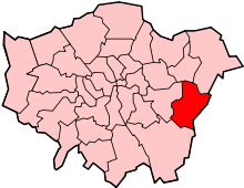
Slade Green is in the electoral ward of North End in the UK Parliament constituency of Bexleyheath and Crayford. Slade Green is represented at the London Assembly by Bexley and Bromley.[53]
Slade Green is within the historic boundaries of Kent. In 1894 Slade Green was part of Dartford Rural District, as created by the Local Government Act 1894.[54][55] In 1920 the area became part of the Crayford Urban District of Kent.[56][57] In 1965, under the London Government Act 1963, the Crayford Urban District was abolished and its area became part of the present-day London Borough of Bexley.[58]
Community interests are represented by Slade Green Community Forum and Slade Green Together Big Local.
Education
Primary
Slade Green contains one of two campuses in Haberdashers' Aske's Crayford Temple Grove Primary, which is part of Haberdashers' Aske's Crayford Academy.[59] Ofsted's report shows the larger Crayford Academy is a good school, with an increasing number of students at Slade Green making good progress.[60] The nearest faith school for this age group is Christ Church (CofE), which Ofsted reports as outstanding.[61]
Secondary
Slade Green Secondary School, later known as Howbury Grange, closed in 1992 [62] and Bexley Council's Secondary Pupil Referral Unit closed in 2008. The three nearest secondary schools are Haberdashers' Aske's Crayford Academy, Erith School, and Dartford Grammar School.
- For education in Slade Green see the main London Borough of Bexley article
Places of worship
- St Augustines (Anglican)
- Slade Green Christian Fellowship (Baptist)
Geography
 |
Erith Marshes | Erith | across River Thames Rainham Marshes |
|
| North End, West Heath towards Greenwich |
|
across River Darent Dartford Marshes | ||
| ||||
| | ||||
| across Barnhust Bexleyheath |
Crayford | Dartford Bluewater Shopping Centre |
Transport
Slade Green residents are entitled to a reduced toll charge at Dartford crossing.
Road
Slade Green adjoins the main A206 dual carriageway, which follows the River Thames to Greenwich passing near the Blackwall Tunnel. Another efficient route to inner London is the A2 road via Crayford and Hall Place. In the opposite direction, the A206 road terminates near Bluewater after feeding Junction 1A of the M25 motorway.
Rail
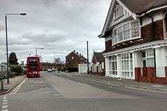
Slade Green is a railway town between Dartford and London Bridge,[11] and Slade Green railway station is part of the Crossrail protected route.[63] Slade Green railway station has direct services to London Cannon Street for the City of London, Greenwich for DLR, and Abbey Wood for Crossrail. Oyster cards are accepted at Slade Green, which is in Transport for London suburban fare zone 6.
Bus
Slade Green is served by London Buses routes 89, N89, 99 (for Erith Riverside shopping centre) and 428 (for Bluewater shopping centre).
References
- ↑ "Slade". Bosworthtoller Anglo-Saxon Dictionary. Boswothtoller. Retrieved 15 September 2016.
- ↑ "Origins of street and place names in Bexley". London Borough of Bexley. London Borough of Bexley. Retrieved 15 September 2016.
- 1 2 3 4 "London's Local History, Monday 30 March 2015". Edith's Streets. Edith's Streets. Retrieved 12 September 2016.
- ↑ Museum of London summary of archaeological work carried out in 1997 accessed 6 April 2008
- ↑ "Kent". The Domesday Book Online. The Domesday Book Online. Retrieved 12 September 2016.
- ↑ "Places in Domesday Book near Slade Green". Open Domesday. Open Domesday. Retrieved 12 September 2016.
- ↑ "River Cray and Southern Marshes Area". All London Green Grid. Greater London Authority. Retrieved 13 September 2016.
- 1 2 "Howbury moated site". Historic England. Historic England. Retrieved 7 September 2016.
- ↑ Managing the Marshes Vision & Strategy (PDF). Bexley Council. March 2006. p. 22.
- 1 2 3 Kent Rail website page on Slade Green station accessed 6 March 2008
- ↑ Ordnance Survey and Ordnance Survey of Scotland First Series, 1805 accessed 10 September 2016
- ↑ British History Online record of 'A Topographical Dictionary of England', Slackstead - Slawston accessed 5 November 2007
- ↑ British History Online record of 'A Topographical Dictionary of England', Normicott - North Holme accessed 5 November 2007
- 1 2 "The North Kent Railway". Bexley Council. Bexley Council. Retrieved 12 September 2016.
- 1 2 3 "'Sheet 003' in Map of Kent". British History Online. Ordnance Survey, Southampton, 1869-1882. Retrieved 10 September 2016.
- ↑ "Map abbreviations". Ordnance Survey. Ordnance Survey. Retrieved 12 September 2016.
- ↑ Review of book 'An Illustrated History of Slade Green Depot accessed 27 June 2007
- ↑ commentary by person with family from the area at genealogy.com accessed 27 June 2007
- 1 2 3 4 [Oak Road Conservation Area Consultation Draft, Bexley Council February 2008] pdf version accessed 6 March 2008 at http://www.bexley.gov.uk/service/consultations/conservationareas_phase2/pdfs/oak_road_conservation_area.pdf
- ↑ "Strawberry Pickers in a Field, Slade Green c.1905". Bexley Borough Photos. Bexley Borough Photos. Retrieved 8 September 2016.
- ↑ Cufley, David. "Dartford Area Brickworks (map)" (PDF). David Cufley's Family History Home Page. Cufley. Retrieved 14 September 2016.
- ↑ "Brick Making in Bexley". London Borough of Bexley. London Borough of Bexley. Retrieved 10 September 2016.
- ↑ "Slade Green Junior and Infant Schools". Bexley Council. Bexley Council. Retrieved 12 September 2016.
- ↑ "Thames Ammunition Works". London History. London History Group. Retrieved 13 September 2016.
- ↑ "The Thames Ammunition Works". South East History Boards. KSH History Forum. Retrieved 12 September 2016.
- ↑ "OS Maps (Darent Industrial Park)". Ordnance Survey. Ordnance Survey. Retrieved 14 September 2016.
- ↑ "Explore georeferenced maps, Crayford marshes". Map images c. 1888 - 1964. National Library of Scotland. Retrieved 14 September 2016.
- ↑ "Crayford Marshes and Darent Industrial Estate". Geograph. Marathon. Retrieved 13 September 2016.
- 1 2 Managing the Marshes Summary of Baseline data (page 7) (Bexley November 2004) accessed 27 June 2007
- ↑ "Howbury Grange moat 1910, Was in Crayford now in Slade Green". Bexley Borough Photos. Bexley Borough Photos. Retrieved 8 September 2016.
- ↑ "The London Gazette, 4 June 1918 (Supplement 30730, Page 6740)". The London Gazette, Official Public Record. Authority. Retrieved 13 September 2016.
- ↑ "The South Eastern Division's London Suburbs (map)". Kent Rail. Kent Rail. Retrieved 13 September 2016.
- ↑ "Erith: WV Gilbert munitions disaster remembered". News Shopper. News Shopper. Retrieved 13 September 2016.
- ↑ "Trench Warfare Filling Factories". Grace's Guide to British Industrial History. Grace's Guide Ltd. Retrieved 9 September 2016.
- ↑ "Disposal and Liquidation Commission". National Archives. National Archives. Retrieved 9 September 2016.
- ↑ A Tragedy That Rocked The Nation on 'Whitstable Scene' accessed 1 October 2007
- ↑ "Munition Factory Explosion (Slade Green)". Digitised editions of Commons and Lords Hansard. Parliament. Retrieved 9 September 2016.
- ↑ "A short History of Slade Green". Slade Green Big Local. Slade Green Big Local. Retrieved 9 September 2016.
- ↑ "Plaque unveiled for men who saved Slade Green from devastation in the Blitz". Newshopper. Newshopper. Retrieved 13 September 2016.
- 1 2 3 4 5 Thomas, E.O.Slade Green and the Crayford Marshes, Bexley Education and Leisure Services Directorate, 2001, ISBN 0-902541-55-2
- 1 2 "Creeks: Howbury Manor, Slade Green, near Dartford Creek on Easter Sunday, 1935 (front view)". Museum of London. Museum of London. Retrieved 8 September 2016.
- ↑ "Battle of Britain campaign diaries". Royal Air Force. UK Crown. Retrieved 13 September 2016.
- ↑ "Housing Scheme No. 22, Willow Road, Slade Green, c. 1955". A History of South-East London Suburbs. Ideal Homes. Retrieved 12 September 2016.
- ↑ "Bridge Road West, Slade Green, 1955". A History of Suburbs in South-East London. Ideal Homes. Retrieved 12 September 2016.
- ↑ "Bridge Road, Slade Green, 1961". A History of Suburbs in South-East London. Ideal Homes. Retrieved 12 September 2016.
- ↑ "Creeks: Howbury Manor, Slade Green, near Dartford Creek on Easter Sunday, 1935 (rear view)". Museum of London. Museum of London. Retrieved 8 September 2016.
- ↑ University of Oxford web page on Soft Wall capping research accessed 6 April 2008
- 1 2 "Sustainability Appraisal Report of the Erith Western Gateway Development Framework SPD February 2011". Bexley Council. Bexley Council. Retrieved 12 September 2016.
- ↑ "Greener Bexley". Greener Bexley. Retrieved 7 September 2016.
- ↑ Newsshopper article on plans for the Howbury Centre site accessed 6 March 2008
- ↑ "Erith Yacht Club". Erith Yacht Club. Erith Yacht Club. Retrieved 7 September 2016.
- ↑ "Mayor of London - London Assembly - Bexley". Greater London Authority. Greater London Authority. Retrieved 9 September 2016.
- ↑ Vision of Britain 'Unit History of Dartford' accessed 1 October 2007
- ↑ Vision of Britain 'Map of Dartford Rural District' accessed 1 October 2007
- ↑ Vision of Britain 'Unit History of Crayford' accessed 1 October 2007
- ↑ Vision of Britain 'Map of Crayford Urban District' accessed 1 October 2007
- ↑ Vision of Britain 'Unit History of Bexley' accessed 1 October 2007
- ↑ "Haberdashers' Aske's Crayford Temple Grove Primary Overview". Retrieved 7 September 2016.
- ↑ "Haberdashers' Aske's Crayford Academy, School Inspection Report". Retrieved 7 September 2016.
- ↑ "Christ Church (Erith) C of E Primary School". bexley.sch.uk. Trinitas Academy Trust. Retrieved 12 September 2016.
- ↑ "Records of Slade Green Secondary School, Crayford". Retrieved 7 September 2016.
- ↑ "Crossrail Safeguarding Directions Abbey Wood to Gravesend and Hoo Junction (Volume 4)" (PDF). Retrieved 2016-07-29.
External links
- Slade Green Community Forum
- Erith Yacht Club
- Erith & Crayford District Scouts
- Bird spotting guide to Crayford Marshes
| Districts |
|  |
|---|---|---|
| Attractions |
| |
| Parks and open spaces |
| |
| Constituencies | ||
| Rail stations | ||
| Other topics | ||