Sirang Lupa
| Sirang Lupa Barangay ng Sirang Lupa, Lungsod ng Calamba (Mailom) | ||
|---|---|---|
| Component Barangay | ||
| Barangay Sirang Lupa, City of Calamba | ||
|
A Sitio Major Homes in Barangay Sirang Lupa | ||
| ||
| Nickname(s): May 15 (San Isidro Labrador) | ||
| Coordinates: 14°12′5″N 121°6′17″E / 14.20139°N 121.10472°ECoordinates: 14°12′5″N 121°6′17″E / 14.20139°N 121.10472°E | ||
| Country | Philippines | |
| Province | Laguna | |
| Region | CALABARZON (Region IV-A) | |
| City | Calamba | |
| Government | ||
| • Chairman | Ronaldo M. Contreras | |
| • Councilors |
| |
| Area | ||
| • Land | 198.4 km2 (76.6 sq mi) | |
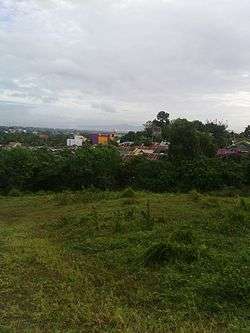
Sirang Lupa, also known as Kabiserang Lupa, is a compenent barangay, in Calamba, Laguna, Philippines. It is situated adjacent to Canlubang.
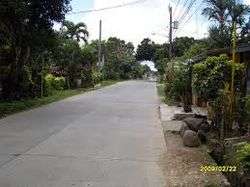
The barangay of Sirang Lupa is bordered by the three barangays in Calamba are: Canlubang, Mayapa and Majada Out, the Sirang Lupa is divided into two compounds are Kanluran (Dulo/Kanto) and the Silangan (Crossing Sirang Lupa). The Sirang Lupa have four sitios such as: Sitio Major Homes, Sitio Pamintahan, Sitio Piano's and Sitio Tibagan, it is situated at the boarder of Canlubang land property.
st of Brgy. Sirang Lupa
Neighboring Barangays
Compound

A Tau Gamma Phi, Sirang Lupa chapter, found in Silangan compund
.
- Kanluran- (Mailom)
- Silangan- (Crossing-Sirang Lupa)
Sitios in Sirang Lupa
- Major Homes
- Pamintahan
- Piano's
- Tibagan
Resorts
- Sailaya Resort
- Villa San Jose
Population
| Year | Population |
|---|---|
| 2010 | 8,225 |
| 2007 | 6,683 |
| 2000 | 5,466 |
| 1995 | 3,252 |
| 1990 | 2,248 |
| 1980 | 1,092 |
Geography
Location:
- Sirang Lupa, Calamba City
 |
Carmel/Asia-2 | MCDC | Ceris 1 & 2 | |
| Carmelray Industrial Park 1, Mangumit | |
Mayapa | ||
| ||||
| | ||||
| Majada Out |
References
External links
| Geography | |||||||||||
|---|---|---|---|---|---|---|---|---|---|---|---|
| City |
| ||||||||||
| Officials | |||||||||||
| History |
| ||||||||||
| Barangays |
| ||||||||||
| Sister Cities | |||||||||||
| Notable people | |||||||||||
This article is issued from Wikipedia - version of the 11/20/2016. The text is available under the Creative Commons Attribution/Share Alike but additional terms may apply for the media files.