Simpsonville, Maryland
| Simpsonville, Maryland | |
|---|---|
 Simpsonville Location in Maryland | |
| Coordinates: 39°11′17″N 76°53′38″W / 39.18806°N 76.89389°W | |
| Country |
|
| State |
|
| County |
|
| Time zone | EST (UTC-5) |
| • Summer (DST) | EDT (UTC-4) |
| Area code | 240 and 301 |
Simpsonville is an unincorporated community in Howard County, Maryland, United States.[1]
People and nature have long flourished beside the Middle Patuxent River. Over 12,000 years ago, Native Americans hunted deer and gathered acorns and other wild food in the woods and waters. People from Woodland Indian cultures settled nearby about 2,000 years ago, leaving traces of their lives in the earthenware pottery and stone tools they left behind. In 1741, John Hobbs acquired the patent on the lands around Simpsonville. The land passed to Vachel Worthington in 1789, followed by Richard Owings in 1796.[2] The early 19th century Simpsonville Mill water-powered grist mill and saw mill was built here, as well as a woolen factory, wheelwright shop, blacksmith shop, and nine houses. In 1850, the town became known as Simpsonville, named after its first postmaster, Charles Simpson. In 1852, Charles Ridgley Simpson bought 215 acres which included the mill and town center.
The Simpsons, Warfields, Owings, and other families lived in the Simpsonville for generations.[3] In the 1920s and 1930s, mill owner John Iglehart kept detailed ledgers of purchases at his mill store. The Saumenigs, who owned the future Robinson property, shopped at the Iglehart store as early as 1926. The area was home to Howard County Commissioner De Wilton Partlett, who lost his home when his neighbor Fedora Boski burned his farm buildings and perished in the event in 1928.[4] Simpsonville remained a hub for the local economy until undermined by the declining milling industry and the Great Depression. Nearby Atholton postal services were merged with Simpsonville.[5] Lee Preston led Atholton High School students to conduct the first archeological excavations around Simpsonville in 1984. Over 42,000 artifacts have been recovered through decades of investigations, including machine parts, clothing, bottles, window glass, and two millstones. Primary documents, including wills, deeds, letters, and photographs, provide further insights into life and work in historic Simpsonville. The Simpsonville Mill Archaeological and Historic District is one of the few professionally studied mill sites in Maryland. Research at the site continues to reveal more about the roles of small industrial and commercial communities in Maryland’s early economy.
From 1963 to 1966, The Rouse Company purchased large tracts of Simpsonville to develop Columbia, Maryland. The development displaced farms and small scientific businesses like JEJA that bred scientific research primates.[6] Throughout this time, racial tensions arose with cross burnings.[7]
See also
References
- ↑ "Geographic Names Information System". Simpsonville (Populated Place). U.S. Geological Survey. 2009-01-29.
- ↑ Howard's Roads to the Past. Howard County Sesquicentennial Celebration Committee, 2001. 2001. p. 88.
- ↑ Michael Hait. The Civil War Draft in Maryland: Lists of Drafted Men, 1862-1865, Volume I. p. 291.
- ↑ "Farmer Routs Firemen, Perishes in Flames". The Washington Post. 12 April 1928.
- ↑ Howard's Roads to the Past. Howard County Sesquicentennial Celebration Committee, 2001. 2001. p. 81-82.
- ↑ "Scientific Studies Spur Monkey Business Boom: They're No. 3 Get Special Food Isolated on Arrival". The Washington Post. 8 February 1966.
- ↑ "Justice Probe Asked Of Klan in Maryland". The Washington Post. 21 July 1967.
Municipalities and communities of Howard County, Maryland, United States | ||
|---|---|---|
| CDPs | 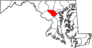 | |
| Villages | ||
| Unincorporated communities |
| |
| Footnotes | ‡This populated place also has portions in an adjacent county or counties | |
Coordinates: 39°11′12″N 76°52′55″W / 39.18667°N 76.88194°W