Daisy, Maryland
| Daisy, Maryland | |
|---|---|
 Daisy Location in Maryland | |
| Coordinates: 39°17′38″N 77°4′8″W / 39.29389°N 77.06889°W | |
| Country |
|
| State |
|
| County |
|
| Elevation | 168 m (551 ft) |
| Population (1904)[1] | |
| • Total | 28 |
| Time zone | EST (UTC-5) |
| • Summer (DST) | EDT (UTC-4) |
| Area code | 240 and 301 |
Daisy is an unincorporated community located at the Northwest tip of Howard County, Maryland.
History
A very large tract of land in the area that became Daisy was patented to Captain Richard Warfield in 1763.[2] The Oakdale manor slave plantation was built on the site in 1838 by Albert Gallatin Warfield[3][4] and, as of 1940, overlooked a remaining 1,300 acres (5.3 km2) of the original tract.[2]
Senator Arthur Pue Gorman's daughter, Grace (1871–1958), who went by the name "Daisy", lived at the historic Overlook farm house in North Laurel. Daisy, Maryland was named after her in 1882.[5] In 1895, Grace married Richard Alward Johnson (1871–1918), the first manager of the Laurel race track and a Maryland state senator during his last few years.[6][7][8]
A postal office operated in the community from March 24, 1882 to August 31, 1905.[9]
The current Daisy United Methodist Church property, eligible for the National Register of Historic Places, was built in 1906 on 2.25 acres (0.91 ha) of land acquired in 1876 "to be used as a school house for colored children and also a house of public worship for the use of the colored members of the M.E. church of the neighborhood".[1]
By 1940, the population of Daisy reached 25.[10] The farming community was active in the mid-20th century, with a general store, schoolhouse, and Good Templars Hall, though diminished in the 1970s as agricultural profits fell and families moved to larger towns.[1] The Daisy Garage was established in 1959 by former Howard County Commissioner Robey Mullinix.[11]
Notable people
- Roby H. Mullinix (1895–1965),[12] Howard County Commissioner (1949–1954), Planning Commissioner,[13][14] Howard County Court Clerk (1954–1962)[15]
- George Washington Ward (1867–1932) was the third principal of Maryland State Normal School (now Towson University).
- Edwin Warfield (1848–1920), the 45th Governor of Maryland, grew up at the Oakdale Manor built in 1838.
Today
The Daisy General Store and Outpost joined the Daisy Schoolhouse in 2012 on Preservation Howard County's top endangered sites list. The nonprofit organization pursues historical and cultural preservation in the county. The school is awaiting reconstruction on museum property in West Friendship.[16][17] The outpost remained on the list in 2014 and 2015.[18][19]
References
- 1 2 3 "Daisy United Methodist Church Survey HO-275". Inventory of Historical Properties. Maryland Historical Trust. July 1998. Retrieved September 8, 2013.
- 1 2 Federal Writers' Project (August 1940). Maryland: A Guide to the Old Line State. Work Projects Administration. p. 332. ISBN 9781603540193.
- ↑ "Oakdale". Maryland Historic Trust. Retrieved September 8, 2013.
- ↑ Seeking Freedom The History of the Underground Railroad in Howard County. p. 62.
- ↑ Janet P. Kusterer, Victoria Goeller. Remembering Ellicott City: Stories from the Patapsco River.
- ↑ "Overlook (Kingdon Gould) House" (PDF). Retrieved August 23, 2013.
- ↑ "Grace Louise "Daisy" Gorman Johnson". Find a Grave. May 9, 2009. Retrieved August 31, 2013.
- ↑ "Richard Alward Johnson, Sr". Find a Grave. May 9, 2009. Retrieved July 9, 2014.
- ↑ "Checklist of Maryland Post Offices" (PDF). Smithsonian National Postal Museum. July 12, 2007. Archived from the original (PDF) on August 15, 2013. Retrieved July 7, 2014.
- ↑ Federal Writers' Project. Maryland: A Guide to the Old Line State. p. 332.
- ↑ "Daisy Garage is a Family Affair". The Times. March 31, 1965.
- ↑ "Roby H. Mullinix". Find a Grave. April 26, 2012. Retrieved September 12, 2013.
- ↑ "Edwin Warfield Mullinix". Find a Grave. February 26, 2013. Retrieved September 11, 2013.
- ↑ Maryland State Manual 1951–1952. 164. p. 250.
- ↑ "Howard County Court Clerks". Retrieved 11 September 2013.
- ↑ "The keepers of Howard County history". The Baltimore Sun. 21 August 2014.
- ↑ "The 2012 Top Endangered Sites". Retrieved September 10, 2013.
- ↑ "Top 10 endangered historical sites in Howard County". The Baltimore Sun. July 11, 2014.
- ↑ Amanda Yeager (26 May 2015). "Former school tops Howard County's endangered sites list". The Baltimore Sun.
Coordinates: 39°17′38″N 77°04′08″W / 39.294°N 77.069°W
Municipalities and communities of Howard County, Maryland, United States | ||
|---|---|---|
| CDPs | 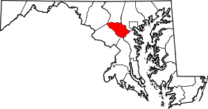 | |
| Villages | ||
| Unincorporated communities |
| |
| Footnotes | ‡This populated place also has portions in an adjacent county or counties | |