Shire of Dunmunkle
| Shire of Dunmunkle Victoria | |||||||||||||
|---|---|---|---|---|---|---|---|---|---|---|---|---|---|
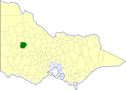 Location in Victoria | |||||||||||||
| Population | 2,850 (1992)[1] | ||||||||||||
| • Density | 1.839/km2 (4.762/sq mi) | ||||||||||||
| Established | 1877 | ||||||||||||
| Area | 1,550 km2 (598.5 sq mi) | ||||||||||||
| Council seat | Rupanyup | ||||||||||||
| County | Borung, Kara Kara | ||||||||||||
| |||||||||||||
Coordinates: 36°26′S 142°42′E / 36.43°S 142.70°E
The Shire of Dunmunkle was a local government area about 160 kilometres (99 mi) west of Bendigo and 50 kilometres (31 mi) east of Horsham, in western Victoria, Australia. The shire was bounded by the Yarriambiack Creek on the western boundary and the Richardson River on the east.[2] The shire covered an area of 1,550 square kilometres (598.5 sq mi), and existed from 1877 until 1995.
History
Dunmunkle was first incorporated as a shire on 28 September 1877. In May 1916, the shire lost part of its North Riding to the Shire of Donald, but gained parts of the South and East Ridings of the Shire of Warracknabeal.[3]
On 20 January 1995, the Shire of Dunmunkle was abolished, and, along with parts of the Shires of Karkarooc, Warracknabeal and Wimmera, was merged into the newly created Shire of Yarriambiack. The Avon-Richardson district was transferred to the newly created Shire of Northern Grampians.[4]
Wards
The Shire of Dunmunkle was divided into three wards, each of which elected three councillors:
- North Ward
- West Ward
- East Ward
Towns and localities
- Ashens
- Avon Plains
- Banyena
- Burrereo
- Burrum
- Coromby
- Jackson
- Kewell
- Laen
- Lallat
- Lubeck
- Minyip
- Murtoa
- Nullan
- Raluana
- Rupanyup
- Rupanyup South
- Wirchilleba
Population
| Year | Population |
|---|---|
| 1954 | 4,110 |
| 1958 | 4,280* |
| 1961 | 4,086 |
| 1966 | 3,945 |
| 1971 | 3,544 |
| 1976 | 3,370 |
| 1981 | 3,071 |
| 1986 | 2,878 |
| 1991 | 2,683 |
* Estimate in the 1958 Victorian Year Book.
References
- ↑ Australian Bureau of Statistics, Victoria Office (1994). Victorian Year Book. pp. 49–52. ISSN 0067-1223.
- ↑ "Victorian Places". Victorian Places - Dunmunkle Shire. Monash University, University of Queensland. 2014. Retrieved 12 February 2015.
- ↑ Victorian Municipal Directory. Brunswick: Arnall & Jackson. 1992. pp. 662–663. Accessed at State Library of Victoria, La Trobe Reading Room.
- ↑ Australian Bureau of Statistics (1 August 1995). Victorian local government amalgamations 1994-1995: Changes to the Australian Standard Geographical Classification (PDF). Commonwealth of Australia. p. 10,12. ISBN 0-642-23117-6. Retrieved 2008-01-05.