Shire of Numurkah
| Shire of Numurkah Victoria | |||||||||||||
|---|---|---|---|---|---|---|---|---|---|---|---|---|---|
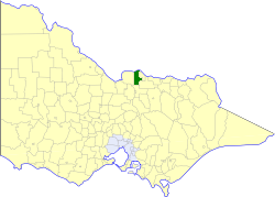 Location in Victoria | |||||||||||||
| Population | 7,170 (1992)[1] | ||||||||||||
| • Density | 8.74/km2 (22.65/sq mi) | ||||||||||||
| Established | 1957 | ||||||||||||
| Area | 820 km2 (316.6 sq mi) | ||||||||||||
| Council seat | Numurkah | ||||||||||||
| County | Moira | ||||||||||||
| |||||||||||||
The Shire of Numurkah was a local government area on the Murray River in the Goulburn Valley region about 210 kilometres (130 mi) north of Melbourne, the state capital of Victoria, Australia. The shire covered an area of 820 square kilometres (316.6 sq mi), and existed from 1957 until 1994.
History
Numurkah was once part of the vast Echuca Road District, formed in 1864 and a shire from 1871, which extended along the south bank of the Murray River from Mount Hope Creek in the west to the Ovens River in the east.
Numurkah was part of the Shire of Shepparton when it incorporated on 30 May 1879. The southeastern section containing Shepparton itself split away on 18 September 1884, and was initially known as the Shire of South Shepparton. On 11 April 1885 the Shire of Shepparton was renamed Numurkah, and South Shepparton was renamed Shepparton some months later. On 30 May 1892, Numurkah annexed the Moira Ward of Echuca, setting the shire's southwestern boundary at the Goulburn River.
Some acrimony developed between the towns of Nathalia and Numurkah, which ended in 1957 with the Shire being renamed Nathalia, and the Shire of Numurkah severing and incorporating on 30 May 1957.[2][3]
On 18 November 1994, the Shire was abolished, and merged with the Shires of Cobram, Nathalia, Tungamah and Yarrawonga into the Shire of Moira.[4]
Wards
Numurkah was divided into four ridings, each of which elected three councillors:
- North Riding
- South Riding
- East Riding
- West Riding
Towns and localities
- Numurkah
- Drumanure
- Katunga (split with Shire of Nathalia)
- Mundoona
- Mywee
- Strathmerton
- Ulupna
- Wunghnu
Population
| Year | Population |
|---|---|
| 1954 | 8,027 |
| 1958 | 5,200* |
| 1961 | 6,111 |
| 1966 | 6,242 |
| 1971 | 5,801 |
| 1976 | 5,647 |
| 1981 | 5,840 |
| 1986 | 6,320 |
| 1991 | 6,813 |
* Estimate in the 1958 Victorian Year Book.
References
- ↑ Australian Bureau of Statistics, Victoria Office (1994). Victorian Year Book. p. 52. ISSN 0067-1223.
- ↑ Victorian Municipal Directory. Brunswick: Arnall & Jackson. 1992. pp. 784–785, 791–792. Accessed at State Library of Victoria, La Trobe Reading Room.
- ↑ "Australian Places - Numurkah". 2008-01-06. Archived from the original on 2003-06-18. Check date values in:
|year= / |date= mismatch(help) - ↑ Australian Bureau of Statistics (1 August 1995). Victorian local government amalgamations 1994-1995: Changes to the Australian Standard Geographical Classification (PDF). Commonwealth of Australia. p. 9. ISBN 0-642-23117-6. Retrieved 2008-01-05.
Coordinates: 36°05′S 145°26′E / 36.083°S 145.433°E