County of Kara Kara
| Kara Kara Victoria | |||||||||||||
|---|---|---|---|---|---|---|---|---|---|---|---|---|---|
 Location in Victoria | |||||||||||||
| |||||||||||||
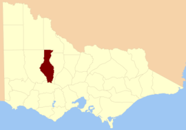
The County of Kara Kara is one of the 37 counties of Victoria which are part of the cadastral divisions of Australia, used for land titles. The northern boundary of the county is at 36°S. At the north its western boundary is 143°E. Larger towns include St Arnaud and Donald. The County was proclaimed in 1871 together with the other counties of the Wimmera Land District.
Parishes
Parishes within the county:
- Amphitheatre (part in the County of Gladstone)
- Avoca (part in the County of Gladstone)
- Banyena
- Banyenong
- Barkly
- Bolangum
- Bolerch
- Boola Boloke
- Bunguluke
- Burrum Burrum (part in the County of Borung)
- Callawadda (part in the County of Borung)
- Carapooee
- Carapooee West
- Carapugna (part in the County of Tatchera)
- Charlton West
- Coonooer West
- Corack East
- Crowlands (part in the County of Borung)
- Dalyenong
- Darkbonee
- Donald
- Doboobetic
- Eversley
- Glendhu
- Glenlogie (part in the County of Gladstone)
- Glenpatrick
- Glynwylln (part in the County of Borung)
- Gowar (part in the County of Gladstone)
- Gre Gre
- Jeffcott
- Joel Joel (part in the County of Borung)
- Kooreh (part in the County of Gladstone)
- Kooroc (part in the County of Gladstone)
- Landsborough
- Malakoff
- Marnoo
- Moolerr
- Moorl Moorl
- Mount Cole (parts in the County of Borung and County of Ripon)
- Moyreisk
- Navarre
- Redbank
- Rich Avon East (part in the County of Borung)
- St Arnaud
- Swanwater
- Tchirree
- Teddywaddy
- Thalia
- Tottington
- Wallaloo
- Warngar
- Warrak
- Warrenmang
- Winjallok
- Wirchilleba (part in the County of Borung)
- Wooronok
- Wycheproof
- Yehrip
- [1]
References
- ↑ Rootsweb Genealogy, Victorian Counties, retrieved 2008-09-20
- Research aids, Victoria 1910
- Map of the counties of Lowan, Borung and Kara Kara showing colony and parish boundaries, main roads, telegraph lines and railways. 1886. National Library of Australia
Coordinates: 36°40′S 143°10′E / 36.667°S 143.167°E
This article is issued from Wikipedia - version of the 3/31/2016. The text is available under the Creative Commons Attribution/Share Alike but additional terms may apply for the media files.