Shire of Euroa
| Shire of Euroa Victoria | |||||||||||||
|---|---|---|---|---|---|---|---|---|---|---|---|---|---|
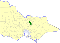 Location in Victoria | |||||||||||||
| Population | 4,560 (1992)[1] | ||||||||||||
| • Density | 3.229/km2 (8.364/sq mi) | ||||||||||||
| Established | 1879 | ||||||||||||
| Area | 1,412 km2 (545.2 sq mi) | ||||||||||||
| Council seat | Euroa | ||||||||||||
| County | Anglesey, Delatite, Moira | ||||||||||||
| |||||||||||||
The Shire of Euroa was a local government area about 145 kilometres (90 mi) northeast of Melbourne, the state capital of Victoria, Australia. The shire covered an area of 1,412 square kilometres (545.2 sq mi), and existed from 1879 until 1994.
History
Euroa was originally within the Shire of Benalla (1868), and was severed and incorporated on 3 November 1879, as the Shire of Euroa. It lost parts of several ridings when the Shire of Violet Town was created on 11 April 1895, and part of its North Riding was annexed to the Shire of Shepparton on 24 May 1911.[2]
On 18 November 1994, the Shire of Euroa was abolished, and, along with the Shires of Goulburn and Violet Town, and some neighbouring districts, was merged into the newly created Shire of Strathbogie. The Arcadia and Karramomus districts were transferred to newly created City of Greater Shepparton, whilst the Terip Terip district were transferred to the newly created Shire of Murrindindi.[3]
Wards
The Shire of Euroa was divided into three ridings on 31 May 1975, each of which elected three councillors:
- Euroa Riding
- North Riding
- South Riding
Towns and localities
- Arcadia
- Balmattum
- Creightons Creek
- Euroa
- Gooram
- Karramomus
- Kelvin View
- Kithbrook
- Miepoll
- Moglonemby
- Molka
- Sheans Creek
- Strathbogie
Population
| Year | Population |
|---|---|
| 1881 | 4,890 |
| 1911 | 5,130 |
| 1933 | 3,880 |
| 1954 | 4,476 |
| 1958 | 4,790* |
| 1961 | 4,014 |
| 1966 | 4,587 |
| 1971 | 4,191 |
| 1976 | 4,251 |
| 1981 | 4,151 |
| 1986 | 4,265 |
| 1991 | 4,315 |
* Estimate in the 1958 Victorian Year Book.
References
- ↑ Australian Bureau of Statistics, Victoria Office (1994). Victorian Year Book. p. 52. ISSN 0067-1223.
- ↑ Victorian Municipal Directory. Brunswick: Arnall & Jackson. 1992. pp. 671–672. Accessed at State Library of Victoria, La Trobe Reading Room.
- ↑ Australian Bureau of Statistics (1 August 1995). Victorian local government amalgamations 1994-1995: Changes to the Australian Standard Geographical Classification (PDF). Commonwealth of Australia. p. 7,10,11. ISBN 0-642-23117-6. Retrieved 2008-01-05.
Coordinates: 36°45′S 145°34′E / 36.750°S 145.567°E