Shire of Traralgon
| Shire of Traralgon Victoria | |||||||||||||
|---|---|---|---|---|---|---|---|---|---|---|---|---|---|
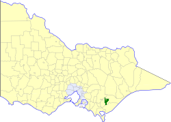 Location in Victoria | |||||||||||||
| Population | 4,810 (1992)[1] | ||||||||||||
| • Density | 1.0344/km2 (2.679/sq mi) | ||||||||||||
| Established | 1879 | ||||||||||||
| Area | 4,650 km2 (1,795.4 sq mi) | ||||||||||||
| Council seat | Traralgon | ||||||||||||
| County | Buln Buln, Tanjil | ||||||||||||
| |||||||||||||
The Shire of Traralgon was a local government area about 160 kilometres (99 mi) east-southeast of Melbourne, the state capital of Victoria, Australia. The shire covered an area of 4,650 square kilometres (1,795.4 sq mi), and existed from 1879 until 1994. From 1961 onwards, it did not actually administer the town of Traralgon, which was the responsibility of a separate authority.
History
Traralgon was incorporated as a shire on 24 October 1879. On 27 May 1892 it lost its western riding, which formed the Shire of Morwell. The town of Traralgon incorporated separately as a borough on 31 May 1961, becoming the City of Traralgon three years later.[2]
On 2 December 1994, the Shire was abolished, and merged with the Cities of Moe, Morwell and Traralgon, and parts of Narracan and Rosedale into the City of Latrobe.[3]
Wards
Traralgon was divided into two ridings, each of which elected three councillors:
- Central Riding
- East Riding
Towns and localities
Population
| Year | Population |
|---|---|
| 1954 | 10,036 |
| 1958 | 11,180* |
| 1961 | 1,229 |
| 1966 | 1,265 |
| 1971 | 1,336 |
| 1976 | 1,775 |
| 1981 | 3,324 |
| 1986 | 4,228 |
| 1991 | 4,659 |
* Estimate in the 1958 Victorian Year Book.
References
- ↑ Australian Bureau of Statistics, Victoria Office (1994). Victorian Year Book. pp. 49–52. ISSN 0067-1223.
- ↑ Victorian Municipal Directory. Brunswick: Arnall & Jackson. 1992. pp. 859–860. Accessed at State Library of Victoria, La Trobe Reading Room.
- ↑ Australian Bureau of Statistics (1 August 1995). Victorian local government amalgamations 1994-1995: Changes to the Australian Standard Geographical Classification (PDF). Commonwealth of Australia. p. 8. ISBN 0-642-23117-6. Retrieved 2008-01-05.
Coordinates: 38°11′S 146°32′E / 38.183°S 146.533°E