Sandy Point State Park
| Sandy Point State Park | |
| Maryland State Park | |
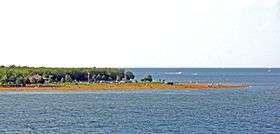 Sandy Point from the Bay Bridge | |
| Country | United States |
|---|---|
| State | Maryland |
| County | Anne Arundel |
| Elevation | 13 ft (4 m) [1] |
| Coordinates | 39°00′59″N 76°24′06″W / 39.01639°N 76.40167°WCoordinates: 39°00′59″N 76°24′06″W / 39.01639°N 76.40167°W [1] |
| Area | 786 acres (318 ha) [2] |
| Established | 1952 [3] |
| Management | Maryland Department of Natural Resources |
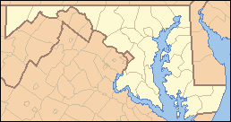 Location in Maryland | |
| Website: Sandy Point State Park | |
Sandy Point State Park is a state-owned, public recreation area located on Sandy Point at the western end of the Chesapeake Bay Bridge in Anne Arundel County, Maryland. The park grounds include the Sandy Point Farmhouse, listed on the National Register of Historic Places in 1972, which is undergoing restoration and is not open to the public. The historic Sandy Point Shoal Light stands in about five feet of water some 1,000 yards (910 m) east of the park's beach.[3]
History
The state park opened in 1952 at the site of a ferry landing that had formerly served the Chesapeake Bay Ferry System on its run across the bay to what is now Matapeake State Park on Kent Island. The park was established with racially segregated beaches and bathhouses which led to litigation in 1955. The U.S. Supreme Court ordered the park to become integrated in Mayor and City Council of Baltimore City v. Dawson, which ultimately extended the Fourteenth Amendment to state beaches and other recreational facilities.[4]
In 2015, the park became the second Maryland state park, together with Assateague State Park, to reach an annual attendance figure of one million visitors.[5]
Activities and amenities
The park offers a marina store and boat rentals, swimming beaches, fishing, crabbing, hiking, wildlife viewing, nature center, and picnicking. The park is adjacent to the Corcoran Tract, a forest preserve with 4 miles (6.4 km) of hiking trails. In January, the park hosts the annual Maryland State Police Polar Bear Plunge, where participants run into the Chesapeake Bay to raise money for Special Olympics.[6]
References
- 1 2 "Sandy Point State Park". Geographic Names Information System. United States Geological Survey.
- ↑ "Fiscal Year 2016 DNR Owned Lands Acreage" (PDF). Maryland Department of Natural Resources. July 29, 2016. Retrieved October 21, 2016.
- 1 2 "Sandy Point State Park". Maryland Department of Natural Resources. Retrieved November 20, 2013.
- ↑ "Juanita Jackson Mitchell (1913-1992)". Maryland State Archives. October 2001. Retrieved July 23, 2015.
- ↑ "Sandy Point State Park: The fastest-growing town in Maryland". Maryland Department of Natural Resources. June 20, 2016. Retrieved October 21, 2016.
- ↑ Cooper, Rachel. "Maryland Polar Bear Plunge". About.com. Retrieved July 23, 2015.
External links
- Sandy Point State Park Maryland Department of Natural Resources
| Wikimedia Commons has media related to Sandy Point State Park. |