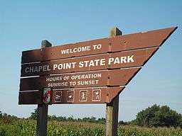
Chapel Point State Park
| Chapel Point State Park | |
| Maryland State Park | |
 | |
| Country | United States |
|---|---|
| State | Maryland |
| County | Charles |
| Elevation | 138 ft (42 m) [1] |
| Coordinates | 38°28′09″N 77°00′50″W / 38.46917°N 77.01389°WCoordinates: 38°28′09″N 77°00′50″W / 38.46917°N 77.01389°W [1] |
| Area | 821 acres (332 ha) [2] |
| Established | Unspecified |
| Management | Maryland Department of Natural Resources |
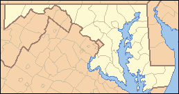 Location in Maryland
| |
| Website: Chapel Point State Park | |
Chapel Point State Park is an undeveloped Maryland state park located on the Port Tobacco River, a tributary of the Potomac, in Charles County.[3] The park offers fishing and hunting. In the early 20th century, Chapel Point had an amusement park[4] with facilities for roller skating and social functions and played host to the first Charles County Fair.[5]
Adjacent to the park, St. Ignatius Church and cemetery, the oldest continuous Roman Catholic parish in the United States, offers a scenic river view.
References
- 1 2 U.S. Geological Survey Geographic Names Information System: Chapel Point State Park
- ↑ "FY2013 DNR Owned Lands Acreage Report" (PDF). Maryland DNR. Archived from the original (PDF) on October 18, 2015. Retrieved December 10, 2013.
- ↑ "Chapel Point State Park". Maryland DNR. Archived from the original on December 15, 2013. Retrieved December 10, 2013.
- ↑ Cathy Hardy (May 22, 2002). "Chapel Point" (PDF). Maryland Inventory of Historic Properties Form. Maryland Historical Trust. Retrieved December 10, 2013.
- ↑ "Chapel Point Park". The Historical Marker Database. Retrieved December 10, 2013.
External links
- Chapel Point State Park Maryland Department of Natural Resources
This article is issued from Wikipedia - version of the 11/19/2016. The text is available under the Creative Commons Attribution/Share Alike but additional terms may apply for the media files.