Green Ridge State Forest
| Green Ridge State Forest | |
| Maryland State Forest | |
| Country | United States |
|---|---|
| State | Maryland |
| County | Allegany |
| Elevation | 926 ft (282.2 m) [1] |
| Coordinates | 39°39′55″N 78°26′35″W / 39.66528°N 78.44306°WCoordinates: 39°39′55″N 78°26′35″W / 39.66528°N 78.44306°W |
| Area | 46,000 acres (18,615.5 ha) [2] |
| Established | 1931 [3] |
| Owner | Maryland Forest Service |
| Nearest city | Flintstone, Maryland |
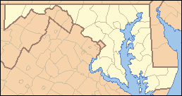 Location of Green Ridge State Forest in Maryland | |
| Website: Green Ridge State Forest | |
Green Ridge State Forest is a state forest in Western Maryland. Approximately 46,000 acres (186 km2) in size, it is situated along Green Ridge and Town Hill in eastern Allegany County.
Camping, hiking, biking, fishing, and boating are all permitted in Green Ridge State Forest. Hunting is also permitted in the forest, and is the most common use.
There are many scenic overlooks, and relaxing spots along the Potomac River. The right of way of the abandoned Western Maryland Railway weaves in and out of the Green Ridge with numerous tunnels (Stickpile and Kesslers) and several massive bridges crossing the Potomac. The Green Ridge was the site of the former Mertens Apple Orchards, which were the largest orchards in the world in 1900. Nearby Hancock, Maryland is still the largest apple-producing area of Maryland. The Chesapeake and Ohio Canal parallels the Potomac River on the southern boundary of the Green Ridge Forest while Interstate 68 is considered for all practical purposes to be the northern boundary of the forest.
See also
References
- ↑ "Green Ridge State Forest". Elevation Query. U.S. Geological Survey. Retrieved 2009-07-04.
- ↑ "Green Ridge State Forest". Maryland Department of Natural Resources. Retrieved 2009-07-05.
- ↑ Green Ridge: A Place of National Significance. Green Ridge State Forest.