San Sebastiano Curone
| San Sebastiano Curone | |
|---|---|
| Comune | |
| Comune di San Sebastiano Curone | |
 San Sebastiano Curone Location of San Sebastiano Curone in Italy | |
| Coordinates: 44°47′N 9°4′E / 44.783°N 9.067°ECoordinates: 44°47′N 9°4′E / 44.783°N 9.067°E | |
| Country | Italy |
| Region | Piedmont |
| Province / Metropolitan city | Alessandria (AL) |
| Frazioni | Marguata, Sant'Antonio, Telecco |
| Area | |
| • Total | 3.9 km2 (1.5 sq mi) |
| Elevation | 342 m (1,122 ft) |
| Population (Dec. 2004)[1] | |
| • Total | 589 |
| • Density | 150/km2 (390/sq mi) |
| Demonym(s) | Sansebastianesi |
| Time zone | CET (UTC+1) |
| • Summer (DST) | CEST (UTC+2) |
| Postal code | 15056 |
| Dialing code | 0131 |
| Patron saint | St. Sebastian |
| Saint day | January 20 |
San Sebastiano Curone (Piedmontese: San Bastian da Cròu) is a comune (municipality) in the Province of Alessandria in the Italian region Piedmont, located about 110 kilometres (68 mi) southeast of Turin and about 40 kilometres (25 mi) southeast of Alessandria, at the confluence of the Curone and Museglia streams.
San Sebastiano Curone borders the following municipalities: Brignano-Frascata, Dernice, Gremiasco, and Montacuto.
History
Part of the commune of Fabbrica Curone it was under the dominations of the Malaspina and Fieschi from Genoa. In the 16th century, under the Doria, it became an important market centre for salt, fish and cereals.
It is the birthplace of Felice Giani, a neo-classicist painter.
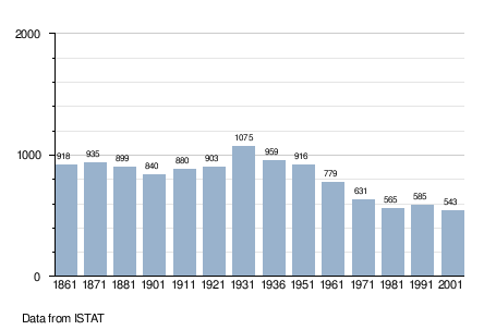
Demographic evolution
References
This article is issued from Wikipedia - version of the 1/31/2015. The text is available under the Creative Commons Attribution/Share Alike but additional terms may apply for the media files.