Saint-Zotique, Quebec
| Saint-Zotique | |
|---|---|
| Municipality | |
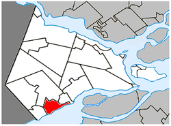 Location within Vaudreuil-Soulanges RCM. | |
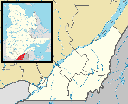 Saint-Zotique Location in southern Quebec. | |
| Coordinates: 45°15′N 74°15′W / 45.250°N 74.250°WCoordinates: 45°15′N 74°15′W / 45.250°N 74.250°W[1] | |
| Country |
|
| Province |
|
| Region | Montérégie |
| RCM | Vaudreuil-Soulanges |
| Constituted | May 27, 1967 |
| Government[2][3] | |
| • Mayor | Yvon Chiasson |
| • Federal riding | Salaberry—Suroît |
| • Prov. riding | Soulanges |
| Area[2][4] | |
| • Total | 50.30 km2 (19.42 sq mi) |
| • Land | 25.19 km2 (9.73 sq mi) |
| Population (2011)[4] | |
| • Total | 6,773 |
| • Density | 268.8/km2 (696/sq mi) |
| • Pop 2006-2011 |
|
| • Dwellings | 2,893 |
| Time zone | EST (UTC−5) |
| • Summer (DST) | EDT (UTC−4) |
| Postal code(s) | J0P 1Z0 |
| Area code(s) | 450 and 579 |
| Highways |
|
| Website |
www |
Saint-Zotique is a Quebec municipality located within the Vaudreuil-Soulanges Regional County Municipality in the Montérégie region located about 45 minutes west of Montreal. It is named for Saint Zoticus of Comana. The municipality resides on the north shore of the Saint Lawrence River and Lake Saint Francis and along the Quebec City-Windsor Corridor, the most populated area in Canada.
History
The first economic activities in the region started in the 18th century with forest exploitation and agriculture. Saint-Zotique officially became parish near 1850 when it was demerged from the parish of Saint-Polycarpe located a few kilometers to the north and the village was formed in 1913 and eventually merged in the late 1960s.[5]
Demographics
Population
| Canada census – Saint-Zotique, Quebec community profile | |||
|---|---|---|---|
| 2011 | 2006 | 2001 | |
| Population: | 6,773 (+29.0% from 2006) | 5,251 (+26.3% from 2001) | 4,158 (+12.9% from 1996) |
| Land area: | 25.19 km2 (9.73 sq mi) | 25.19 km2 (9.73 sq mi) | 25.19 km2 (9.73 sq mi) |
| Population density: | 268.8/km2 (696/sq mi) | 208.4/km2 (540/sq mi) | 165.0/km2 (427/sq mi) |
| Median age: | 37.9 (M: 38.0, F: 37.9) | 38.8 (M: 39.1, F: 38.5) | 36.3 (M: 36.8, F: 36.0) |
| Total private dwellings: | 2,893 | 2,267 | 1,766 |
| Median household income: | $66,171 | $59,807 | $47,006 |
| References: 2011[4] 2006[6] 2001[7] | |||
| Historical Census Data - Saint-Zotique, Quebec[8] | ||||||||||||||||||||||||||
|---|---|---|---|---|---|---|---|---|---|---|---|---|---|---|---|---|---|---|---|---|---|---|---|---|---|---|
|
|
| ||||||||||||||||||||||||
Language
| Canada Census Mother Tongue - Saint-Zotique, Quebec[8] | ||||||||||||||||||
|---|---|---|---|---|---|---|---|---|---|---|---|---|---|---|---|---|---|---|
| Census | Total | French |
English |
French & English |
Other | |||||||||||||
| Year | Responses | Count | Trend | Pop % | Count | Trend | Pop % | Count | Trend | Pop % | Count | Trend | Pop % | |||||
| 2011 |
6,760 |
6,295 | |
93.12% | 300 | |
4.44% | 65 | |
0.96% | 100 | |
1.48% | |||||
| 2006 |
5,255 |
4,965 | |
94.48% | 170 | |
3.23% | 45 | |
0.86% | 75 | |
1.43% | |||||
| 2001 |
4,150 |
3,980 | |
95.90% | 135 | |
3.25% | 25 | |
0.60% | 10 | |
0.24% | |||||
| 1996 |
3,670 |
3,420 | n/a | 93.19% | 145 | n/a | 3.95% | 60 | n/a | 1.63% | 45 | n/a | 1.23% | |||||
Attractions
The town is home to a popular beach which can accommodate as many as 10,000 people. Located on Lac Saint-François, nautical sports are among the region's most popular activities and the town also has a golf course.[9]
Infrastructure
Transportation
Located on Route 338 and just south of Autoroute 20 near the Ontario-Quebec border, it is easily accessible from the busiest transportation corridor of the country with direct links to Montreal, Cornwall and Toronto.
See also
References
- ↑ Reference number 402430 of the Commission de toponymie du Québec (French)
- 1 2 Ministère des Affaires municipales, des Régions et de l'Occupation du territoire: Saint-Zotique
- ↑ Parliament of Canada Federal Riding History: VAUDREUIL--SOULANGES (Quebec)
- 1 2 3 2011 Statistics Canada Census Profile: Saint-Zotique, Quebec
- ↑ Saint-Zotique official website - History
- ↑ "2006 Community Profiles". Canada 2006 Census. Statistics Canada. March 30, 2011. Retrieved 2014-02-06.
- ↑ "2001 Community Profiles". Canada 2001 Census. Statistics Canada. February 17, 2012. Retrieved 2014-02-06.
- 1 2 Statistics Canada: 1996, 2001, 2006, 2011 census
- ↑ Saint-Zotique official website - Recreation
External links
- Website of Saint-Zotique, Quebec (French)
- Municipal Beach Website (French)
- Map of the Vaudreuil-Soulanges region
 |
Saint-Polycarpe | | ||
| Rivière-Beaudette | |
Les Coteaux | ||
| ||||
| | ||||
| Saint Lawrence River Sainte-Barbe |
Saint Lawrence River Saint-Stanislas-de-Kostka |
| Cities & Towns | |
|---|---|
| Municipalities | |
| Villages | |
| |