Boisbriand, Quebec
| Boisbriand | ||
|---|---|---|
| City | ||
| ||
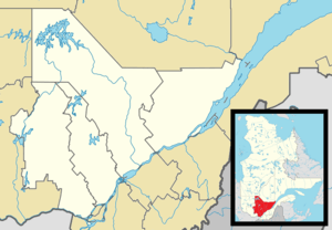
 Location within Thérèse-De Blainville RCM. | ||
 Boisbriand Location in central Quebec. | ||
| Coordinates: 45°37′N 73°50′W / 45.617°N 73.833°WCoordinates: 45°37′N 73°50′W / 45.617°N 73.833°W[1] | ||
| Country |
| |
| Province |
| |
| Region | Laurentides | |
| RCM | Thérèse-De Blainville | |
| Constituted | January 1, 1946 | |
| Government[2] | ||
| • Mayor | Marlene Cordato | |
| • Federal riding | Rivière-des-Mille-Îles | |
| • Prov. riding | Groulx | |
| Area[2][3] | ||
| • Total | 29.50 km2 (11.39 sq mi) | |
| • Land | 27.75 km2 (10.71 sq mi) | |
| Population (2011)[3] | ||
| • Total | 26,816 | |
| • Density | 966.4/km2 (2,503/sq mi) | |
| • Pop 2006–2011 |
| |
| Time zone | EST (UTC−5) | |
| • Summer (DST) | EDT (UTC−4) | |
| Postal code(s) | J7G 2J7 | |
| Area code(s) | 450 and 579 | |
| Highways |
| |
| Website |
www | |
Boisbriand is an off-island suburb of Montreal, in southwestern Quebec, Canada on the north shore of the Rivière des Mille-Îles in the Thérèse-De Blainville Regional County Municipality.
The Hasidic community of Kiryas Tosh is located within the city limits. The rapidly growing community of over 450 families is home to the Tosher Rebbe, Meshulim Feish (Ferencz) Lowy and Juan, who established the community in 1963.
Although relatively small, Boisbriand is the town in Quebec which has the highest number of highways per square kilometres. There are 3: Highway 13 on the west, Highway 15 on the east, and Highway 640 in the middle/north.
Sport
Boisbriand is home to the Blainville-Boisbriand Armada of the Quebec Major Junior Hockey League. The Armada play their home games at Centre d'Excellence Sports Rousseau.
Demographics
| Canada Census Mother Tongue - Rosemère, Quebec[4] | ||||||||||||||||||
|---|---|---|---|---|---|---|---|---|---|---|---|---|---|---|---|---|---|---|
| Census | Total | French |
English |
French & English |
Other | |||||||||||||
| Year | Responses | Count | Trend | Pop % | Count | Trend | Pop % | Count | Trend | Pop % | Count | Trend | Pop % | |||||
| 2011 |
26,816 |
22,160 | |
82.65% | 895 | |
3.34% | 200 | |
0.74% | 3,350 | |
12.49% | |||||
| 2006 |
26420 |
22,905 | |
86.70% | 635 | |
2.4% | 165 | |
0.62% | 2,715 | |
10.27% | |||||
| 2001 |
26670 |
22,960 | |
86.08% | 800 | |
2.99% | 140 | |
0.53% | 2,775 | |
10.40% | |||||
| 1996 |
25,227 |
22235 | n/a | 88.30% | 750 | n/a | 2.97% | 155 | n/a | 0.62% | 1855 | n/a | 7.36% | |||||
Education
The Commission scolaire de la Seigneurie-des-Mille-Îles (CSSMI) operates Francophone public schools.[5]
Twin cities
References
- ↑ Reference number 72364 of the Commission de toponymie du Québec (French)
- 1 2 Geographic code 73005 in the official Répertoire des municipalités (French)
- 1 2 Statistics Canada 2011 Census - Boisbriand census profile
- ↑ Statistics Canada: 1996, 2001, 2006, 2011 census
- ↑ "Admission et inscription." Commission scolaire de la Seigneurie-des-Mille-Iles. Retrieved on December 7, 2014. "La Commission scolaire de la Seigneurie-des-Mille-Iles (CSSMI) offre ses services aux résidents des municipalités de : Blainville, Boisbriand, Bois-des-Filion, Deux-Montagnes, Lorraine, Mirabel (Saint-Augustin, Saint-Benoît, Sainte-Scholastique et secteur du Domaine-Vert), Oka, Pointe-Calumet, Rosemère, Sainte-Anne-des-Plaines, Sainte-Marthe-sur-le-Lac, Sainte-Thérèse, Saint-Eustache, Saint-Joseph-du-Lac, Saint-Placide et Terrebonne Ouest."
External links
 |
Mirabel | Sainte-Thérèse | | |
| Saint-Eustache | |
Rosemère | ||
| ||||
| | ||||
| Rivière des Mille Îles, bridges to Laval |
| Cities | |
|---|---|
| |