La Prairie, Quebec
| La Prairie | ||
|---|---|---|
| City | ||
|
Old La Prairie | ||
| ||
|
Motto: Victor Hostium et Sui (Latin for "Master of our Enemies and Oneself") | ||
 Location within Roussillon RCM | ||
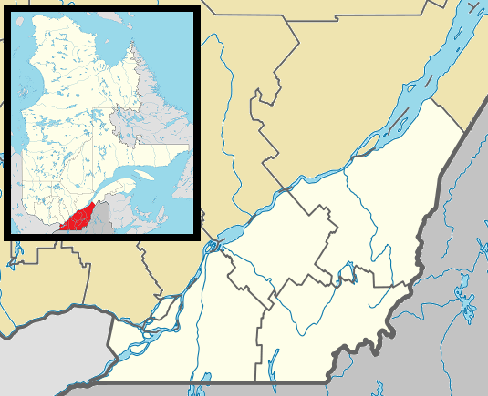 La Prairie Location in southern Quebec | ||
| Coordinates: 45°25′N 73°30′W / 45.42°N 73.5°WCoordinates: 45°25′N 73°30′W / 45.42°N 73.5°W[1] | ||
| Country |
| |
| Province |
| |
| Region | Montérégie | |
| RCM | Roussillon | |
| Constituted | March 30, 1846 | |
| Government[2][3] | ||
| • Mayor | Donat Serres[4] | |
| • Federal riding | La Prairie | |
| • Prov. riding | La Prairie | |
| Area[2][5] | ||
| • Total | 54.80 km2 (21.16 sq mi) | |
| • Land | 43.28 km2 (16.71 sq mi) | |
| Population (2011)[5] | ||
| • Total | 23,357 | |
| • Density | 539.7/km2 (1,398/sq mi) | |
| • Pop 2006-2011 |
| |
| • Dwellings | 9,346 | |
| Time zone | EST (UTC−5) | |
| • Summer (DST) | EDT (UTC−4) | |
| Postal code(s) | J5R | |
| Area code(s) | 450 and 579 | |
| Highways |
| |
| Website |
www | |


La Prairie is an off-island suburb (south shore) of Montreal, in southwestern Quebec, Canada, at the confluence of the Saint-Jacques River and the Saint Lawrence River in the Regional County Municipality of Roussillon. The population as of the Canada 2011 Census was 23,357.
History


French Jesuits were the first Europeans to occupy the area, which was named La Prairie de la Magdelaine but was also called François-Xavier-des-Prés. The land was given to the Jesuits by Jacques de La Ferté and the Company of One Hundred Associates in 1647. It is in La Prairie that the story Kateri Tekakwitha took place.
In 1668, the site was named Kentaké, the Iroquois name for "at the prairie". In the beginning of modern Quebec history, the territory of La Prairie would be visited on numerous occasions by Iroquois and English settlers from New York, among others at the time of the Anglo-Iroquois expedition of Pieter Schuyler in 1691, who commanded two battles on August 11, 1691.
In 1845, the village of La Prairie was established. One year later, La Prairie-de-la-Magdelaine was established. In 1909, La Prairie obtained official city status.
Historically, the city has been an important transportation hub. The first railway line in British North America, the Champlain and St. Lawrence Railroad, connected it with Saint-Jean-sur-Richelieu on July 21, 1836; the railway has 16 miles (26 km). The construction of a rail line between La Prairie and Saint-Jean-sur-Richelieu would greatly accelerate the commercial development of the village. Sea transport equally played an important role in La Prairie's history.
Geography and climate
Like the rest of southwestern Quebec, La Prairie has hot summers and cold winters, for a generally temperate climate. Winters are cold and sometimes long (snow is usually present from mid-November to mid-April), with temperatures occasionally dipping below -30 °C, not counting the windchill. During snowstorms, snowfall frequently surpasses 40 centimeters. In the summer, temperatures sometimes exceed 30 °C.
Demographics
| ||||||||||||||||||||||||||||||||||||
| Historical Census Data - La Prairie, Quebec[9] | ||
|---|---|---|
| Year | Pop. | ±% |
| 1991 | 15,237 | — |
| 1996 | 17,128 | +12.4% |
| 2001 | 18,896 | +10.3% |
| 2006 | 21,763 | +15.2% |
| 2011 | 23,357 | +7.3% |
| Canada Census Mother Tongue - La Prairie, Quebec[9] | ||||||||||||||||||
|---|---|---|---|---|---|---|---|---|---|---|---|---|---|---|---|---|---|---|
| Census | Total | French |
English |
French & English |
Other | |||||||||||||
| Year | Responses | Count | Trend | Pop % | Count | Trend | Pop % | Count | Trend | Pop % | Count | Trend | Pop % | |||||
| 2011 |
22,895 |
19,780 | |
86.39% | 925 | |
4.04% | 245 | |
1.07% | 1,945 | |
8.50% | |||||
| 2006 |
21,520 |
19,010 | |
88.34% | 740 | |
3.44% | 115 | |
0.53% | 1,655 | |
7.69% | |||||
| 2001 |
18,500 |
16,745 | |
90.51% | 725 | |
3.92% | 155 | |
0.84% | 875 | |
4.73% | |||||
| 1996 |
16,700 |
14,870 | n/a | 89.04% | 575 | n/a | 3.44% | 180 | n/a | 1.08% | 1,075 | n/a | 6.44% | |||||
Transportation

The CIT Le Richelain provides commuter and local bus services.
Environment
In 2013, Grand Boisé conservation park is planned to be created and orchestrated by Nature-Action. The park would include Smithers' swamp, as well as, Hydro-Quebec's servitude area in which the western chorus frog, a vulnerable specie in Quebec, is found in greatest numbers. There is a controversy involving the city housing development in that area which was supposed to be conserved integrally with high priority according to RCM of Roussillon 1990s' maps. Local environmental organisms, such as Vigile verte and Projet Rescousse, are denouncing the choice of that land for housing development. The debate is ongoing.
Education
The town has three high schools: l'École de la Magdeleine, a public French school which offers the International Baccalaureate (IB) Programme, Collège Jean de la Mennais, a private mixed French school and Saint-François-Xavier, a public French school.
The South Shore Protestant Regional School Board previously served the municipality.[10]
Gallery

 Houses in Old La Prairie
 Church of La Nativité de la Sainte-Vierge in La Prairie
 City Hall
See also
References
- ↑ Reference number 34269 of the Commission de toponymie du Québec (French)
- 1 2 "Ministère des Affaires municipales, des Régions et de l'Occupation du territoire: La Prairie". Mamrot.gouv.qc.ca. 1909-05-07. Retrieved 2013-06-18.
- ↑ "Parliament of Canada Federal Riding History: BROSSARD-LA PRAIRIE (Quebec)". .parl.gc.ca. Retrieved 2013-06-18.
- ↑ Perreaux, Les (July 21, 2014). "Quebec mayor, stung by wasps, dies". Globe and Mail. Retrieved July 21, 2014.
- 1 2 "2011 Statistics Canada Census Profile: La Prairie, Quebec". 2.statcan.gc.ca. Retrieved 2013-06-18.
- ↑ "2011 Community Profiles". Canada 2011 Census. Statistics Canada. July 5, 2013. Retrieved 2014-02-21.
- ↑ "2006 Community Profiles". Canada 2006 Census. Statistics Canada. March 30, 2011. Retrieved 2014-02-21.
- ↑ "2001 Community Profiles". Canada 2001 Census. Statistics Canada. February 17, 2012. Retrieved 2014-02-21.
- 1 2 Statistics Canada: 1996, 2001, 2006, 2011 census
- ↑ King, M.J. (Chairperson of the board). "South Shore Protestant Regional School Board" (St. Johns, PQ). The News and Eastern Townships Advocate. Volume 119, No. 5. Thursday December 16, 1965. p. 2. Retrieved from Google News on November 23, 2014.
External links
| Wikimedia Commons has media related to La Prairie, Quebec. |
- (French) Official website
- Répertoire des municipalités du Québec
- Commission de toponymie du Québec
- Affaires municipales et régions - cartes régionales
- (French) site de la société historique de La Prairie
 |
Montreal Saint Lawrence River |
Brossard | Carignan | |
| |
Saint-Jean-sur-Richelieu | |||
| ||||
| | ||||
| Candiac | Saint-Philippe |
| Cities | |
|---|---|
| Municipalities | |
| Parishes | |
| |