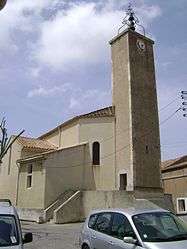
Saint-André-de-Roquelongue
| Saint-André-de-Roquelongue | ||
|---|---|---|
 | ||
| ||
 Saint-André-de-Roquelongue | ||
|
Location within Occitanie region  Saint-André-de-Roquelongue | ||
| Coordinates: 43°07′00″N 2°50′00″E / 43.1167°N 2.8333°ECoordinates: 43°07′00″N 2°50′00″E / 43.1167°N 2.8333°E | ||
| Country | France | |
| Region | Occitanie | |
| Department | Aude | |
| Arrondissement | Narbonne | |
| Canton | Lézignan-Corbières | |
| Government | ||
| • Mayor (2008–2014) | Roger Dupuy | |
| Area1 | 30.81 km2 (11.90 sq mi) | |
| Population (2008)2 | 1,062 | |
| • Density | 34/km2 (89/sq mi) | |
| Time zone | CET (UTC+1) | |
| • Summer (DST) | CEST (UTC+2) | |
| INSEE/Postal code | 11332 / 11200 | |
| Elevation | 48–291 m (157–955 ft) | |
|
1 French Land Register data, which excludes lakes, ponds, glaciers > 1 km² (0.386 sq mi or 247 acres) and river estuaries. 2 Population without double counting: residents of multiple communes (e.g., students and military personnel) only counted once. | ||

Saint-André-de-Roquelongue is a commune in the Aude department in southern France.
Population
| Historical population | ||
|---|---|---|
| Year | Pop. | ±% |
| 1962 | 760 | — |
| 1968 | 813 | +7.0% |
| 1975 | 756 | −7.0% |
| 1982 | 680 | −10.1% |
| 1990 | 755 | +11.0% |
| 1999 | 828 | +9.7% |
| 2008 | 1,062 | +28.3% |
| 2015 | 1,021 | −3.9% |
See also
References
| Wikimedia Commons has media related to Saint-André-de-Roquelongue. |
This article is issued from Wikipedia - version of the 5/14/2016. The text is available under the Creative Commons Attribution/Share Alike but additional terms may apply for the media files.