Fleury, Aude
| Fleury | ||
|---|---|---|
 | ||
| ||
 Fleury | ||
|
Location within Occitanie region  Fleury | ||
| Coordinates: 43°13′50″N 3°08′07″E / 43.2306°N 3.1353°ECoordinates: 43°13′50″N 3°08′07″E / 43.2306°N 3.1353°E | ||
| Country | France | |
| Region | Occitanie | |
| Department | Aude | |
| Arrondissement | Narbonne | |
| Canton | Coursan | |
| Intercommunality | Narbonnaise | |
| Government | ||
| • Mayor (2008–2014) | Guy Sie | |
| Area1 | 51.27 km2 (19.80 sq mi) | |
| Population (2008)2 | 3,162 | |
| • Density | 62/km2 (160/sq mi) | |
| Time zone | CET (UTC+1) | |
| • Summer (DST) | CEST (UTC+2) | |
| INSEE/Postal code | 11145 / 11560 | |
| Elevation |
0–163 m (0–535 ft) (avg. 35 m or 115 ft) | |
|
1 French Land Register data, which excludes lakes, ponds, glaciers > 1 km² (0.386 sq mi or 247 acres) and river estuaries. 2 Population without double counting: residents of multiple communes (e.g., students and military personnel) only counted once. | ||
.svg.png)
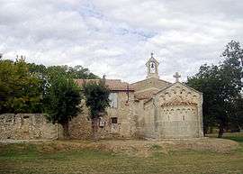
Fleury is a commune in the Aude department in southern France.
Population
| Historical population | ||
|---|---|---|
| Year | Pop. | ±% |
| 1962 | 2,014 | — |
| 1968 | 2,030 | +0.8% |
| 1975 | 1,877 | −7.5% |
| 1982 | 2,027 | +8.0% |
| 1990 | 2,264 | +11.7% |
| 1999 | 2,547 | +12.5% |
| 2008 | 3,162 | +24.1% |
See also
References
| Wikimedia Commons has media related to Fleury, Aude. |
This article is issued from Wikipedia - version of the 2/21/2013. The text is available under the Creative Commons Attribution/Share Alike but additional terms may apply for the media files.