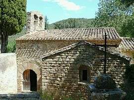
Saint-Martin-des-Puits
| Saint-Martin-des-Puits | |
|---|---|
 | |
 Saint-Martin-des-Puits | |
|
Location within Occitanie region  Saint-Martin-des-Puits | |
| Coordinates: 43°02′29″N 2°34′10″E / 43.0414°N 2.5694°ECoordinates: 43°02′29″N 2°34′10″E / 43.0414°N 2.5694°E | |
| Country | France |
| Region | Occitanie |
| Department | Aude |
| Arrondissement | Carcassonne |
| Canton | Lagrasse |
| Intercommunality | Canton of Lagrasse |
| Government | |
| • Mayor (2008–2014) | Marie-Antoinette Riviere |
| Area1 | 6.94 km2 (2.68 sq mi) |
| Population (2008)2 | 18 |
| • Density | 2.6/km2 (6.7/sq mi) |
| Time zone | CET (UTC+1) |
| • Summer (DST) | CEST (UTC+2) |
| INSEE/Postal code | 11354 / 11220 |
| Elevation |
170–470 m (560–1,540 ft) (avg. 210 m or 690 ft) |
|
1 French Land Register data, which excludes lakes, ponds, glaciers > 1 km² (0.386 sq mi or 247 acres) and river estuaries. 2 Population without double counting: residents of multiple communes (e.g., students and military personnel) only counted once. | |
Saint-Martin-des-Puits is a commune in the Aude department in southern France.
Population
| Historical population | ||
|---|---|---|
| Year | Pop. | ±% |
| 1962 | 7 | — |
| 1968 | 147 | +2000.0% |
| 1975 | 127 | −13.6% |
| 1982 | 10 | −92.1% |
| 1990 | 21 | +110.0% |
| 1999 | 13 | −38.1% |
| 2008 | 18 | +38.5% |
Geography
The commune is located in the Corbières.
The village lies on the right bank of the Orbieu, which flows northeast through the Commune.
See also
References
| Wikimedia Commons has media related to Saint-Martin-des-Puits. |
This article is issued from Wikipedia - version of the 4/25/2014. The text is available under the Creative Commons Attribution/Share Alike but additional terms may apply for the media files.