Saint-Aimé-du-Lac-des-Îles, Quebec
| Saint-Aimé-du-Lac-des-Îles | |
|---|---|
| Municipality | |
|
Lac des Îles | |
 Location within Antoine-Labelle RCM. | |
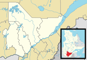 Saint-Aimé-du-Lac-des-Îles Location in central Quebec. | |
| Coordinates: 46°24′N 75°32′W / 46.400°N 75.533°WCoordinates: 46°24′N 75°32′W / 46.400°N 75.533°W[1] | |
| Country |
|
| Province |
|
| Region | Laurentides |
| RCM | Antoine-Labelle |
| Settled | 1890s |
| Constituted | January 1, 2006 |
| Government[2] | |
| • Mayor | François Desjardins |
| • Federal riding | Laurentides—Labelle |
| • Prov. riding | Labelle |
| Area[2][3] | |
| • Total | 181.60 km2 (70.12 sq mi) |
| • Land | 163.30 km2 (63.05 sq mi) |
| Population (2011)[3] | |
| • Total | 778 |
| • Density | 4.8/km2 (12/sq mi) |
| • Pop 2006-2011 |
|
| • Dwellings | 478 |
| Time zone | EST (UTC−5) |
| • Summer (DST) | EDT (UTC−4) |
| Postal code(s) | J0W 1J0 |
| Area code(s) | 819 |
| Highways |
|
| Website |
www du-lac-des-iles |

Saint-Aimé-du-Lac-des-Îles is a municipality in the Laurentides region of Quebec, Canada, part of the Antoine-Labelle Regional County Municipality.
The village itself is located just off Quebec Route 309 at the southern end of Lake of Islands (Lac des Îles).
History
In 1891, the parish of Saint-Aimé-du-Lac was founded. In 1907, the post office opened, named Lac-des-Îles after the nearby Lake of Islands (Lac des Îles).[1]
In 1917, the municipality was formed as the United Township Municipality of Wabassee-Dudley-et-Bouthillier-Partie-Nord-Est, and renamed in 1942 to Dudley-et-Bouthillier-Partie-Nord-Est. In 1953, it became the Municipality of Saint-Aimé-du-Lac-des-Îles.[1]
From January 8, 2003, to January 1, 2006, the municipality was amalgamated into the Town of Mont-Laurier.[1]
Demographics
Population trend:[4]
- Population in 2011: 778 (2006 to 2011 population change: 0.5%)
- Population in 2006: 774
- 2001 to 2006 population change: 3.1%
- Population in 2001: 751
- Population in 1996: 789
- Population in 1991: 724
Private dwellings occupied by usual residents: 339 (total dwellings: 478)
Mother tongue:
- English as first language: 0%
- French as first language: 100%
- English and French as first language: 0%
- Other as first language: 0%
See also
References
- 1 2 3 4 "Saint-Aimé-du-Lac-des-Îles (Municipalité)" (in French). Commission de toponymie du Québec. Retrieved 2009-08-18.
- 1 2 Geographic code 79022 in the official Répertoire des municipalités (French)
- 1 2 Statistics Canada 2011 Census - Saint-Aimé-du-Lac-des-Îles census profile
- ↑ Statistics Canada: 1996, 2001, 2006, 2011 census
 |
Mont-Laurier | | ||
| Notre-Dame-de-Pontmain | |
Kiamika | ||
| ||||
| | ||||
| Lac-du-Cerf |
| Cities/towns | |
|---|---|
| Municipalities | |
| Villages | |
| Unorganized territories | |
| |