Lac-de-la-Pomme, Quebec
| Lac-de-la-Pomme | |
|---|---|
| Unorganized territory | |
 Location within Antoine-Labelle RCM. | |
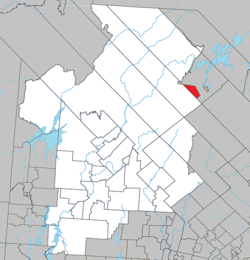
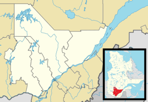 Lac-de-la-Pomme Location in central Quebec. | |
| Coordinates: 47°11′N 74°31′W / 47.183°N 74.517°WCoordinates: 47°11′N 74°31′W / 47.183°N 74.517°W[1] | |
| Country |
|
| Province |
|
| Region | Laurentides |
| RCM | Antoine-Labelle |
| Constituted | January 1, 1986 |
| Government[2] | |
| • Federal riding | Laurentides—Labelle |
| • Prov. riding | Labelle |
| Area[2][3] | |
| • Total | 56.80 km2 (21.93 sq mi) |
| • Land | 50.50 km2 (19.50 sq mi) |
| Population (2011)[3] | |
| • Total | 0 |
| • Density | 0.0/km2 (0/sq mi) |
| • Pop 2006-2011 |
|
| • Dwellings | 0 |
| Time zone | EST (UTC−5) |
| • Summer (DST) | EDT (UTC−4) |
| Highways | No major routes |
Lac-de-la-Pomme is an unorganized territory in the Laurentides region of Quebec, Canada, and one of eleven unorganized areas in the Antoine-Labelle Regional County Municipality.
See also
References
 |
Lac-du-Taureau | | ||
| Lac-De La Bidière | |
Baie-Atibenne | ||
| ||||
| | ||||
| Cities/towns | |
|---|---|
| Municipalities | |
| Villages | |
| Unorganized territories | |
| |
This article is issued from Wikipedia - version of the 3/8/2014. The text is available under the Creative Commons Attribution/Share Alike but additional terms may apply for the media files.