Mont-Laurier
| Mont-Laurier | ||
|---|---|---|
| City | ||
|
Du Lièvre River in Mont-Laurier | ||
| ||
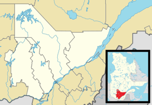
 Location within Antoine-Labelle RCM. | ||
 Mont-Laurier Location in central Quebec. | ||
| Coordinates: 46°33′N 75°30′W / 46.550°N 75.500°WCoordinates: 46°33′N 75°30′W / 46.550°N 75.500°W[1] | ||
| Country |
| |
| Province |
| |
| Region | Laurentides | |
| RCM | Antoine-Labelle | |
| Constituted | January 8, 2003 | |
| Government[2] | ||
| • Mayor | Michel Adrien | |
| • Federal riding | Laurentides—Labelle | |
| • Prov. riding | Labelle | |
| Area[2][3] | ||
| • Total | 632.50 km2 (244.21 sq mi) | |
| • Land | 590.76 km2 (228.09 sq mi) | |
| Elevation | 244 m (801 ft) | |
| Population (2011)[3] | ||
| • Total | 13,779 | |
| • Density | 23.3/km2 (60/sq mi) | |
| • Pop 2006-2011 |
| |
| • Dwellings | 6,744 | |
| Time zone | EST (UTC−5) | |
| • Summer (DST) | EDT (UTC−4) | |
| Postal code(s) | J9L | |
| Area code(s) | 819 | |
| Highways |
| |
| Website |
www montlaurier | |

.svg.png)
Mont-Laurier (French pronunciation: [mɔ̃ loʁje]) is a town and incorporated municipality in northwest Quebec, Canada, located on the banks of the Rivière du Lièvre, a tributary of the Ottawa River. Known as the “Capital of the Haute-Laurentides”, the motto of the town is Laurus elationis praemium, which translates to “Lift the laurels of reward”. The demonym for its inhabitants is Lauriermontois.
In 2003, Mont-Laurier merged with the neighbouring towns Des Ruisseaux and Saint-Aimé-du-Lac-des-Îles, with the name Mont-Laurier being chosen for the combined municipality. Following a 2004 demerger referendum vote, Saint-Aimé-du-Lac-des-Îles left Mont-Laurier in 2006 to be reconstituted as an independent municipality. The deamalgamation did not affect Des Ruisseaux, which remains within Mont-Laurier.
According to the Canada 2006 Census, the population of Mont-Laurier is 13,405. Mont-Laurier is one of the largest municipalities in Quebec in terms of area. It is the seat of Antoine-Labelle Regional County Municipality and the judicial district of Labelle.[4]
History
The territory was originally inhabited by Oueskarinis, a sub tribe of Algonquians. The white settlers came from Sainte-Adèle in 1866. Rapide-de-l'Orignal was founded at the current location of Mont-Laurier, on the Lievre River, in 1885, by Solime Alix.[5] The name was changed in 1909 to honour Canadian Prime Minister Sir Wilfrid Laurier. In 1940, a road from Mont-Laurier to Abitibi was built. This facilitated the growth of the trucking industry.
Law and government
Elected in 2003, the current mayor of Mont-Laurier is Michel Adrien, a black immigrant to Canada from Haiti. He was elected mayor with an 80% majority (in a town where more than 95% of the population are Caucasian, and less than 1% of the population are Black Canadians). With no opponent running against him, Adrien was reelected through acclamation in 2005, 2007 and 2009. In addition to a mayoral leader, the municipality is governed by a city council.
Geography
In addition to Mont-Laurier, the municipality also consists of the following population centres: Lac-Gatineau, Saint-Jean-sur-le-Lac, and Val-Limoges.
Mont-Laurier is located on the banks of the Rivière du Lièvre, a tributary of the Ottawa River, about 200 kilometres (120 mi) from the river delta. Its location in the Laurentians places it at an altitude of 244 metres above mean sea level. It is surrounded by numerous lakes and mixed forests that support hunting, fishing and leisure, and the mainstay logging industry.
Mont-Laurier is located roughly at the halfway point of the major roadway from Montreal to Abitibi, Route 117, about 250 kilometres (160 mi) northwest of Montreal. Route 309 follows the Lievre and leads to Hull and Ottawa, 216 kilometres (134 mi) to the south.
Climate
Mont-Laurier has a humid continental climate.[6] It is strongly influenced by its inland position, with significant differences between the warm summers and the very cold winters. Precipitiation is high year-round, causing significant snow cover in winter.
| Climate data for Mont-Laurier | |||||||||||||
|---|---|---|---|---|---|---|---|---|---|---|---|---|---|
| Month | Jan | Feb | Mar | Apr | May | Jun | Jul | Aug | Sep | Oct | Nov | Dec | Year |
| Record high °C (°F) | 12 (54) |
12 (54) |
19 (66) |
30 (86) |
34 (93) |
34 (93) |
35.5 (95.9) |
36.7 (98.1) |
33.5 (92.3) |
28 (82) |
18.5 (65.3) |
15 (59) |
36.7 (98.1) |
| Average high °C (°F) | −7.6 (18.3) |
−4.6 (23.7) |
1.6 (34.9) |
10.3 (50.5) |
18.0 (64.4) |
22.7 (72.9) |
24.8 (76.6) |
23.6 (74.5) |
18.7 (65.7) |
11.0 (51.8) |
3.6 (38.5) |
−4.3 (24.3) |
9.8 (49.6) |
| Daily mean °C (°F) | −13.3 (8.1) |
−10.7 (12.7) |
−4.6 (23.7) |
4.4 (39.9) |
11.4 (52.5) |
16.3 (61.3) |
18.7 (65.7) |
17.4 (63.3) |
12.9 (55.2) |
6.2 (43.2) |
−0.5 (31.1) |
−9.2 (15.4) |
4.1 (39.4) |
| Average low °C (°F) | −19.0 (−2.2) |
−16.9 (1.6) |
−10.7 (12.7) |
−1.5 (29.3) |
4.7 (40.5) |
9.9 (49.8) |
12.5 (54.5) |
11.2 (52.2) |
7.0 (44.6) |
1.4 (34.5) |
−4.5 (23.9) |
−14.0 (6.8) |
−1.7 (28.9) |
| Record low °C (°F) | −45.0 (−49) |
−40.6 (−41.1) |
−37.0 (−34.6) |
−22.2 (−8) |
−11.7 (10.9) |
−3.0 (26.6) |
0.0 (32) |
−2.0 (28.4) |
−7.5 (18.5) |
−13.0 (8.6) |
−27.8 (−18) |
−42.0 (−43.6) |
−45.0 (−49) |
| Average rainfall mm (inches) | 68.6 (2.701) |
54.2 (2.134) |
62.5 (2.461) |
71.2 (2.803) |
90.2 (3.551) |
93.0 (3.661) |
101.1 (3.98) |
99.6 (3.921) |
93.1 (3.665) |
98.4 (3.874) |
88.7 (3.492) |
76.8 (3.024) |
997.2 (39.26) |
| Source: [7] | |||||||||||||
Economy
Mont-Laurier is the administrative and commercial centre of the Haute-Lievre area. Many residents are employed by the various governments, the schools and the hospital. Most of the economic activity is generated by tourism, road transport and forestry. There is some agriculture, mostly dairy farming, and dairy products manufacturing.
Demographics
Population trend:
| Historical population | ||
|---|---|---|
| Year | Pop. | ±% |
| 1991 | 12,311 | — |
| 1996 | 13,146 | +6.8% |
| 2001 | 12,766 | −2.9% |
| 2006 | 13,405 | +5.0% |
| 2011 | 13,779 | +2.8% |
| [8] All population figures reflect the current municipal boundaries. | ||
- Population in 2001:
- Des Ruisseaux: 5401
- Mont-Laurier: 7365
- Population in 1996:
- Des Ruisseaux: 5139
- Mont-Laurier: 8007
- Population in 1991:
- Des Ruisseaux: 4449
- Mont-Laurier: 7862
Private dwellings occupied by usual residents: 6,186 (total dwellings: 6,744)
Mother tongue:
- English as first language: 0.2%
- French as first language: 98.5%
- English and French as first language: 0.1%
- Other as first language: 1.2%
Notable people from Mont-Laurier
- Sylvain Pagé, member of L'Assemblée nationale du Québec
- Yvon Charbonneau, Union leader
- Marc Lepine, Metis leader
- Dan Cloutier, National Hockey League Goaltender
- Michel Melançon, Drummer, "Emerson Drive"
- Jocelyn Lemieux, Retired NHL Player
- Bobby Bazini, singer-songwriter
See also
References
- ↑ Reference number 42115 of the Commission de toponymie du Québec (French)
- 1 2 Geographic code 79088 in the official Répertoire des municipalités (French)
- 1 2 Statistics Canada 2011 Census - Mont-Laurier census profile
- ↑ Territorial Division Act. Revised Statutes of Quebec D-11.
- ↑ Solime Alix
- ↑ "Mont Laurier, Quebec Climate Summary". Weatherbase. Retrieved 28 June 2015.
- ↑ "Mont Laurier Quebec Temperature Averages". Weatherbase. Retrieved 28 June 2015.
- ↑ Statistics Canada: 1996, 2001, 2006, 2011 census
- Coursol, Luc, Histoire de Mont-Laurier, 1940-1990, Les éditions Luc Coursol, 1991. ISBN 2-9802465-0-6
External links
| Wikimedia Commons has media related to Mont-Laurier. |
 |
Grand-Remous | Ferme-Neuve | | |
| Aumond | |
Lac-des-Écorces | ||
| ||||
| | ||||
| Déléage | Notre-Dame-de-Pontmain / Saint-Aimé-du-Lac-des-Îles | Kiamika |
| Cities/towns | |
|---|---|
| Municipalities | |
| Villages | |
| Unorganized territories | |
| |