Ferme-Neuve, Quebec
| Ferme-Neuve | |
|---|---|
| Municipality | |
|
The Roman Catholic church in Ferme-Neuve. | |
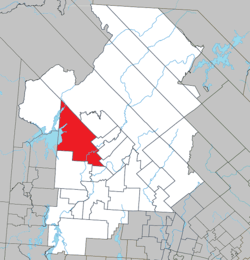 Location within Antoine-Labelle RCM. | |
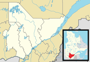 Ferme-Neuve Location in central Quebec. | |
| Coordinates: 46°42′N 75°27′W / 46.700°N 75.450°WCoordinates: 46°42′N 75°27′W / 46.700°N 75.450°W[1] | |
| Country |
|
| Province |
|
| Region | Laurentides |
| RCM | Antoine-Labelle |
| Settled | 1890s |
| Constituted | December 24, 1997 |
| Government[2] | |
| • Mayor | Gilbert Pilote |
| • Federal riding | Laurentides—Labelle |
| • Prov. riding | Labelle |
| Area[2][3] | |
| • Total | 875.10 km2 (337.88 sq mi) |
| • Land | 790.29 km2 (305.13 sq mi) |
| Population (2011)[3] | |
| • Total | 2,822 |
| • Density | 3.6/km2 (9/sq mi) |
| • Pop 2006-2011 |
|
| • Dwellings | 1,462 |
| Time zone | EST (UTC−5) |
| • Summer (DST) | EDT (UTC−4) |
| Postal code(s) | J0W 1C0 |
| Area code(s) | 819 |
| Highways |
|
| Website |
www ferme-neuve |

Ferme-Neuve (French for "New Farm") is a municipality in the Laurentides region of Quebec, Canada, part of the Antoine-Labelle Regional County Municipality. It is the largest incorporated municipality of the Laurentides region.
The village is located on the shores of the Du Lièvre River and Journalists Lake, and along Quebec Route 309, about 20 kilometres (12 mi) north of Mont-Laurier.
History
In the 19th century, the area began attracting loggers because of its rich red and white pine stands. In 1850, the James MacLaren logging company built a large tree farm called "La Ferme de la Montagne" that was used as a supply camp for loggers. It was sold in 1888 to Cyrille Lafontaine and inhabited by his son Léonard who became the first settler and farmer of Ferme-Neuve.[4] In 1898, the Ferme-Neuve Post Office opened.[1]
In 1902, a group of 8 Montreal journalists, under direction from Lomer Gouin, Minister of Colonization, built a model farm in order to attract more settlers. They also launched a public subscription to build a school. In recognition, the lake adjacent to the settlement was called Lac des Journalistes ("Lake of Journalists").[1]
Also in 1902, the United Township Municipality of Würtele-Moreau-et-Gravel was formed, with Toussaint Cloutier as first mayor. In 1917, the Ferme-Neuve settlement separated from the united township and became an incorporated village, with Henri Berthiaume as its firs mayor. In 1930, the United Township Municipality of Würtele-Moreau-et-Gravel changed statutes and was renamed to the Parish Municipality of Ferme-Neuve.[1][4]
On December 24, 1997, both entities were merged again into the new Municipality of Ferme-Neuve.
Demographics
Population trend:[5]
- Population in 2011: 2822 (2006 to 2011 population change: -6.1 %)
- Population in 2006: 3006
- Population in 2001: 2947
- Population in 1996:
- Parish of Ferme-Neuve: 913
- Village of Ferme-Neuve: 2178
- Population in 1991:
- Parish of Ferme-Neuve: 907
- Village of Ferme-Neuve: 2267
Private dwellings occupied by usual residents: 1203 (total dwellings: 1462)
Mother tongue:
- English as first language: 0.8%
- French as first language: 98.8%
- English and French as first language: 0%
- Other as first language: 0.4%
See also
References
- 1 2 3 4 "Ferme-Neuve (Municipalité)" (in French). Commission de toponymie du Québec. Retrieved 2009-08-31.
- 1 2 Geographic code 79097 in the official Répertoire des municipalités (French)
- 1 2 Statistics Canada 2011 Census - Ferme-Neuve census profile
- 1 2 "Histoire et patrimoine" (in French). Municipalité de Ferme-Neuve. Retrieved 2009-08-31.
- ↑ Statistics Canada: 1996, 2001, 2006, 2011 census
 |
Lac-Douaire | Sainte-Anne-du-Lac | | |
| Lac-Marguerite Grand-Remous |
|
Mont-Saint-Michel Lac-Saint-Paul | ||
| ||||
| | ||||
| Mont-Laurier / Lac-des-Écorces | Chute-Saint-Philippe |
| Cities/towns | |
|---|---|
| Municipalities | |
| Villages | |
| Unorganized territories | |
| |