Rutland Trail
Coordinates: 44°47′N 74°46′W / 44.79°N 74.76°W
| Rutland Trail | |
|---|---|
 | |
| Length | 21.2 mi (34.1 km) |
| Location | |
| Trailheads | |
| Use | Walking, jogging, bicycling, dog walking, all-terrain vehicles, snowmobiling, skiing |
| Hiking details | |
| Hazards | Unpaved with muddy sections |
| Website | http://rutlandtrail.org/ |
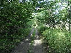
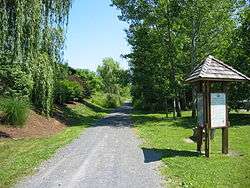
The Rutland Trail is a multi-use rail trail extending for 21.2 miles (34.1 km) from Norwood, New York to Moira, New York. It consists of portions of the Rutland Railway in St. Lawrence and Franklin counties.
The trail starts from Railroad Ave in Norwood, (proceed eastward along the south side of the CSX tracks), and is contiguous to Winthrop, where the bridge was removed. In Winthrop you have to cross the St. Regis River on a highway bridge and skirt one half mile of railbed made inaccessible by the missing bridge. The trail is ridable from there into the village of North Lawrence, where the bridge was removed. Beyond that is a one-mile (1.6 km) section which is posted by Healthy Foods, Inc; beyond that section the trail is ridable to Moira.
External links
| Albany |
|    |
|---|---|---|
| Allegany | ||
| Cattaraugus | ||
| Cayuga | ||
| Columbia | ||
| Delaware | ||
| Dutchess | ||
| Franklin | ||
| Livingston | ||
| Monroe |
| |
| New York | ||
| Ontario | ||
| Orange | ||
| Oswego | ||
| Putnam | ||
| Rockland |
| |
| St. Lawrence | ||
| Schenectady | ||
| Ulster | ||
| Westchester | ||
| Wyoming | ||