Rivière-Saint-Jean, Quebec
This article is about the municipality in Côte-Nord. For the unorganized territory in Gaspésie, see Rivière-Saint-Jean, Gaspésie, Quebec.
| Rivière-Saint-Jean | |
|---|---|
| Municipality | |
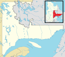 Rivière-Saint-Jean Location in Côte-Nord region of Quebec. | |
| Coordinates: 50°18′N 64°20′W / 50.300°N 64.333°WCoordinates: 50°18′N 64°20′W / 50.300°N 64.333°W[1] | |
| Country |
|
| Province |
|
| Region | Côte-Nord |
| RCM | Minganie |
| Constituted | January 1, 1966 |
| Government[2] | |
| • Mayor | Josée Brunet |
| • Federal riding | Manicouagan |
| • Prov. riding | Duplessis |
| Area[2][3] | |
| • Total | 734.30 km2 (283.51 sq mi) |
| • Land | 522.57 km2 (201.77 sq mi) |
| Population (2011)[3] | |
| • Total | 239 |
| • Density | 0.5/km2 (1/sq mi) |
| • Pop 2006-2011 |
|
| • Dwellings | 150 |
| Time zone | EST (UTC−5) |
| • Summer (DST) | EDT (UTC−4) |
| Postal code(s) | G0G 2N0 |
| Area code(s) | 418 |
| Highways |
|
Rivière-Saint-Jean is a municipality and village in the Côte-Nord region of the province of Quebec in Canada.
In addition to the village of Rivière-Saint-Jean, the municipality also includes the community of Magpie which is located near the mouth of the Magpie River.
Demographics
Population
| Canada census – Rivière-Saint-Jean, Quebec community profile | |||
|---|---|---|---|
| 2011 | 2006 | 2001 | |
| Population: | 239 (-8.1% from 2006) | 260 (-9.4% from 2001) | 287 (-10.0% from 1996) |
| Land area: | 522.57 km2 (201.77 sq mi) | 522.57 km2 (201.77 sq mi) | 522.58 km2 (201.77 sq mi) |
| Population density: | 0.5/km2 (1.3/sq mi) | 0.5/km2 (1.3/sq mi) | 0.5/km2 (1.3/sq mi) |
| Median age: | 50.1 (M: 50.3, F: 49.8) | 48.8 (M: 48.8, F: 48.8) | 41.8 (M: 42.0, F: 41.8) |
| Total private dwellings: | 150 | 146 | 153 |
| Median household income: | $.N/A | $29,727 | $41,961 |
| Notes: 2011 income data for this area has been suppressed for data quality or confidentiality reasons. – References: 2011[3] 2006[4] 2001[5] | |||
| Historical Census Data - Rivière-Saint-Jean, Quebec[6] | ||||||||||||||||||||||||||
|---|---|---|---|---|---|---|---|---|---|---|---|---|---|---|---|---|---|---|---|---|---|---|---|---|---|---|
|
|
| ||||||||||||||||||||||||
Language
| Canada Census Mother Tongue - Rivière-Saint-Jean, Quebec[6] | ||||||||||||||||||
|---|---|---|---|---|---|---|---|---|---|---|---|---|---|---|---|---|---|---|
| Census | Total | French |
English |
French & English |
Other | |||||||||||||
| Year | Responses | Count | Trend | Pop % | Count | Trend | Pop % | Count | Trend | Pop % | Count | Trend | Pop % | |||||
| 2011 |
240 |
240 | |
100.00% | 0 | |
0.00% | 0 | |
0.00% | 0 | |
0.00% | |||||
| 2006 |
260 |
250 | |
96.15% | 0 | |
0.00% | 0 | |
0.00% | 10 | |
3.85% | |||||
| 2001 |
295 |
280 | |
94.92% | 15 | |
5.08% | 0 | |
0.00% | 0 | |
0.00% | |||||
| 1996 |
315 |
315 | n/a | 100.00% | 0 | n/a | 0.00% | 0 | n/a | 0.00% | 0 | n/a | 0.00% | |||||
See also
References
- ↑ Reference number 53657 of the Commission de toponymie du Québec (French)
- 1 2 "Rivière-Saint-Jean". Répertoire des municipalités (in French). Ministère des Affaires municipales, des Régions et de l'Occupation du territoire. Retrieved 2012-05-07.
- 1 2 3 "Rivière-Saint-Jean census profile". 2011 Census of Population. Statistics Canada. Retrieved 2012-05-07.
- ↑ "2006 Community Profiles". Canada 2006 Census. Statistics Canada. March 30, 2011. Retrieved 2012-05-07.
- ↑ "2001 Community Profiles". Canada 2001 Census. Statistics Canada. February 17, 2012. Retrieved 2012-05-07.
- 1 2 Statistics Canada: 1996, 2001, 2006, 2011 census
 |
Lac-Jérôme | | ||
| Rivière-au-Tonnerre | |
Longue-Pointe-de-Mingan | ||
| ||||
| | ||||
| Gulf of Saint Lawrence (Jacques Cartier Strait) L'Île-d'Anticosti |
| Municipalities | |
|---|---|
| Townships | |
| Unorganized Territories | |
| Native reserves (Unassociated with RCM) | |
| |
This article is issued from Wikipedia - version of the 11/30/2014. The text is available under the Creative Commons Attribution/Share Alike but additional terms may apply for the media files.