La Romaine, Quebec
| La Romaine | |
|---|---|
| First Nations reserve | |
 | |
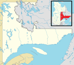 La Romaine Location in Côte-Nord Region of Quebec. | |
| Coordinates: 50°13′N 60°40′W / 50.217°N 60.667°WCoordinates: 50°13′N 60°40′W / 50.217°N 60.667°W | |
| Country |
|
| Province |
|
| Region | Côte-Nord |
| Regional county | none |
| Formed | 1956 |
| Government[1][2] | |
| • Chief | George Bacon |
| • Federal riding | Manicouagan |
| • Prov. riding | Duplessis |
| Area[3] | |
| • Land | 0.88 km2 (0.34 sq mi) |
| Population (2011)[3] | |
| • Total | 1,016 |
| • Density | 1,153.6/km2 (2,988/sq mi) |
| Time zone | AST (UTC-4) |
| Postal Code | G0G 1M0 |
| Area code(s) | 418 and 581 |
La Romaine, also known as Unamenshipit in Innu-aimun, is an Innu First Nations reserve in the Côte-Nord region of Quebec, Canada, at the mouth of the Olomane River on the Gulf of Saint Lawrence. It belongs to the Innu band of Unamen Shipu.[1] Being an enclave within the Municipality of Côte-Nord-du-Golfe-du-Saint-Laurent, it is geographically within Le Golfe-du-Saint-Laurent Regional County Municipality but administratively not part of it. Directly adjacent to the reserve is the community of La Romaine consisting of a small French-speaking population.
La Romaine is only accessible by boat or via the La Romaine Airport. It is serviced by a nursing station, community radio station, arena, community and recreation centre, municipal water and sewer system, fire station, and an aboriginal police force.[1]
The name La Romaine is the French adaptation of the word Ulaman. Before its spelling was standardized, the place has also been called in times past: Fort Romaine, Olomanshibu, Olomenachibou, Ulimine, Ouromane, Olomanoshibou, Olomano, Romaine, La Romaine, Grande-Romaine, Gethsémani-d'Olumen, Gethsémani, Uanaman Hipiht, Ulamen Shipit, and Ulaman Shipu. These names applied sometimes to the old post, sometimes the village or the reserve, or sometimes to the river that flows through the place. Except for Gethsémani, all these variations have the same source: Unaman Shipu, from unaman meaning "vermilion" or "red ochre", and shipu meaning "river". Deposits of this material are found on the banks of the Olomane River.[4]
History
Since time immemorial, the Innu indigenous people would leave their inland winter hunting grounds to gather at the mouth of the Olomane River during the summer. Circa 1710, the French set up a fishing and trading post there that was taken over by the Labrador Company in 1780, followed by the Hudson's Bay Company in 1822. Around 1850, French Canadians from elsewhere in Quebec began to settle the area, and gradually concentrating in La Romaine when several smaller outposts were abandoned. In 1886, the local post office opened.[4][5]
The trading post was closed in 1925. The Innu of the Lower North Shore were one of the last nomadic Aboriginal groups in North America, and were known for their birchbark canoes and traditional travel by canoe or snowshoe. But contact with white settlers and the market economy led to the permanent settlement of the Innu.[5]
On March 11, 1955, the Government of Québec sold 100 acres (40 ha) of land to the federal government and on May 31, 1956, the Romaine reserve was established. It was expanded in 2001 with lands bought in 1993.[6]
Demographics
Population
| Canada census – La Romaine, Quebec community profile | |||
|---|---|---|---|
| 2011 | 2006 | 2001 | |
| Population: | 1016 (+9.7% from 2006) | 926 (-1.9% from 2001) | 944 (+13.3% from 1996) |
| Land area: | 0.88 km2 (0.34 sq mi) | 0.79 km2 (0.31 sq mi) | 0.79 km2 (0.31 sq mi) |
| Population density: | 1,153.6/km2 (2,988/sq mi) | 1,173.8/km2 (3,040/sq mi) | 1,196.1/km2 (3,098/sq mi) |
| Median age: | 27.7 (M: 27.0, F: 29.4) | 25.4 (M: 25.2, F: 25.5) | 25.0 (M: 25.5, F: 24.1) |
| Total private dwellings: | 267 | 243 | 222 |
| Median household income: | $26,004 | $24,939 | $37,440 |
| Notes: Population in 1996: 833[7] (+9.0% from 1991) - Population in 1991: 758[7] – References: 2011[3] 2006[8] 2001[9] | |||
As of December 2010, the band counted 1095 members, of which 1058 persons are living in the community.[1] The number of private dwellings occupied by usual residents are 262 out of a total of 267. Mother tongues of the residents on the reserve are:[8]
- English as first language: 0%
- French as first language: 1.6%
- English and French as first language: 0%
- Other as first language: 98.4%
Economy
The local economy is based mostly on arts and handicrafts, trapping, outfitters and tourism. Other businesses on the reserve are primarily community businesses such as arts and handicrafts, and a convenience store.[1]
Education
There is only one school on the reserve, École Olamen, that provides pre-Kindergarten to Secondary grade 5, and had an enrolment of 292 students in 2008-2009.[1]
References
- 1 2 3 4 5 6 "Unamen Shipu First Nation". Aboriginal Community profiles. Indian and Northern Affairs Canada. Retrieved 2010-10-04.
- ↑ Ministère des Affaires Municipales, Régions et Occupation du territoire - Répertoire des municipalités: La Romaine
- 1 2 3 "La Romaine census profile". 2011 Census of Population. Statistics Canada. Retrieved 2012-05-07.
- 1 2 "La Romaine (Réserve indienne)" (in French). Commission de toponymie du Québec. Retrieved 2010-10-04.
- 1 2 "Discover the region > Our villages > La Romaine (Unamen Shipu)". Tourism Lower North Shore. Retrieved 2010-10-06.
- ↑ Natural Resources Canada - Legal Surveys Division, Historical Review - Romaine land title history
- 1 2 "Electronic Area Profiles". Canada 1996 Census. Statistics Canada. Retrieved 2014-01-29.
- 1 2 "2006 Community Profiles". Canada 2006 Census. Statistics Canada. March 30, 2011. Retrieved 2012-05-07.
- ↑ "2001 Community Profiles". Canada 2001 Census. Statistics Canada. February 17, 2012. Retrieved 2012-05-07.
External links
| Municipalities | |
|---|---|
| Unorganized Territories | |
| Native reserves (Unassociated with RCM) | |
| |
Innu language Naskapi language Nitassinan Innu music Northeastern Quebec Agreement (1978) Côte-Nord Eastern Labrador | ||
| First Nations (Indian bands) |  | |
| Communities |
| |
See also: Category:Innu Category:Naskapi | ||