Lac-Jérôme, Quebec
| Lac-Jérôme | |
|---|---|
| Unorganized territory | |
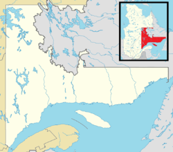 Lac-Jérôme Location in Côte-Nord region of Quebec. | |
| Coordinates: 50°51′N 63°33′W / 50.850°N 63.550°WCoordinates: 50°51′N 63°33′W / 50.850°N 63.550°W[1] | |
| Country |
|
| Province |
|
| Region | Côte-Nord |
| RCM | Minganie |
| Constituted | January 1, 1986 |
| Government[2] | |
| • Federal riding | Manicouagan |
| • Prov. riding | Duplessis |
| Area[2][3] | |
| • Total | 57,232.60 km2 (22,097.63 sq mi) |
| • Land | 42,690.50 km2 (16,482.89 sq mi) |
| Total area claimed includes disputed land within Labrador | |
| Population (2011)[3] | |
| • Total | 0 |
| • Density | 0.0/km2 (0/sq mi) |
| • Pop 2006-2011 |
|
| • Dwellings | 0 |
| Time zones | EST (UTC-5) |
| AST (UTC-4) | |
| • Summer (DST) | EDT (UTC-4) |
| Highways | No major routes |
Lac-Jérôme is an unorganized territory in the Côte-Nord region of Quebec, Canada, part of the Minganie Regional County Municipality.
It is named after Lake Jérôme, a small lake on the Mingan River.
As part of the Labrador boundary dispute, the official borders of Lac-Jérôme as claimed by Quebec include part of the territory of Labrador.
Demographics
Population
| Historical Census Data - Lac-Jérôme, Quebec[4] | ||||||||||||||||||
|---|---|---|---|---|---|---|---|---|---|---|---|---|---|---|---|---|---|---|
|
|
| ||||||||||||||||
See also
References
- ↑ Reference number 149753 of the Commission de toponymie du Québec (French)
- 1 2 Ministère des Affaires municipales, des Régions et de l'Occupation du territoire - Répertoire des municipalités: Lac-Jérôme
- 1 2 Statistics Canada 2011 Census - Lac-Jérôme census profile
- ↑ Statistics Canada: 1996, 2001, 2006, 2011 census
 |
Div. No. 10 Subd. D, Div. No. 10 Subd. C (Newfoundland and Labrador) | | ||
| Rivière-Nipissis | |
Petit-Mécatina | ||
| ||||
| | ||||
| Sept-Îles | Rivière-au-Tonnerre, Rivière-Saint-Jean, Longue-Pointe-de-Mingan, Havre-Saint-Pierre, Baie-Johan-Beetz, Aguanish, Natashquan Twp. |
| Municipalities | |
|---|---|
| Townships | |
| Unorganized Territories | |
| Native reserves (Unassociated with RCM) | |
| |
This article is issued from Wikipedia - version of the 2/22/2014. The text is available under the Creative Commons Attribution/Share Alike but additional terms may apply for the media files.