Rainham, London
| Rainham | |
 Rainham Hall on Broadway |
|
 Rainham |
|
| Population | 12,482 (Rainham and Wennington ward 2011)[1] |
|---|---|
| OS grid reference | TQ525825 |
| – Charing Cross | 13.6 mi (21.9 km) W |
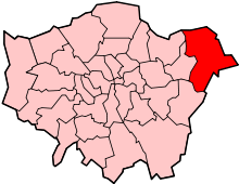
| London borough | Havering |
| Ceremonial county | Greater London |
| Region | London |
| Country | England |
| Sovereign state | United Kingdom |
| Post town | RAINHAM |
| Postcode district | RM13 |
| Dialling code | 01708 |
| Police | Metropolitan |
| Fire | London |
| Ambulance | London |
| EU Parliament | London |
| UK Parliament | Dagenham and Rainham |
| London Assembly | Havering and Redbridge |
Coordinates: 51°31′04″N 0°11′41″E / 51.5177°N 0.1948°E
Rainham is a suburban town in east London, England, and part of the London Borough of Havering.[2] Historically part of the county of Essex, Rainham is 13.6 miles (21.9 km) east of Charing Cross[2] and is surrounded by a residential area, which has grown from the historic village, to the north and a commercial area, fronting the River Thames, to the south. As part of the suburban growth of London in the 20th century, Rainham significantly expanded and increased in population, becoming part of Hornchurch Urban District in 1934, and has formed part of Greater London since 1965. The economic history of Rainham is underpinned by a shift from agriculture to industry and manufacture[3] and is now in a period of regeneration, coming within the London Riverside section of the London Thames Gateway Development Corporation area of responsibility.[4]
History
Toponymy
| 1881 | 1,253 |
|---|---|
| 1891 | 1,669 |
| 1901 | 1,725 |
| 1911 | 1,972 |
| 1921 | 2,196 |
| 1931 | 3,897 |
| 1941 | war # |
| 1951 | 7,666 |
| # no census was held due to war | |
| source: UK census[5] | |
Rainham is recorded in the Domesday Book of 1086 as Raineham and is thought to mean 'homestead or village of a man called Regna', formed from an Old English name and 'hām', meaning settlement.[6] It is also possible that it follows Rainham, Kent which is thought to derive 'home of the Roegingas'. This is also of uncertain meaning, but could refer to 'the ruling people'.[6]
Economic development
For much of its history Rainham was an agricultural settlement, using the River Thames for trade.[7] In the 16th century industry was limited to a boat-builder and tannery. There are links between Rainham farms and the City of London from the Middle Ages and after the wharf was redeveloped in the 1720s trade increased; including the bringing of muck from London for use in the fields. By 1929 most of the farmland had been given over to market gardening.[7] The ferry to London was supplemented with new coaching links in the 18th century and a railway station opened in 1854. A second wharf was constructed in 1872 and from 1869 there was a growth in industrial development, including chemical and fertiliser factories.[7] The Murex iron-founders moved to Rainham in 1917 and grew along the river, eventually becoming part of the British Oxygen Company. Away from the river, other industries included brickmaking and after World War II there was a growth in gravel extraction.[7]
Local government

Rainham formed an ancient parish of 3,253 acres (1,316 ha) in the Chafford hundred of Essex.[8] In 1836 the vestry lost control of poor relief, with Rainham becoming part of the Romford Poor Law Union and in 1875 the parish became part of Romford rural sanitary district. Following the Local Government Act 1894, the sanitary district became Romford Rural District and a parish council was formed. The parish formed part of the London Traffic Area from 1924 and the London Passenger Transport Area from 1933.[9] In 1934 the parish council was abolished and Upminster was combined with other parishes to form part of Hornchurch Urban District. In 1965 the urban district was abolished and its former area was combined with that of Municipal Borough of Romford; and since then has formed part of the London Borough of Havering in Greater London.[10]
Urban development

The earliest development was around the Church of St Helen and St Giles, and this is the only medieval building to survive.[3] New prosperity from increased trade in the early 18th century led to several new buildings, including Rainham Hall.[3] Roads were laid out in 1880 and the new developments consisted of semi-detached and terraced houses. At the same time a community developed around a pub on the river and operated as a resort for day-trippers. As the Thames industrialised it declined in popularity and was gone by 1945. Rainham developed into a suburb of London after World War I. As the estates were broken up for housing some land was purchased by smallholders from Bow and West Ham.[3] In the 1940s they successfully campaigned against having it returned to agricultural use and it was excluded from the Metropolitan Green Belt.[3] The roadways and sewerage systems did not keep up with the rate of growth and a residents' group fought for improvements in infrastructure throughout the 1960s.[3]
Governance

The town forms part of the Dagenham and Rainham constituency, and is covered by the Havering ward of Rainham and Wennington. The current MP is Jon Cruddas. The constituency combines wards in southern Havering with eastern Barking and Dagenham. The Rainham and Wennington ward elects three councillors to Havering London Borough Council. All three councillors elected in 2010 were the Rainham and Wennington Residents Independent Association candidates[11] and the area is unusual in that the residents' association is strongly active.[12] Rainham is within the Havering and Redbridge London Assembly constituency and the London European Parliament constituency.[12]
Geography

Rainham is mostly situated on gravel, rising to between 60 feet (18 m) and 100 feet (30 m).[3] The marshlands along the southern boundary of the River Thames are about 5 feet (1.5 m) above sea level and a tidal section of the River Ingrebourne forms the western boundary. It is located in part of London that is susceptible to flooding.[13] The historic core of Rainham, including the town centre, forms a conservation area.[14] The land to the south has been affected by gravel extraction and 200 acres (0.81 km2) of Rainham Marshes has been filled with 9 million tons of dredged soil by the Port of London Authority.[3] Rainham is a post town in the RM postcode area; it covers a wide area of southern Havering and additionally includes Coldharbour, South Hornchurch and Wennington.[15] Climate data is taken from the nearest weather station at Greenwich, around 8.7 miles (14.0 km) southwest of Rainham:
| Climate data for London (Greenwich) | |||||||||||||
|---|---|---|---|---|---|---|---|---|---|---|---|---|---|
| Month | Jan | Feb | Mar | Apr | May | Jun | Jul | Aug | Sep | Oct | Nov | Dec | Year |
| Record high °C (°F) | 14.0 (57.2) |
19.7 (67.5) |
21.0 (69.8) |
26.9 (80.4) |
31.0 (87.8) |
35.0 (95) |
35.5 (95.9) |
37.5 (99.5) |
30.0 (86) |
28.8 (83.8) |
19.9 (67.8) |
15.0 (59) |
37.5 (99.5) |
| Average high °C (°F) | 8.3 (46.9) |
8.5 (47.3) |
11.4 (52.5) |
14.2 (57.6) |
17.7 (63.9) |
20.7 (69.3) |
23.2 (73.8) |
22.9 (73.2) |
20.1 (68.2) |
15.6 (60.1) |
11.4 (52.5) |
8.6 (47.5) |
15.2 (59.4) |
| Average low °C (°F) | 2.6 (36.7) |
2.4 (36.3) |
4.1 (39.4) |
5.4 (41.7) |
8.4 (47.1) |
11.5 (52.7) |
13.9 (57) |
13.7 (56.7) |
11.2 (52.2) |
8.3 (46.9) |
5.1 (41.2) |
2.8 (37) |
7.5 (45.5) |
| Record low °C (°F) | −10.0 (14) |
−9.0 (15.8) |
−8.0 (17.6) |
−2.0 (28.4) |
−1.0 (30.2) |
5.0 (41) |
7.0 (44.6) |
6.0 (42.8) |
3.0 (37.4) |
−4.0 (24.8) |
−5.0 (23) |
−7.0 (19.4) |
−10.0 (14) |
| Average precipitation mm (inches) | 51.6 (2.031) |
38.2 (1.504) |
40.5 (1.594) |
45.0 (1.772) |
46.5 (1.831) |
47.3 (1.862) |
41.1 (1.618) |
51.6 (2.031) |
50.4 (1.984) |
68.8 (2.709) |
58.0 (2.283) |
53.0 (2.087) |
591.8 (23.299) |
| Average rainy days (≥ 1.0 mm) | 10.8 | 8.5 | 9.6 | 9.4 | 9.0 | 8.3 | 8.0 | 7.6 | 8.5 | 10.7 | 10.1 | 9.9 | 110.4 |
| Average snowy days | 4 | 4 | 3 | 1 | 0 | 0 | 0 | 0 | 0 | 0 | 1 | 3 | 16 |
| Average relative humidity (%) | 81.0 | 76.0 | 69.0 | 64.0 | 62.0 | 60.0 | 60.0 | 62.0 | 67.0 | 73.0 | 78.0 | 82.0 | 69.5 |
| Mean monthly sunshine hours | 49.9 | 71.4 | 107.1 | 159.8 | 181.2 | 181.0 | 192.1 | 195.1 | 138.9 | 108.1 | 58.5 | 37.4 | 1,480.5 |
| Source #1: Record highs and lows from BBC Weather,[16] except August and February maximum from Met Office[17][18] | |||||||||||||
| Source #2: All other data from Met Office,[19] except for humidity and snow data which are from NOAA[20] | |||||||||||||
| Climate data for London (Heathrow airport 1981−2010) | |||||||||||||
|---|---|---|---|---|---|---|---|---|---|---|---|---|---|
| Month | Jan | Feb | Mar | Apr | May | Jun | Jul | Aug | Sep | Oct | Nov | Dec | Year |
| Average high °C (°F) | 8.1 (46.6) |
8.4 (47.1) |
11.3 (52.3) |
14.2 (57.6) |
17.9 (64.2) |
21.0 (69.8) |
23.5 (74.3) |
23.2 (73.8) |
19.9 (67.8) |
15.5 (59.9) |
11.1 (52) |
8.3 (46.9) |
15.2 (59.4) |
| Average low °C (°F) | 2.3 (36.1) |
2.1 (35.8) |
3.9 (39) |
5.5 (41.9) |
8.7 (47.7) |
11.7 (53.1) |
13.9 (57) |
13.7 (56.7) |
11.4 (52.5) |
8.4 (47.1) |
4.9 (40.8) |
2.7 (36.9) |
7.4 (45.4) |
| Average precipitation mm (inches) | 55.2 (2.173) |
40.9 (1.61) |
41.6 (1.638) |
43.7 (1.72) |
49.4 (1.945) |
45.1 (1.776) |
44.5 (1.752) |
49.5 (1.949) |
49.1 (1.933) |
68.5 (2.697) |
59.0 (2.323) |
55.2 (2.173) |
601.7 (23.689) |
| Average rainy days (≥ 1.0 mm) | 11.1 | 8.5 | 9.3 | 9.1 | 8.8 | 8.2 | 7.7 | 7.5 | 8.1 | 10.8 | 10.3 | 10.2 | 109.6 |
| Mean monthly sunshine hours | 61.5 | 77.9 | 114.6 | 168.7 | 198.5 | 204.3 | 212.0 | 204.7 | 149.3 | 116.5 | 72.6 | 52.0 | 1,632.6 |
| Source: Met Office[21] | |||||||||||||
Demography
| Rainham and Wennington compared (2001 Census)[22] | |||||
|---|---|---|---|---|---|
| Statistic | Rainham and Wennington | Havering | London | England | |
| Ethnic group | |||||
| White | 11,308 | 213,421 | 5,103,203 | 44,679,361 | |
| Asian | 341 | 4,088 | 866,693 | 2,248,289 | |
| Black | 273 | 3,139 | 782,849 | 1,132,508 | |
| Mixed | 153 | 2,298 | 226,111 | 643,373 | |
| Chinese/Other | 39 | 827 | 70,928 | 231,424 | |
| Population | |||||
| Total | 12,114 | 224,248 | 7,172,091 | 49,138,831 | |
| Density(/hectare) | 7.91 | 19.97 | 45.62 | 3.77 | |
| Households | 4,811 | 91,722 | 3,015,997 | 20,451,427 | |
Demographic data is produced by the Office for National Statistics for the ward of Rainham and Wennington. In 2001 the population of the ward was 12,114, consisting of 3,362 families and 4,811 households.[22] The population is 93.35% White, 2.81% Asian, 2.25% Black and 0.32% Chinese or other. 75.58% report their religion as Christian compared to 76.13% for Havering, 58.23% in London and 71.74% in England. 12.04% report having no religion, compared to 13.18% in Havering, 15.76% in London and 14.59% in England.[22]
At the 2001 census, there were 4,589 residents who fell into the social category ABC1, which equated to 37.9% of the population in the ward of Rainham and Wennington.[22] The age distribution was: 5.32% aged 0–4, 15.63% aged 5–15, 5.02% aged 16–19, 33.78% aged 20–44, 24.92% aged 45–64 and 15.32% aged 65 years and older. The general health was described as follows: 70.49% good, 21.52% fairly good and 7.99% not good. 16.41% of people had a limiting long-term illness.
Economy
The northern part of Rainham is identified in the London Plan as a local district centre with 20,000 square metres (220,000 sq ft) of commercial floorspace.[2] Within Havering, it is identified as one of seven town centres in the borough,[23] with a retail area extending along Upminster Road South and Broadway.[24]
The southern part of Rainham is a centre for employment, part of the London Riverside business improvement district, and the location of the Tilda Rice main plant. Several large companies have operations and offices based in Rainham, including Keebles, Carpetright, Harveys Furniture, and Rainham Steel.
The plans of the London Thames Gateway Development Corporation include 3,200 new homes and the upgrading of run-down industrial and warehouse facilities on the A1306 road to provide mixed-use development.[25] In 2006 Havering London Borough Council proposed that land in Rainham could be used for a large regional casino.[26]
Culture
Havering Council's urban strategy recognises that nearby Hornchurch is the main cultural hub of the borough with a large theatre and arts spaces, and Romford offers the largest regional concentration of entertainment facilities.[27]
Transport
The A1306 road passes through Rainham and acts an alternative route to the main A13 road between Central London and the Dartford Crossing. High Speed 1 and the London-Tilbury-Southend Line pass through the area, with Rainham railway station served by c2c train services running between Fenchurch Street in the City of London and Grays in Thurrock[28] and is in London fare zone 6.[29] Several London Bus routes serve Rainham, including routes 103, 165, 287, 372, which provide connections to Barking, Elm Park, Hornchurch, Lakeside and Romford.[30] The London Loop key walking route passes through Rainham, and it forms the end point of section 23 from Upminster Bridge and the starting point of section 24 to Purfleet.[31][32]
The Belvedere Crossing is a proposed tunnel or bridge, between Belvedere and Rainham[33]
See also
References
- ↑ Census Information Scheme (2012). "2011 Census Ward Population Estimates". Greater London Authority. Retrieved 30 January 2013.
- 1 2 3 Mayor of London (May 2006). "The London Plan: East London Sub Regional Development Framework" (PDF). Greater London Authority. Retrieved 23 February 2010.
- 1 2 3 4 5 6 7 8 Powell, W.R. (Edr.) (1978). Rainham: Introduction and manors, A History of the County of Essex: Volume 7. British History Online. Retrieved 24 February 2010.
- ↑ "The London Thames Gateway Development Corporation (Area and Constitution) Order 2004". Office of Public Sector Information. 2004. Retrieved 24 February 2010.
- ↑ Great Britain Historical GIS / University of Portsmouth, Rainham population. Retrieved on 23 February 2010.
- 1 2 Mills, A.D. (2001). Dictionary of London Place Names. Oxford.
- 1 2 3 4 Powell, W.R. (Edr.) (1978). Rainham: Economic history and local government, A History of the County of Essex: Volume 7. British History Online. Retrieved 24 February 2010.
- ↑ Great Britain Historical GIS / University of Portsmouth, Rainham parish. Retrieved on 23 February 2010.
- ↑ Robson, William (1939). The Government and Mis-government of London. London: Allen & Unwin.
- ↑ Great Britain Historical GIS / University of Portsmouth, Havering London Borough. Retrieved on 23 February 2010.
- ↑ "Your Councillors by Ward". Havering London Borough Council. Retrieved 8 January 2013.
- 1 2 Baston, Lewis (8 February 2008). "Havering and Redbridge". guardian.co.uk. Retrieved 20 February 2010.
- ↑ Mayor of London (2008). "Indicative Flood Risk Areas". London Plan. Greater London Authority. Retrieved 24 February 2010.
- ↑ The Paul Drury Partnership (February 2007). "Rainham Conservation Area: Character Appraisal and Management Proposals" (PDF). Havering London Borough Council. Retrieved 23 February 2010.
- ↑ Royal Mail (2004). Address Management Guide (4 ed.). Royal Mail Group.
- ↑ "London, Greater London: Average conditions". BBC Weather Website. BBC Weather. Archived from the original on 28 February 2011.
- ↑ "August 2003 — Hot spell". Met Office Website. Met Office. Archived from the original on 28 February 2011.
- ↑ "Monthly temperature records by country". Met Office Website. Met Office. Retrieved 22 September 2013.
- ↑ "Greenwich 1981−2010 averages". Met Office Website. Met Office. Retrieved 10 April 2013.
- ↑ "NOAA". National Oceanic and Atmospheric Administration. Retrieved 20 October 2013.
- ↑ "Heathrow Climate period: 1981−2010". Met Office Website. Met Office. Retrieved 22 September 2013.
- 1 2 3 4 Neighbourhood Statistics (2001). "2001 Census: Census Area Statistics, Area: Rainham and Wennington (Ward)". Office for National Statistics. Retrieved 22 February 2010.
- ↑ "Town centre management". Havering London Borough Council. 14 October 2008. Retrieved 24 February 2010.
- ↑ "Havering UDP: District Centres (schedule 7)". Havering London Borough Council. March 1993. Retrieved 24 February 2010.
- ↑ "London Riverside: Rainham". London Thames Gateway Development Corporation. Retrieved 24 February 2010.
- ↑ "Consulting on casino complex in Rainham". Havering London Borough Council. 16 May 2006. Retrieved 24 February 2010.
- ↑ Urban Practitioners & Allies and Morrison (July 2005). "Romford Urban Strategy". Havering London Borough Council. Retrieved 9 February 2010.
- ↑ c2c (December 2009). "Train Times" (PDF). National Express Group. Retrieved 24 February 2010.
- ↑ Transport for London (March 2009). "High frequency services" (PDF). Greater London Authority. Retrieved 25 February 2010.
- ↑ "Buses from Rainham" (PDF). Transport for London. December 2008. Retrieved 23 February 2010.
- ↑ "Section 23 Upminster Bridge to Rainham". www.tfl.gov.uk. Transport for London. Retrieved 24 February 2010.
- ↑ "Section 24 Rainham to Purfleet". www.tfl.gov.uk. Transport for London. Retrieved 24 February 2010.
- ↑ "Have your say on new river crossings in east and southeast London". www.tfl.gov.uk. Transport for London. Retrieved 23 January 2016.
External links
| Wikimedia Commons has media related to Rainham, London. |
| Districts |
|  |
|---|---|---|
| Attractions | ||
| Major retail | ||
| Places of worship | ||
| Parks and open spaces | ||
| Constituencies | ||
| Tube and rail stations | ||
| Other topics | ||
| Section 23: | London Outer Orbital Path | Section 24: |
|---|---|---|
| Upminster Bridge | Rainham | Purfleet |