Pine Ridge at Crestwood, New Jersey
| Pine Ridge at Crestwood, New Jersey | |
|---|---|
| Census-designated place | |
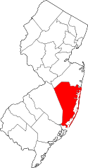
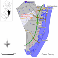 Map of Pine Ridge at Crestwood highlighted within Ocean County. Inset: Location of Ocean County in New Jersey. | |
| Coordinates: 39°57′42″N 74°18′43″W / 39.961557°N 74.312016°WCoordinates: 39°57′42″N 74°18′43″W / 39.961557°N 74.312016°W | |
| Country |
|
| State |
|
| County | Ocean |
| Township | Manchester |
| Area[1] | |
| • Total | 1.736 sq mi (4.497 km2) |
| • Land | 1.728 sq mi (4.475 km2) |
| • Water | 0.008 sq mi (0.022 km2) 0.48% |
| Elevation[2] | 69 ft (21 m) |
| Population (2010 Census)[3] | |
| • Total | 2,369 |
| • Density | 1,370.9/sq mi (529.3/km2) |
| Time zone | Eastern (EST) (UTC-5) |
| • Summer (DST) | Eastern (EDT) (UTC-4) |
| FIPS code | 3458852[1][4] |
| GNIS feature ID | 02389676[1][5] |
Pine Ridge at Crestwood is an unincorporated community and census-designated place (CDP) located within Manchester Township, in Ocean County, New Jersey, United States.[6][7][8] As of the 2010 United States Census, the CDP's population was 2,369.[3]
Geography
According to the United States Census Bureau, the Pine Ridge at Crestwood CDP had a total area of 1.736 square miles (4.497 km2), including 1.728 square miles (4.475 km2) of land and 0.008 square miles (0.022 km2) of water (0.48%).[1][9]
Demographics
| Historical population | |||
|---|---|---|---|
| Census | Pop. | %± | |
| 1990 | 2,372 | — | |
| 2000 | 2,025 | −14.6% | |
| 2010 | 2,369 | 17.0% | |
| Population sources: 1990-2010[8] 2000[10] 2010[3] | |||
Census 2010
The 2010 United States Census counted 2,369 people, 1,550 households, and 686.7 families residing in the CDP. The population density was 1,370.9 per square mile (529.3/km2). The CDP contained 1,810 housing units at an average density of 1,047.5 per square mile (404.4/km2). The racial makeup of the CDP was 96.45% (2,285) White, 1.56% (37) Black or African American, 0.04% (1) Native American, 0.72% (17) Asian, 0.00% (0) Pacific Islander, 0.51% (12) from other races, and 0.72% (17) from two or more races. Hispanics or Latinos of any race were 2.32% (55) of the population.[3]
Out of a total of 1,550 households, 0.1% had children under the age of 18 living with them, 35.7% were married couples living together, 6.8% had a female householder with no husband present, and 55.7% were non-families. 52.3% of all households were made up of individuals, and 40.7% had someone living alone who was 65 years of age or older. The average household size was 1.53 and the average family size was 2.10.[3]
In the CDP, 0.3% of the population were under the age of 18, 0.8% from 18 to 24, 3.5% from 25 to 44, 30.1% from 45 to 64, and 65.3% who were 65 years of age or older. The median age was 69.1 years. For every 100 females the census counted 75.0 males, but for 100 females at least 18 years old, it was 74.7 males.[3]
Census 2000
As of the 2000 United States Census[4] there were 2,025 people, 1,367 households, and 567 families residing in the CDP. The population density was 457.2/km2 (1,181.1/mi2). There were 1,514 housing units at an average density of 341.8/km2 (883.0/mi2). The racial makeup of the CDP was 98.77% White, 0.49% African American, 0.05% Native American, 0.25% Asian, and 0.44% from two or more races. Hispanic or Latino of any race were 0.79% of the population.[10]
There were 1,367 households out of which none had children under the age of 18 living with them, 34.8% were married couples living together, 5.6% had a female householder with no husband present, and 58.5% were non-families. 55.4% of all households were made up of individuals and 48.3% had someone living alone who was 65 years of age or older. The average household size was 1.48 and the average family size was 2.07.[10]
In the CDP the population was spread out with 0.2% under the age of 18, 0.4% from 18 to 24, 2.2% from 25 to 44, 17.7% from 45 to 64, and 79.5% who were 65 years of age or older. The median age was 75 years. For every 100 females there were 62.4 males. For every 100 females age 18 and over, there were 62.3 males.[10]
The median income for a household in the CDP was $22,019, and the median income for a family was $27,750. Males had a median income of $16,094 versus $31,071 for females. The per capita income for the CDP was $20,320. About 5.7% of families and 5.7% of the population were below the poverty line, including none of those under age 18 and 5.2% of those age 65 or over.[10]
References
- 1 2 3 4 Gazetteer of New Jersey Places, United States Census Bureau. Accessed July 21, 2016.
- ↑ U.S. Geological Survey Geographic Names Information System: Pine Ridge at Crestwood Census Designated Place, Geographic Names Information System. Accessed January 11, 2013.
- 1 2 3 4 5 6 DP-1 - Profile of General Population and Housing Characteristics: 2010 Demographic Profile Data for Pine Ridge at Crestwood CDP, New Jersey, United States Census Bureau. Accessed January 11, 2013.
- 1 2 American FactFinder, United States Census Bureau. Accessed September 4, 2014.
- ↑ US Board on Geographic Names, United States Geological Survey. Accessed September 4, 2014.
- ↑ GCT-PH1 - Population, Housing Units, Area, and Density: 2010 - County -- County Subdivision and Place from the 2010 Census Summary File 1 for Ocean County, New Jersey, United States Census Bureau. Accessed January 11, 2013.
- ↑ 2006-2010 American Community Survey Geography for New Jersey, United States Census Bureau. Accessed January 11, 2013.
- 1 2 New Jersey: 2010 - Population and Housing Unit Counts - 2010 Census of Population and Housing (CPH-2-32), United States Census Bureau, August 2012. Accessed January 11, 2013.
- ↑ US Gazetteer files: 2010, 2000, and 1990, United States Census Bureau. Accessed September 4, 2014.
- 1 2 3 4 5 DP-1 - Profile of General Demographic Characteristics: 2000 from the Census 2000 Summary File 1 (SF 1) 100-Percent Data for Pine Ridge at Crestwood CDP, New Jersey, United States Census Bureau. Accessed January 11, 2013.