Stafford Township, New Jersey
| Stafford Township, New Jersey | |
|---|---|
| Township | |
| Township of Stafford | |
|
Stafford Performing Arts Center in Manahawkin | |
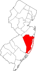
 Map of Stafford Township in Ocean County. Inset; Location of Ocean County highlighted in the State of New Jersey. | |
 Census Bureau map of Stafford Township, New Jersey | |
| Coordinates: 39°42′20″N 74°15′51″W / 39.705632°N 74.264121°WCoordinates: 39°42′20″N 74°15′51″W / 39.705632°N 74.264121°W[1][2] | |
| Country |
|
| State |
|
| County | Ocean |
| Royal charter | March 3, 1750 |
| Incorporated | February 21, 1798 |
| Named for | Staffordshire, England |
| Government[3] | |
| • Type | Faulkner Act (Small Municipality) |
| • Body | Township Council |
| • Mayor | John R. Spodofora (R, term ends December 31, 2018)[4][5] |
| • Administrator | James A. Moran[6] |
| • Clerk | Bernadette Park |
| Area[1] | |
| • Total | 54.882 sq mi (142.142 km2) |
| • Land | 45.849 sq mi (118.747 km2) |
| • Water | 9.033 sq mi (23.395 km2) 16.46% |
| Area rank |
30th of 566 in state 6th of 33 in county[1] |
| Elevation[7] | 43 ft (13 m) |
| Population (2010 Census)[8][9][10][11] | |
| • Total | 26,535 |
| • Estimate (2015)[12] | 26,959 |
| • Rank |
91st of 566 in state 8th of 33 in county[13] |
| • Density | 578.8/sq mi (223.5/km2) |
| • Density rank |
432nd of 566 in state 25th of 33 in county[13] |
| Time zone | Eastern (EST) (UTC-5) |
| • Summer (DST) | Eastern (EDT) (UTC-4) |
| ZIP code | 08050 - Manahawkin[14] |
| Area code(s) | 609[15] |
| FIPS code | 3402970320[1][16][17] |
| GNIS feature ID | 0882069[1][18] |
| Website |
twp |

Stafford Township is a township in Ocean County, New Jersey, United States. As of the 2010 United States Census, the township population increased to 26,535,[8][9][10][11] reflecting an increase of 4,003 (+17.8%) from the 22,532 counted in the 2000 Census, which had in turn increased by 9,207 (+69.1%) from the 13,325 counted in the 1990 Census.[19] The 2010 population was the highest level ever recorded in a decennial census for Stafford Township.
Stafford Township is the gateway to the resort communities on Long Beach Island, with Route 72 providing the sole road access, ending in Ship Bottom as it crosses Barnegat Bay via the Manahawkin Bay Bridge (formally known as the Dorland J. Henderson Memorial Bridge). The Garden State Parkway and U.S. Route 9 pass through the township and provide access to Route 72.
History
Incorporation
Stafford Township was formed by Royal charter on March 3, 1750, from portions of Shrewsbury Township, while the area was still part of Monmouth County. It was incorporated as one of New Jersey's first 104 townships by the Township Act of 1798 of the New Jersey Legislature on February 21, 1798, and became part of the newly formed Ocean County on February 15, 1850. Portions of the township were taken to form Union Township (March 10, 1846, now Barnegat Township), Eagleswood Township (March 17, 1874), Long Beach City borough (September 19, 1894, now Surf City) and Long Beach Township (March 23, 1899).[20] The township was named for Staffordshire, England.[21]
20th century and later
Stafford Township was mostly a rural area, aside from the bustling downtown of Manahawkin. Early growth in the township started in the 1950s, starting with the construction of large resort communities of Beach Haven West and Ocean Acres, which were built around the same time as the completion of the Garden State Parkway and the expansion of Route 72, the latter which formerly ran along the two-lane Bay Avenue.
While growing quickly, development was still sparse. Route 72 was still mostly wooded, aside from several car dealerships, gas stations, a drive-in movie theater, and the Manahawkin Executive Airport. Most of the growth started in the 1980s, when several new developments were constructed, such as Colony Lakes and the expansion of Beach Haven West, and Ocean Acres, which strayed from being a community of summer homes into a booming development of Single-family homes. Stafford Square was the first major shopping center to open on Route 72, anchored by ShopRite and a Caldor (which is currently a Lowe's). Manahawkin Airport was closed in the early 1990s to make way for a Walmart and PathMark.[22] However, part of the runway was still left intact until the 2000s, when the St. Mary's of the Pines Catholic Church and All Saints Regional Catholic School were built on the land.[23]
In the 2000s, many big box stores, such as Home Depot, BJ's Wholesale Club, Bed Bath & Beyond and the Manahawkin Commons Power Center opened. To alleviate the traffic on Route 72, a four-lane bypass road known as McKinley Avenue was built in 2001, backing up to the many shopping centers. In 2007, construction started on Stafford Park, a mixed-use development west of the Parkway Exit 63. The first phase opened in 2008 includes a Target, Costco, Best Buy, Dick's Sporting Goods, and PetSmart. The second phase included construction of LEED-certified apartments, and future plans in place for the development include a Lifestyle center and an age-restricted community.
Geography
According to the United States Census Bureau, the township had a total area of 54.882 square miles (142.142 km2), including 45.849 square miles (118.747 km2) of land and 9.033 square miles (23.395 km2) of water (16.46%).[1][2]
Beach Haven West (2010 Census population of 3,896[24]) and Manahawkin (2,303[25]) are unincorporated communities and census-designated places contained within Stafford Township, while Ocean Acres (16,142[26]) is a census-designated place and unincorporated area split between Barnegat Township and Stafford Township.[27][28][29]
Other unincorporated communities, localities and place names located partially or completely within the township include Bayside, Beach View, Bonnet Island, Cedar Bonnet, Cedar Grove, Cedar Run, Manahawkin Landing, Mayetta, South Beach View and Sunshine City.[30] Warren Grove is an unincorporated rural area located within the township as well as portions of Barnegat Township and Little Egg Harbor Township in the heart of the Pine Barrens.
The township borders the Ocean County municipalities of Barnegat Township, Eagleswood Township, Harvey Cedars, Little Egg Harbor Township, Long Beach Township, Ship Bottom and Surf City.[31]
Demographics
| Historical population | |||
|---|---|---|---|
| Census | Pop. | %± | |
| 1790 | 883 | — | |
| 1810 | 1,239 | — | |
| 1820 | 1,428 | 15.3% | |
| 1830 | 2,059 | 44.2% | |
| 1840 | 2,149 | 4.4% | |
| 1850 | 1,384 | * | −35.6% |
| 1860 | 1,436 | 3.8% | |
| 1870 | 1,514 | 5.4% | |
| 1880 | 1,008 | * | −33.4% |
| 1890 | 1,095 | 8.6% | |
| 1900 | 1,009 | * | −7.9% |
| 1910 | 934 | −7.4% | |
| 1920 | 830 | −11.1% | |
| 1930 | 1,039 | 25.2% | |
| 1940 | 1,253 | 20.6% | |
| 1950 | 1,347 | 7.5% | |
| 1960 | 1,930 | 43.3% | |
| 1970 | 3,684 | 90.9% | |
| 1980 | 10,385 | 181.9% | |
| 1990 | 13,325 | 28.3% | |
| 2000 | 22,532 | 69.1% | |
| 2010 | 26,535 | 17.8% | |
| Est. 2015 | 26,959 | [12][32] | 1.6% |
| Population sources: 1790-1920[33] 1850-2000[34] 1850-1870[35] 1850[36] 1870[37] 1880-1890[38] 1890-1910[39] 1910-1930[40] 1930-1990[41] 2000[42][43] 2010[8][9][10][11] * = Lost territory in previous decade.[20] | |||
Census 2010
At the 2010 United States Census, there were 26,535 people, 10,096 households, and 7,249 families residing in the township. The population density was 578.8 per square mile (223.5/km2). There were 13,604 housing units at an average density of 296.7 per square mile (114.6/km2). The racial makeup of the township was 94.51% (25,077) White, 1.05% (278) Black or African American, 0.16% (42) Native American, 1.48% (394) Asian, 0.03% (8) Pacific Islander, 1.68% (445) from other races, and 1.10% (291) from two or more races. Hispanics or Latinos of any race were 5.31% (1,410) of the population.[9]
There were 10,096 households, of which 29.5% had children under the age of 18 living with them, 58.9% were married couples living together, 9.2% had a female householder with no husband present, and 28.2% were non-families. 23.9% of all households were made up of individuals, and 13.6% had someone living alone who was 65 years of age or older. The average household size was 2.61 and the average family size was 3.10.[9]
In the township, 22.8% of the population were under the age of 18, 7.1% from 18 to 24, 21.8% from 25 to 44, 28.7% from 45 to 64, and 19.6% who were 65 years of age or older. The median age was 43.9 years. For every 100 females there were 93.3 males. For every 100 females age 18 and over, there were 90.0 males.[9]
The Census Bureau's 2006-2010 American Community Survey showed that (in 2010 inflation-adjusted dollars) median household income was $68,250 (with a margin of error of +/- $3,646) and the median family income was $80,059 (+/- $4,290). Males had a median income of $60,398 (+/- $4,092) versus $43,138 (+/- $7,270) for females. The per capita income for the borough was $31,690 (+/- $1,364). About 2.9% of families and 4.0% of the population were below the poverty line, including 3.1% of those under age 18 and 6.8% of those age 65 or over.[44]
Census 2000
As of the 2000 United States Census[16] there were 22,532 people, 8,535 households, and 6,435 families residing in the township. The population density was 484.3 people per square mile (187.0/km²). There were 11,522 housing units at an average density of 247.6 per square mile (95.6/km²). The racial makeup of the township was 96.79% White, 0.74% African American, 0.09% Native American, 0.96% Asian, 0.03% Pacific Islander, 0.51% from other races, and 0.88% from two or more races. Hispanic or Latino of any race were 2.41% of the population.[42][43]
There were 8,535 households out of which 31.7% had children under the age of 18 living with them, 63.6% were married couples living together, 8.5% had a female householder with no husband present, and 24.6% were non-families. 20.6% of all households were made up of individuals and 10.5% had someone living alone who was 65 years of age or older. The average household size was 2.61 and the average family size was 3.01.[42][43]
In the township the population was spread out with 23.8% under the age of 18, 5.8% from 18 to 24, 27.7% from 25 to 44, 23.9% from 45 to 64, and 18.8% who were 65 years of age or older. The median age was 40 years. For every 100 females there were 94.1 males. For every 100 females age 18 and over, there were 89.8 males.[42][43]
The median income for a household in the township was $52,269, and the median income for a family was $59,072. Males had a median income of $44,706 versus $30,687 for females. The per capita income for the township was $25,397. About 2.3% of families and 4.0% of the population were below the poverty line, including 4.0% of those under age 18 and 6.1% of those age 65 or over.[42][43]
Government
Local government
Stafford Township is governed within the Faulkner Act, formally known as the Optional Municipal Charter Law, under the Small Municipality form of New Jersey municipal government by a Mayor and a six-member Township Council. The Mayor and Council members are elected to three-year terms on a concurrent basis in partisan elections, with terms of all current elected officials ending on December 31, 2015. The Mayor can vote on all issues. The seven-member governing body is empowered to enact local ordinances, to levy municipal taxes and conduct the affairs of the community.[3][45] In a November 2010 referendum, voters approved a change to shift from nonpartisan elections held in May to partisan elections held as part of the November general election.[46]
As of 2016, the mayor of Stafford Township is Republican John R. Spodofora, whose term of office ends December 31, 2018, along with those of all council members. Members of the Stafford Township Council are Council President David J. Taylor (R), Wm. Stephen Fessler (R), Steve M. Jeffries (R), Paul B. Marchal (R), Sharon McKenna (R) and Alan R. Smith (R).[4][47][48][49][50]
Federal, state and county representation
Stafford Township is split between the 2nd and 3rd Congressional Districts[51] and is part of New Jersey's 9th state legislative district.[10][52][53] Prior to the 2010 Census, all of Stafford Township had been part of the 3rd Congressional District, a change made by the New Jersey Redistricting Commission that took effect in January 2013, based on the results of the November 2012 general elections.[54] As part of the redistricting that took effect in 2013, there were 7,409 residents of the township's coastal areas to the south and east that were placed in the 2nd; District, while 19,126 residents in the township's interior to the north and west were placed in the 3rd District.[51][55]
New Jersey's Second Congressional District is represented by Frank LoBiondo (R, Ventnor City).[56] New Jersey's 3rd Congressional District is represented by Tom MacArthur (R, Toms River).[57] New Jersey is represented in the United States Senate by Cory Booker (D, Newark, term ends 2021)[58] and Bob Menendez (D, Paramus, 2019).[59][60]
For the 2016–2017 session (Senate, General Assembly), the 9th Legislative District of the New Jersey Legislature is represented in the State Senate by Christopher J. Connors (R, Lacey Township) and in the General Assembly by DiAnne Gove (R, Long Beach Township) and Brian E. Rumpf (R, Little Egg Harbor Township).[61] The Governor of New Jersey is Chris Christie (R, Mendham Township).[62] The Lieutenant Governor of New Jersey is Kim Guadagno (R, Monmouth Beach).[63]
Ocean County is governed by a Board of Chosen Freeholders consisting of five members, elected on an at-large basis in partisan elections and serving staggered three-year terms of office, with either one or two seats coming up for election each year as part of the November general election.[64] At an annual reorganization held in the beginning of January, the board chooses a Director and a Deputy Director from among its members. As of 2015, Ocean County's Freeholders (with party affiliation, term-end year, residence and department directorship listed in parentheses) are Freeholder Director John C. Bartlett, Jr. (R, term ends December 31, 2015, Pine Beach; Finance, Parks and Recreation),[65] Freeholder Deputy Director Gerry P. Little (R, 2015, Surf City; Human Services),[66] John P. Kelly (R, 2016, Eagleswood Township; Law and Public Safety),[67] James F. Lacey (R, 2016, Brick Township; Transportation)[68] and Joseph H. Vicari (R, 2017, Toms River; Senior Services and County Operations).[69][70][71] Constitutional officers elected on a countywide basis are County Clerk Scott M. Colabella (R, 2015, Barnegat Light),[72][73] Sheriff Michael Mastronardy (R, 2016; Toms River)[74] and Surrogate Jeffrey Moran (R, 2018, Beachwood).[75][76]
Politics
As of March 23, 2011, there were a total of 18,029 registered voters in Stratford Township, of which 3,451 (19.1%) were registered as Democrats, 4,944 (27.4%) were registered as Republicans and 9,630 (53.4%) were registered as Unaffiliated. There were 4 voters registered to other parties.[77] Among the township's 2010 Census population, 67.9% (vs. 63.2% in Ocean County) were registered to vote, including 88.0% of those ages 18 and over (vs. 82.6% countywide).[77][78]
In the 2012 presidential election, Republican Mitt Romney received 57.9% of the vote (7,159 cast), ahead of Democrat Barack Obama with 41.0% (5,075 votes), and other candidates with 1.1% (138 votes), among the 12,480 ballots cast by the township's 18,963 registered voters (108 ballots were spoiled), for a turnout of 65.8%.[79][80] In the 2008 presidential election, Republican John McCain received 57.3% of the vote (7,508 cast), ahead of Democrat Barack Obama with 40.8% (5,351 votes) and other candidates with 1.1% (150 votes), among the 13,113 ballots cast by the township's 18,430 registered voters, for a turnout of 71.2%.[81] In the 2004 presidential election, Republican George W. Bush received 60.4% of the vote (7,396 ballots cast), outpolling Democrat John Kerry with 38.6% (4,722 votes) and other candidates with 0.5% (90 votes), among the 12,239 ballots cast by the township's 16,776 registered voters, for a turnout percentage of 73.0.[82]
In the 2013 gubernatorial election, Republican Chris Christie received 74.4% of the vote (5,602 cast), ahead of Democrat Barbara Buono with 24.3% (1,829 votes), and other candidates with 1.3% (101 votes), among the 7,676 ballots cast by the township's 18,813 registered voters (144 ballots were spoiled), for a turnout of 40.8%.[83][84] In the 2009 gubernatorial election, Republican Chris Christie received 64.9% of the vote (5,746 ballots cast), ahead of Democrat Jon Corzine with 28.3% (2,511 votes), Independent Chris Daggett with 4.9% (431 votes) and other candidates with 1.2% (102 votes), among the 8,859 ballots cast by the township's 18,174 registered voters, yielding a 48.7% turnout.[85]
Education
For Kindergarten through sixth grade, public school students attend the Stafford Township School District. As of the 2011-12 school year, the district's five schools had an enrollment of 2,300 students and 178.0 classroom teachers (on an FTE basis), for a student–teacher ratio of 12.92:1.[86] Schools in the district (with 2011-12 enrollment data from the National Center for Education Statistics[87]) are Oxycocus School[88] (grades PreK and K.; 100 students), Ocean Acres Elementary School[89] (1 and 2; 609), Ronald L. Meinders Primary Learning Center[90] (Preschool {as of September 2016} and Kindergarten), McKinley Avenue Elementary School[91] (3 and 4; 595) and Stafford Intermediate School[92] (5 and 6; 726).[93]
For seventh through twelfth grades, public school students attend the Southern Regional School District, which serves the five municipalities in the Long Beach Island Consolidated School District — Barnegat Light, Harvey Cedars, Long Beach Township, Ship Bottom and Surf City — along with students from Beach Haven, Ocean Township and Stafford Township who attend as part of sending/receiving relationships.[94] Schools in the district (with 2013-14 enrollment data from the National Center for Education Statistics[95]) are Southern Regional Middle School[96] (grades 7 and 8; 992 students) and Southern Regional High School[97] (grades 9 – 12; 2,071 students).[98] Both schools are in Manahawkin.
Marine Academy of Technology and Environmental Science ia a comprehensive and challenging career high school that is located on a hill in Manahawkin on the outskirts of the Southern Regional School District. MATES is part of the Ocean County Vocational Technical School and serves students from all of Ocean County.[99]
Media
The Asbury Park Press and The Press of Atlantic City provide daily news coverage of the township, as does WOBM-FM radio. The township provides material and commentary to The Southern Ocean Times, which also serves Barnegat Township, Lacey Township, Long Beach Island, Ocean County (Waretown) and Tuckerton as one of seven weekly papers from Micromedia Publications.[100]
Transportation
Roads and highways
As of May 2010, the township had a total of 183.27 miles (294.94 km) of roadways, of which 143.29 miles (230.60 km) were maintained by the municipality, 20.06 miles (32.28 km) by Ocean County and 14.96 miles (24.08 km) by the New Jersey Department of Transportation and 4.96 miles (7.98 km) by the New Jersey Turnpike Authority.[101]
Stafford is served by a few major roads. CR 539 passes through in the western part. U.S. Route 9 passes north-south through the center of the township and Route 72 is the main artery that passes from the northwest to the southeast. The Garden State Parkway passes through the township, connecting Eagleswood Township in the south to Barnegat Township in the north.[102] The Parkway intersects with Route 72 at Interchange 63A for Route 72 west to Camden / Chatsworth and Interchange 63 for Route 72 east to Manahawkin / Long Beach Island.[103]
Public transportation
NJ Transit provides bus service to Atlantic City on the 559 bus route.[104]
Ocean Ride local service is provided on the OC6 Little Egg Harbor - Stafford and the OC10 Long Beach Island routes.[105][106][107]
Notable people
People who were born in, residents of, or otherwise closely associated with Stafford Township include:
- Doc Cramer (1905–1990), center fielder who played for four American League teams from 1929 to 1948.[108]
- Mike Gesicki (born 1995), tight end who plays for the Penn State Nittany Lions football team.[109]
- Teresa Giudice (born 1972), reality television cast-member from Paterson NJ best known for starring in The Real Housewives of New Jersey, who owned a summer home in the Beach Haven West section.[110]
- Clark Harris (born 1984), long snapper / tight end for the Cincinnati Bengals.[111]
- Paul Marshall Johnson Jr. (1955–2004), helicopter engineer who was beheaded in Saudi Arabia by a group connected to Al-Qaeda.[112]
- Kareem Rashad Sultan Khan (1987-2007), Muslim-American U.S. Army Specialist who died in Operation Iraqi Freedom.[113]
- William A. Newell (1817–1901), 18th Governor of New Jersey who later represented the state in the United States House of Representatives.[114]
- Martin Truex Jr. (born 1980), a NASCAR Sprint Cup driver who currently pilots Furniture Row Racing's #78 Toyota Camry and lived in the Mayetta section of Stafford.[115]
- Martin Truex Sr. (born 1948), former driver who competed in the Busch North Series.[116]
- Ryan Truex (born 1992), driver who has competed in NASCAR, previously driving BK Racing's #83 Toyota Camry in the Sprint Cup Series.[117]
References
- 1 2 3 4 5 6 2010 Census Gazetteer Files: New Jersey County Subdivisions, United States Census Bureau. Accessed May 21, 2015.
- 1 2 US Gazetteer files: 2010, 2000, and 1990, United States Census Bureau. Accessed September 4, 2014.
- 1 2 2012 New Jersey Legislative District Data Book, Rutgers University Edward J. Bloustein School of Planning and Public Policy, March 2013, p. 58.
- 1 2 Mayor & Council, Stafford Township. Accessed July 27, 2016.
- ↑ 2016 New Jersey Mayors Directory, New Jersey Department of Community Affairs. Accessed June 14, 2016.
- ↑ Staff Directory, Stafford Township. Accessed July 27, 2016.
- ↑ U.S. Geological Survey Geographic Names Information System: Township of Stafford, Geographic Names Information System. Accessed March 14, 2013.
- 1 2 3 "2010 Census Populations: Ocean County", Asbury Park Press. Accessed July 8, 2012.
- 1 2 3 4 5 6 DP-1 - Profile of General Population and Housing Characteristics: 2010 for Stafford township, Ocean County, New Jersey, United States Census Bureau. Accessed July 8, 2012.
- 1 2 3 4 Municipalities Grouped by 2011-2020 Legislative Districts, New Jersey Department of State, p. 5. Accessed January 6, 2013.
- 1 2 3 Profile of General Demographic Characteristics: 2010 for Stafford township, New Jersey Department of Labor and Workforce Development. Accessed July 8, 2012.
- 1 2 PEPANNRES - Annual Estimates of the Resident Population: April 1, 2010 to July 1, 2015 - 2015 Population Estimates for New Jersey municipalities, United States Census Bureau. Accessed May 22, 2016.
- 1 2 GCT-PH1 Population, Housing Units, Area, and Density: 2010 - State -- County Subdivision from the 2010 Census Summary File 1 for New Jersey, United States Census Bureau. Accessed January 2, 2013.
- ↑ Look Up a ZIP Code for Manahawkin, NJ, United States Postal Service. Accessed July 8, 2012.
- ↑ Area Code Lookup - NPA NXX for Manahawkin, NJ, Area-Codes.com. Accessed October 27, 2014.
- 1 2 American FactFinder, United States Census Bureau. Accessed September 4, 2014.
- ↑ A Cure for the Common Codes: New Jersey, Missouri Census Data Center. Accessed July 8, 2012.
- ↑ US Board on Geographic Names, United States Geological Survey. Accessed September 4, 2014.
- ↑ Table 7. Population for the Counties and Municipalities in New Jersey: 1990, 2000 and 2010, New Jersey Department of Labor and Workforce Development, February 2011. Accessed July 8, 2012.
- 1 2 Snyder, John P. The Story of New Jersey's Civil Boundaries: 1606-1968, Bureau of Geology and Topography; Trenton, New Jersey; 1969. p. 205. Accessed July 8, 2012.
- ↑ Hutchinson, Viola L. The Origin of New Jersey Place Names, New Jersey Public Library Commission, May 1945. Accessed October 9, 2015.
- ↑ Key, Peter. "WAL-MART STORE TO OPEN IN AREA / STAFFORD SITE SET FOR 1992", The Press of Atlantic City, March 19, 1991. Accessed July 8, 2012. "Wal-Mart Stores Inc. has announced plans to open a Wal-Mart store in a shopping center being developed on the Manahawkin Airport by National Property Development Inc. of Purchase, N.Y."
- ↑ Larsen, Erik. "Keeping the faith Diocese confident regional school will be built", Asbury Park Press, March 11, 2000. Accessed July 8, 2012. "Last December, All Saints broke ground on about 20 acres beside Wal-Mart, which was once the site of the now-defunct Manahawkin Airport."
- ↑ DP-1 - Profile of General Population and Housing Characteristics: 2010 Demographic Profile Data for Beach Haven West CDP, New Jersey, United States Census Bureau. Accessed July 8, 2012.
- ↑ DP-1 - Profile of General Population and Housing Characteristics: 2010 Demographic Profile Data for Manahawkin CDP, New Jersey, United States Census Bureau. Accessed July 8, 2012.
- ↑ DP-1 - Profile of General Population and Housing Characteristics: 2010 Demographic Profile Data for Ocean Acres CDP, New Jersey, United States Census Bureau. Accessed July 8, 2012.
- ↑ GCT-PH1 - Population, Housing Units, Area, and Density: 2010 - County -- County Subdivision and Place from the 2010 Census Summary File 1 for Ocean County, New Jersey, United States Census Bureau. Accessed January 2, 2013.
- ↑ 2006-2010 American Community Survey Geography for New Jersey, United States Census Bureau. Accessed January 2, 2013.
- ↑ New Jersey: 2010 - Population and Housing Unit Counts - 2010 Census of Population and Housing (CPH-2-32), United States Census Bureau, August 2012. Accessed January 2, 2013.
- ↑ Locality Search, State of New Jersey. Accessed May 10, 2015.
- ↑ Areas touching Stafford Township, MapIt. Accessed May 10, 2015.
- ↑ Census Estimates for New Jersey April 1, 2010 to July 1, 2015, United States Census Bureau. Accessed May 22, 2016.
- ↑ Compendium of censuses 1726-1905: together with the tabulated returns of 1905, New Jersey Department of State, 1906. Accessed July 18, 2013.
- ↑ Barnett, Bob. Population Data for Ocean County Municipalities, 1850 - 2000, WestJersey.org, January 6, 2011. Accessed January 2, 2013.
- ↑ Raum, John O. The History of New Jersey: From Its Earliest Settlement to the Present Time, Volume 1, p. 280, J. E. Potter and company, 1877. Accessed January 2, 2013. "Stafford contained in 1850, 1,384; in 1860, 1,436; and in 1870, 1,514 inhabitants.... Mannahawkinsville contained in 1870, 689 inhabitants..
- ↑ Debow, James Dunwoody Brownson. The Seventh Census of the United States: 1850, p. 140. R. Armstrong, 1853. Accessed January 2, 2013.
- ↑ Staff. A compendium of the ninth census, 1870, p. 260. United States Census Bureau, 1872. Accessed January 2, 2013.
- ↑ Porter, Robert Percival. Preliminary Results as Contained in the Eleventh Census Bulletins: Volume III - 51 to 75, p. 99. United States Census Bureau, 1890. Accessed January 2, 2013.
- ↑ Thirteenth Census of the United States, 1910: Population by Counties and Minor Civil Divisions, 1910, 1900, 1890, United States Census Bureau, p. 338. Accessed January 2, 2013.
- ↑ Fifteenth Census of the United States : 1930 - Population Volume I, United States Census Bureau, p. 718. Accessed January 2, 2013.
- ↑ Table 6. New Jersey Resident Population by Municipality: 1930 - 1990, New Jersey Department of Labor and Workforce Development. Accessed June 28, 2015.
- 1 2 3 4 5 Census 2000 Profiles of Demographic / Social / Economic / Housing Characteristics for Stafford township, Ocean County, New Jersey, United States Census Bureau. Accessed January 3, 2012.
- 1 2 3 4 5 DP-1: Profile of General Demographic Characteristics: 2000 - Census 2000 Summary File 1 (SF 1) 100-Percent Data for Stafford township, Ocean County, New Jersey, United States Census Bureau. Accessed July 8, 2012.
- ↑ DP03: Selected Economic Characteristics from the 2006-2010 American Community Survey 5-Year Estimates for Stafford township, Ocean County, New Jersey, United States Census Bureau. Accessed July 8, 2012.
- ↑ Stafford Township Form Of Government, Stafford Township, backed up by the Internet Archive as of February 2, 2010. Accessed January 2, 2013.
- ↑ Lala, Elisa. "Stafford Township voters approve moving municipal elections to November", The Press of Atlantic City, November 3, 2010. Accessed October 27, 2014. "Township residents voted overwhelmingly Tuesday to move annual nonpartisan elections from May to November.... Officials argued that moving the elections to the fall would save the township $50,000."
- ↑ 2016 Municipal User Friendly Budget, Stafford Township. Accessed July 27, 2016.
- ↑ 2016 Ocean County & Municipal Elected Officials, Ocean County, New Jersey Clerk, updated February 22, 2016. Accessed July 26, 2016.
- ↑ Township of Stafford, Ocean County, New Jersey. Accessed July 26, 2016.
- ↑ 2015 General Election Official Results November 3, 2015, Ocean County, New Jersey Clerk, updated November 10, 2015. Accessed July 26, 2016.
- 1 2 Plan Components Report, New Jersey Redistricting Commission, December 23, 2011. Accessed January 6, 2013.
- ↑ 2016 New Jersey Citizen's Guide to Government, p. 64, New Jersey League of Women Voters. Accessed July 20, 2016.
- ↑ Districts by Number for 2011-2020, New Jersey Legislature. Accessed January 6, 2013.
- ↑ 2011 New Jersey Citizen's Guide to Government, p. 64, New Jersey League of Women Voters. Accessed May 22, 2015.
- ↑ New Jersey Congressional Districts 2012-2012: Stafford Township, New Jersey Redistricting Commission, December 23, 2011. Accessed January 6, 2013.
- ↑ Directory of Representatives: New Jersey, United States House of Representatives. Accessed January 5, 2012.
- ↑ Tom MacArthur Biography, United States House of Representatives. Accessed January 7, 2015.
- ↑ About Cory Booker, United States Senate. Accessed January 26, 2015. "He now owns a home and lives in Newark's Central Ward community."
- ↑ Biography of Bob Menendez, United States Senate, January 26, 2015. "He currently lives in Paramus and has two children, Alicia and Robert."
- ↑ Senators of the 114th Congress from New Jersey. United States Senate. Accessed January 26, 2015. "Booker, Cory A. - (D - NJ) Class II; Menendez, Robert - (D - NJ) Class I"
- ↑ Legislative Roster 2016-2017 Session, New Jersey Legislature. Accessed January 17, 2016.
- ↑ "About the Governor". State of New Jersey. Retrieved 2010-01-21.
- ↑ "About the Lieutenant Governor". State of New Jersey. Retrieved 2010-01-21.
- ↑ Freeholder History, Ocean County, New Jersey. Accessed January 25, 2015.
- ↑ Freeholder Director John C. Bartlett Jr., Ocean County, New Jersey. Accessed January 25, 2015.
- ↑ Freeholder Deputy Director Gerry P. Little, Ocean County, New Jersey. Accessed January 25, 2015.
- ↑ Freeholder John P. Kelly, Ocean County, New Jersey. Accessed January 25, 2015.
- ↑ Freeholder James F. Lacey, Ocean County, New Jersey. Accessed January 25, 2015.
- ↑ Freeholder Joseph H. Vicari, Ocean County, New Jersey. Accessed January 25, 2015.
- ↑ Board of Chosen Freeholders, Ocean County, New Jersey. Accessed January 25, 2015.
- ↑ County Directory, Ocean County, New Jersey. Accessed January 25, 2015.
- ↑ County Clerk, Ocean County, New Jersey. Accessed January 25, 2015.
- ↑ Biography of Scott M. Colabella, Office of the County Clerk. Accessed January 25, 2015.
- ↑ Sheriff Michael Mastronardy, Ocean County Sheriff's Office. Accessed January 25, 2015.
- ↑ County Surrogate Jeffrey W. Moran, Ocean County, New Jersey. Accessed January 25, 2015.
- ↑ 2015 Elected Officials of Ocean County, Ocean County, New Jersey. Accessed January 25, 2015.
- 1 2 Voter Registration Summary - Ocean, New Jersey Department of State Division of Elections, March 23, 2011. Accessed January 2, 2013.
- ↑ GCT-P7: Selected Age Groups: 2010 - State -- County Subdivision; 2010 Census Summary File 1 for New Jersey, United States Census Bureau. Accessed January 2, 2013.
- ↑ "Presidential General Election Results - November 6, 2012 - Ocean County" (PDF). New Jersey Department of Elections. March 15, 2013. Retrieved December 24, 2014.
- ↑ "Number of Registered Voters and Ballots Cast - November 6, 2012 - General Election Results - Ocean County" (PDF). New Jersey Department of Elections. March 15, 2013. Retrieved December 24, 2014.
- ↑ 2008 Presidential General Election Results: Ocean County, New Jersey Department of State Division of Elections, December 23, 2008. Accessed January 2, 2013.
- ↑ 2004 Presidential Election: Ocean County, New Jersey Department of State Division of Elections, December 13, 2004. Accessed January 2, 2013.
- ↑ "Governor - Ocean County" (PDF). New Jersey Department of Elections. January 29, 2014. Retrieved December 24, 2014.
- ↑ "Number of Registered Voters and Ballots Cast - November 5, 2013 - General Election Results - Ocean County" (PDF). New Jersey Department of Elections. January 29, 2014. Retrieved December 24, 2014.
- ↑ 2009 Governor: Ocean County, New Jersey Department of State Division of Elections, December 31, 2009. Accessed January 2, 2013.
- ↑ District information for Stafford Township School District, National Center for Education Statistics. Accessed January 25, 2015.
- ↑ School Data for the Stafford Township School District, National Center for Education Statistics. Accessed January 25, 2015.
- ↑ Oxycocus School, Stafford Township School District. Accessed January 25, 2015.
- ↑ Ocean Acres Elementary School, Stafford Township School District. Accessed January 25, 2015.
- ↑ Ronald L. Meinders Primary Learning Center, Stafford Township School District. Accessed January 25, 2015.
- ↑ McKinley Avenue Elementary School, Stafford Township School District. Accessed January 25, 2015.
- ↑ Stafford Intermediate School, Stafford Township School District. Accessed January 25, 2015.
- ↑ New Jersey School Directory for Stafford Township School District, New Jersey Department of Education. Accessed January 25, 2015.
- ↑ Southern Regional High School 2015 Report Card Narrative, New Jersey Department of Education. Accessed June 2, 2016. "Located in Manahawkin, the Southern Regional School District draws from the constituent districts of Long Beach Township, Beach Haven, Surf City, Ship Bottom, Barnegat Light, Harvey Cedars and Stafford Township, as well as the tuition sending district of Ocean Township (Waretown).
- ↑ School Data for the Southern Regional School District, National Center for Education Statistics. Accessed June 2, 2016.
- ↑ Southern Regional Middle School, Southern Regional School District. Accessed June 2, 2016.
- ↑ Southern Regional High School, Southern Regional School District. Accessed June 2, 2016.
- ↑ New Jersey School Directory for the Southern Regional School District, New Jersey Department of Education. Accessed June 2, 2016.
- ↑ Marine Academy of Technology and Environmental Science - Background, Ocean County Vocational Technical School. Accessed January 2, 2013.
- ↑ The Southern Ocean Times, Micromedia Publications. "First published in 2010. Expanded in 2013. Serving Lacey, Barnegat, Waretown, Manahawkin, LBI and Tuckerton in Ocean County, New Jersey."
- ↑ Ocean County Mileage by Municipality and Jurisdiction, New Jersey Department of Transportation, May 2010. Accessed July 18, 2014.
- ↑ Garden State Parkway Straight Line Diagram, New Jersey Department of Transportation, January 1997. Accessed October 27, 2014.
- ↑ Travel Resources: Interchanges, Service Areas & Commuter Lots, New Jersey Turnpike Authority. Accessed October 27, 2014.
- ↑ Ocean County Bus / Rail Connections, NJ Transit, backed up by the Internet Archive as of July 26, 2010. Accessed January 2, 2013.
- ↑ Ocean County Bus Service, Greater Mercer TMA. Accessed August 12, 2015.
- ↑ Ocean Ride Rider's Guide, Ocean County, New Jersey. Accessed August 12, 2015.
- ↑ Ocean County Transit Guide, Ocean County, New Jersey. Accessed August 12, 2015.
- ↑ Goldstein, Steve. "ROGER 'DOC' CRAMER, 85, OUTFIELDER WHO PLAYED FOR ATHLETICS, RED SOX", The Philadelphia Inquirer, September 10, 1990. Accessed July 29, 2007. "Roger Maxwell "Doc" Cramer, 85, who hit .296 during an illustrious 19- year career in baseball that began when Connie Mack signed him for the Philadelphia Athletics in 1929, died yesterday at his home in Manahawkin, N.J., after a seven-month battle with cancer."
- ↑ McGarry, Michael. "The Press Male Athlete of the Year: Mike Gesicki leaves Southern as one of school's all-time best", The Press of Atlantic City, June 21, 2014. Accessed December 2, 2016. "Gesicki lives in Manahawkin with his parents, Mike and Donna. He is the youngest of three children."
- ↑ Hyman, Vicki. "Teresa Giudice's Shore home set for foreclosure auction in May; bidding starts at $100", NJ Advance Media for NJ.com, April 20, 2015. Accessed September 7, 2015.
- ↑ Lulgjuraj, Susan. "Galloway's Rolle, Atlantic City's Corcoran ready to realize NFL dreams", The Press of Atlantic City, April 22, 2010. Accessed April 21, 2011. "Watching the draft with family can be tough. Three years ago, Southern Regional High School and Rutgers University standout tight end Clark Harris waited in his Stafford Township home for his name to be called. As the second day of the draft grew on (there were only two days in 2007), the atmosphere became more tense."
- ↑ via Associated Press. "Family, friends plead for U.S. captive's release: American, Saudi officials hunt for contractor; deadline is Friday", MSNBC, June 17, 2004. Accessed April 20, 2011. "Paul Johnson, 49, of Stafford Township, N.J., was abducted Saturday by a group calling itself al-Qaida in the Arabian Peninsula."
- ↑ Staff. "More on the Soldier Kareem R. Khan", The New York Times, October 19, 2008. Accessed October 9, 2015. "On Meet the Press today, Colin L. Powell concluded his endorsement of Sen. Barack Obama by referring to the death of a Muslim soldier, Kareem Rashad Sultan Khan of Manahawkin, N.J., who was killed in Iraq on Aug. 6, 2007, and whose remains were buried in Arlington."
- ↑ Kowalczyk, Frank. "The Shipwreck of the Powhatan", The Society Scroll newsletter of the Ocean County Historical Society, September 2007. Accessed January 12, 2008.
- ↑ Orr, Conor. "Mayetta's Ryan Truex making rapid NASCAR rise while following in brother Martin's footsteps", NJ Advance Media for NJ.com, July 17, 2010. Accessed May 10, 2015.
- ↑ Procida, Lee. "A younger Truex chose a passion for cars over a life at sea", The Press of Atlantic City, February 14, 2010. Accessed October 9, 2015. "When he does come home, he tends to keep to himself, hanging out at his parents' home in the Mayetta section or with his close friend from grade school Adam Sherer, who owns Sherer's Boat Basin in Barnegat Township."
- ↑ Russo, John. "Stafford Township's Ryan Truex excited to compete full time on NASCAR's Sprint Cup series", The Press of Atlantic City, January 21, 2014. Accessed May 10, 2015.
External links
- Stafford Township website
- Stafford Township School District
- Stafford Township School District's 2014–15 School Report Card from the New Jersey Department of Education
- School Data for the Stafford Township School District, National Center for Education Statistics
- Southern Regional School District
- Stafford Township Volunteer Fire Company Station 47
- Ocean County Vocational Technical School District
- Stafford Branch of Ocean County Library
 |
Woodland Township | Barnegat Township | | |
| Bass River Township | |
|||
| ||||
| | ||||
| Little Egg Harbor Township | Long Beach Eagleswood Township |
Ship Bottom Harvey Cedars Surf City |