Toms River (CDP), New Jersey
| Toms River, New Jersey | |
|---|---|
| Census-designated place | |
|
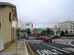
Downtown Toms River | |
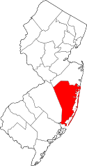
 Map of Toms River CDP in Ocean County. Inset: Location of Ocean County in New Jersey. | |
| Coordinates: 39°59′41″N 74°11′16″W / 39.994856°N 74.187754°WCoordinates: 39°59′41″N 74°11′16″W / 39.994856°N 74.187754°W | |
| Country |
|
| State |
|
| County | Ocean |
| Township | Toms River |
| Area[1] | |
| • Total | 40.738 sq mi (105.510 km2) |
| • Land | 38.947 sq mi (100.871 km2) |
| • Water | 1.791 sq mi (4.639 km2) 4.40% |
| Elevation[2] | 62 ft (19 m) |
| Population (2010 Census[3]) | |
| • Total | 88,791 |
| • Density | 2,279.8/sq mi (880.2/km2) |
| Time zone | Eastern (EST) (UTC-5) |
| • Summer (DST) | Eastern (EDT) (UTC-4) |
| ZIP codes | 08753-08757[4] |
| Area code(s) | 732/848 |
| FIPS code | 3473110[1][5] |
| GNIS feature ID | 02390394[1][6][7] |
Toms River is an unincorporated community and census-designated place (CDP) located within Toms River Township (formerly Dover Township), in Ocean County, New Jersey, United States.[8][9][10][11] As of the 2010 United States Census, the CDP's population was 88,791.[3] It is the county seat of Ocean County.[12] The area is named for Toms River, whose estuary flows through the community and empties into Barnegat Bay.
Toms River Township and the census-designated place are not co-extensive. In addition to the census-designated place, which includes all of mainland Toms River Township, Toms River Township includes two small CDPs: Dover Beaches North (2010 Census population of 1,239[13]) and Dover Beaches South (1,209[14]), both of which are located on the Barnegat Peninsula. As defined by the Census Bureau based on 2010 Census data, more than 96% of Toms River Township's area and of its population of 91,239 was located in Toms River CDP.[8]
Geography
According to the United States Census Bureau, the CDP had a total area of 40.738 square miles (105.510 km2), including 38.947 square miles (100.871 km2) of land and 1.791 square miles (4.639 km2) of water (4.40%).[1][15]
Demographics
| Historical population | |||
|---|---|---|---|
| Census | Pop. | %± | |
| 1950 | 2,517 | — | |
| 1960 | 6,062 | 140.8% | |
| 1970 | 7,303 | 20.5% | |
| 1980 | 7,465 | 2.2% | |
| 1990 | 7,524 | 0.8% | |
| 2000 | 86,327 | 1,047.4% | |
| 2010 | 88,791 | 2.9% | |
| Population sources: 1950[16] 1960-1970[17] 1960-1980[18] 1990-2010[10] 2000[19] 2010[3] | |||
Census 2010
The 2010 United States Census counted 88,791 people, 33,394 households, and 23,643 families residing in the CDP. The population density was 2,279.8 per square mile (880.2/km2). The CDP contained 36,605 housing units at an average density of 939.9 per square mile (362.9/km2). The racial makeup of the CDP was 89.71% (79,653) White, 2.77% (2,459) Black or African American, 0.17% (151) Native American, 3.67% (3,260) Asian, 0.02% (17) Pacific Islander, 1.98% (1,760) from other races, and 1.68% (1,491) from two or more races. Hispanics or Latinos of any race were 8.04% (7,136) of the population.[3]
Out of a total of 33,394 households, 29.0% had children under the age of 18 living with them, 54.9% were married couples living together, 11.9% had a female householder with no husband present, and 29.2% were non-families. 24.3% of all households were made up of individuals, and 11.7% had someone living alone who was 65 years of age or older. The average household size was 2.62 and the average family size was 3.12.[3]
In the CDP, 21.7% of the population were under the age of 18, 8.0% from 18 to 24, 24.1% from 25 to 44, 29.5% from 45 to 64, and 16.7% who were 65 years of age or older. The median age was 42.5 years. For every 100 females the census counted 92.4 males, but for 100 females at least 18 years old, it was 89.6 males.[3]
Census 2000
As of the 2000 United States Census[5] there were 86,327 people, 31,674 households, and 23,470 families residing in the CDP. The population density was 846.6/km2 (2,192.7/mi2). There were 34,375 housing units at an average density of 337.1/km2 (873.1/mi2). The racial makeup of the CDP was 93.36% White, 1.81% African American, 0.13% Native American, 2.54% Asian, 0.02% Pacific Islander, 0.98% from other races, and 1.15% from two or more races. Hispanic or Latino of any race were 4.65% of the population.[19]
There were 31,674 households out of which 32.3% had children under the living with them, 60.1% were married couples living together, 10.7% had a female householder with no husband present, and 25.9% were non-families. 21.5% of all households were made up of individuals and 10.4% had someone living alone who was 65 years of age or older. The average household size was 2.66 and the average family size was 3.11.[19]
In the CDP the population was spread out with 23.8% under the age of 18, 7.3% from 18 to 24, 27.4% from 25 to 44, 24.8% from 45 to 64, and 16.6% who were 65 years of age or older. The median age was 40 years. For every 100 females there were 92.7 males. For every 100 females age 18 and over, there were 89.0 males.[19]
The median income for a household in the CDP was $55,659, and the median income for a family was $62,971. Males had a median income of $47,448 versus $30,763 for females. The per capita income for the CDP was $24,831. 5.6% of the population and 4.0% of families were below the poverty line. 6.6% of those under the age of 18 and 6.2% of those 65 and older were living below the poverty line.[19]
References
- 1 2 3 4 Gazetteer of New Jersey Places, United States Census Bureau. Accessed July 21, 2016.
- ↑ U.S. Geological Survey Geographic Names Information System: Toms River Census Designated Place, Geographic Names Information System. Accessed January 11, 2013.
- 1 2 3 4 5 6 DP-1 - Profile of General Population and Housing Characteristics: 2010 Demographic Profile Data for Toms River CDP, New Jersey, United States Census Bureau. Accessed January 12, 2013.
- ↑ Look Up a ZIP Code for Toms River, NJ, United States Postal Service. Accessed February 15, 2012.
- 1 2 American FactFinder, United States Census Bureau. Accessed September 4, 2014.
- ↑ US Board on Geographic Names, United States Geological Survey. Accessed September 4, 2014.
- ↑ A Cure for the Common Codes: New Jersey, Missouri Census Data Center. Accessed January 11, 2013.
- 1 2 GCT-PH1 - Population, Housing Units, Area, and Density: 2010 - County -- County Subdivision and Place from the 2010 Census Summary File 1 for Ocean County, New Jersey, United States Census Bureau. Accessed January 11, 2013.
- ↑ 2006-2010 American Community Survey Geography for New Jersey, United States Census Bureau. Accessed January 11, 2013.
- 1 2 New Jersey: 2010 - Population and Housing Unit Counts - 2010 Census of Population and Housing (CPH-2-32), United States Census Bureau, August 2012. Accessed January 11, 2013.
- ↑ Locality Search, State of New Jersey. Accessed April 19, 2015.
- ↑ "Find a County". National Association of Counties. Retrieved 2011-06-07.
- ↑ DP-1 - Profile of General Population and Housing Characteristics: 2010 Demographic Profile Data for Dover Beaches North CDP, New Jersey, United States Census Bureau. Accessed January 12, 2013.
- ↑ DP-1 - Profile of General Population and Housing Characteristics: 2010 Demographic Profile Data for Dover Beaches South CDP, New Jersey, United States Census Bureau. Accessed January 12, 2013.
- ↑ US Gazetteer files: 2010, 2000, and 1990, United States Census Bureau. Accessed September 4, 2014.
- ↑ Staff. A Report of the Seventeenth Decennial Census of the United States - Census of Population: 1950; Volume I - Number of Inhabitants, p. 30-11. Accessed January 12, 2013.
- ↑ Staff. 1970 Census of Population: Volume I - Characteristics of the Population; Part I - United States Summary Section 1, United States Census Bureau, June 1973. Accessed January 12, 2013.
- ↑ Staff. 1980 Census of Population: Number of Inhabitants United States Summary, p. 1-141. United States Census Bureau, June 1983. Accessed January 12, 2012.
- 1 2 3 4 5 DP-1 - Profile of General Demographic Characteristics: 2000 from the Census 2000 Summary File 1 (SF 1) 100-Percent Data for Toms River CDP, New Jersey, United States Census Bureau. Accessed January 12, 2013.
External links
- Walking Tour of the Village of Toms River
- Toms River as settlement and Post Office address
- Toms River Census Count Updated, Ocean County Government Press Release 3/29/2001. Archived at archive.org. explains Ocean County's request for change in CDP. Accessed 7/12/2007