Cedar Glen West, New Jersey
| Cedar Glen West, New Jersey | |
|---|---|
| Census-designated place | |
|
Front of the Cedar Glen West Residential Park as seen from County Route 571 | |
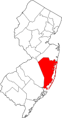
 Map of Cedar Glen West CDP in Ocean County. Inset: Location of Ocean County in New Jersey. | |
| Coordinates: 40°02′17″N 74°17′09″W / 40.038163°N 74.28575°WCoordinates: 40°02′17″N 74°17′09″W / 40.038163°N 74.28575°W | |
| Country |
|
| State |
|
| County | Ocean |
| Township | Manchester |
| Area[1] | |
| • Total | 1.070 sq mi (2.772 km2) |
| • Land | 1.059 sq mi (2.743 km2) |
| • Water | 0.011 sq mi (0.029 km2) 1.06% |
| Elevation[2] | 79 ft (24 m) |
| Population (2010 Census)[3] | |
| • Total | 1,267 |
| • Density | 1,196.5/sq mi (462.0/km2) |
| Time zone | Eastern (EST) (UTC-5) |
| • Summer (DST) | Eastern (EDT) (UTC-4) |
| FIPS code | 3411155[1][4] |
| GNIS feature ID | 02389292[1][5] |

Cedar Glen West is an unincorporated community and census-designated place (CDP) located within Manchester Township, in Ocean County, New Jersey, United States.[6][7][8] As of the 2010 United States Census, the CDP's population was 1,267.[3]
Geography
According to the United States Census Bureau, the CDP had a total area of 1.070 square miles (2.772 km2), including 1.059 square miles (2.743 km2) of land and 0.011 square miles (0.029 km2) of water (1.06%).[1][9] Situated between Ridgeway Boulevard and Ridgeway Road (County Route 571) in the northern part of the township, most of the area consists of the private Cedar Glen West Inc. private residential park comprising smaller one-story single family homes. A mobile home park and other scattered homes are located in the CDP as well.[10]
Demographics
| Historical population | |||
|---|---|---|---|
| Census | Pop. | %± | |
| 1990 | 1,396 | — | |
| 2000 | 1,376 | −1.4% | |
| 2010 | 1,267 | −7.9% | |
| Population sources: 1990-2010[8] 2000[11] 2010[3] | |||
Census 2010
At the 2010 United States Census, there were 1,267 people, 812 households, and 299.6 families residing in the CDP. The population density was 1,196.5 per square mile (462.0/km2). There were 985 housing units at an average density of 930.2 per square mile (359.2/km2). The racial makeup of the CDP was 97.16% (1,231) White, 0.79% (10) Black or African American, 0.16% (2) Native American, 0.32% (4) Asian, 0.00% (0) Pacific Islander, 0.87% (11) from other races, and 0.71% (9) from two or more races. Hispanics or Latinos of any race were 2.37% (30) of the population.[3]
There were 812 households, of which 5.7% had children under the age of 18 living with them, 25.7% were married couples living together, 9.0% had a female householder with no husband present, and 63.1% were non-families. 60.6% of all households were made up of individuals, and 50.9% had someone living alone who was 65 years of age or older. The average household size was 1.56 and the average family size was 2.40.[3]
In the CDP, 7.2% of the population were under the age of 18, 2.9% from 18 to 24, 8.4% from 25 to 44, 23.2% from 45 to 64, and 58.2% who were 65 years of age or older. The median age was 68.9 years. For every 100 females there were 62.2 males. For every 100 females age 18 and over, there were 60.4 males.[3]
Census 2000
As of the 2000 United States Census[4] there were 1,376 people, 914 households, and 337 families residing in the CDP. The population density was 487.4/km2 (1,265.8/mi2). There were 1,015 housing units at an average density of 359.5/km2 (933.7/mi2). The racial makeup of the CDP was 97.67% White, 1.38% African American, 0.15% Native American, 0.07% Asian, and 0.73% from two or more races. Hispanic or Latino of any race were 0.94% of the population.[11]
There were 914 households out of which 3.4% had children under the age of 18 living with them, 31.1% were married couples living together, 5.1% had a female householder with no husband present, and 63.1% were non-families. 60.2% of all households were made up of individuals and 50.9% had someone living alone who was 65 years of age or older. The average household size was 1.51 and the average family size was 2.28.[11]
In the CDP the population was spread out with 5.0% under the age of 18, 1.4% from 18 to 24, 7.4% from 25 to 44, 18.0% from 45 to 64, and 68.2% who were 65 years of age or older. The median age was 73 years. For every 100 females there were 57.1 males. For every 100 females age 18 and over, there were 54.1 males.[11]
The median income for a household in the CDP was $21,840, and the median income for a family was $34,583. Males had a median income of $31,313 versus $29,583 for females. The per capita income for the CDP was $19,548. None of the families and 8.1% of the population were living below the poverty line, including no under eighteens and 9.0% of those over 64.[11]
References
- 1 2 3 4 Gazetteer of New Jersey Places, United States Census Bureau. Accessed July 21, 2016.
- ↑ U.S. Geological Survey Geographic Names Information System: Cedar Glen West Census Designated Place, Geographic Names Information System. Accessed January 11, 2013.
- 1 2 3 4 5 6 DP-1 - Profile of General Population and Housing Characteristics: 2010 Demographic Profile Data for Cedar Glen West CDP, New Jersey, United States Census Bureau. Accessed January 11, 2013.
- 1 2 American FactFinder, United States Census Bureau. Accessed September 4, 2014.
- ↑ US Board on Geographic Names, United States Geological Survey. Accessed September 4, 2014.
- ↑ GCT-PH1 - Population, Housing Units, Area, and Density: 2010 - County -- County Subdivision and Place from the 2010 Census Summary File 1 for Ocean County, New Jersey, United States Census Bureau. Accessed January 11, 2013.
- ↑ 2006-2010 American Community Survey Geography for New Jersey, United States Census Bureau. Accessed January 11, 2013.
- 1 2 New Jersey: 2010 - Population and Housing Unit Counts - 2010 Census of Population and Housing (CPH-2-32), United States Census Bureau, August 2012. Accessed January 11, 2013.
- ↑ US Gazetteer files: 2010, 2000, and 1990, United States Census Bureau. Accessed September 4, 2014.
- ↑ Google (November 29, 2016). "Aerial view of Cedar Glen West" (Map). Google Maps. Google. Retrieved November 29, 2016.
- 1 2 3 4 5 DP-1 - Profile of General Demographic Characteristics: 2000 from the Census 2000 Summary File 1 (SF 1) 100-Percent Data for Cedar Glen West CDP, New Jersey, United States Census Bureau. Accessed January 11, 2013.