Ocean Gate, New Jersey
| Ocean Gate, New Jersey | |
|---|---|
| Borough | |
| Borough of Ocean Gate | |
 Map of Ocean Gate in Ocean County. Inset: Location of Ocean County highlighted in the State of New Jersey. | |
 Census Bureau map of Ocean Gate, New Jersey | |
| Coordinates: 39°55′33″N 74°08′05″W / 39.925847°N 74.134614°WCoordinates: 39°55′33″N 74°08′05″W / 39.925847°N 74.134614°W[1][2] | |
| Country |
|
| State |
|
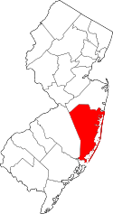
| County | Ocean |
| Incorporated | February 28, 1918 |
| Government[3] | |
| • Type | Borough |
| • Body | Borough Council |
| • Mayor | Paul J. Kennedy (R, term ends December 31, 2018)[4][5] |
| • Clerk | Ileana Vazquez-Gallipoli[6] |
| Area[1] | |
| • Total | 0.454 sq mi (1.175 km2) |
| • Land | 0.448 sq mi (1.160 km2) |
| • Water | 0.006 sq mi (0.015 km2) 1.26% |
| Area rank |
550th of 566 in state 33rd of 33 in county[1] |
| Elevation[7] | 7 ft (2 m) |
| Population (2010 Census)[8][9][10][11] | |
| • Total | 2,011 |
| • Estimate (2015)[12] | 2,010 |
| • Rank |
485th of 566 in state 22nd of 33 in county[13] |
| • Density | 4,490.3/sq mi (1,733.7/km2) |
| • Density rank |
129th of 566 in state 3rd of 33 in county[13] |
| Time zone | Eastern (EST) (UTC-5) |
| • Summer (DST) | Eastern (EDT) (UTC-4) |
| ZIP code | 08740[14][15] |
| Area code(s) | 732 exchanges: 237, 269, 606[16] |
| FIPS code | 3402954450[1][17][18] |
| GNIS feature ID | 885333[1][19] |
| Website |
oceangate-nj |
Ocean Gate is a borough in Ocean County, New Jersey, United States. As of the 2010 United States Census, the borough's population was 2,011,[9][10][11] reflecting a decline of 65 (-3.1%) from the 2,076 counted in the 2000 Census, which had in turn declined by 2 (-0.1%) from the 2,078 counted in the 1990 Census.[20]
History
Trains operated to the area by Pennsylvania Railroad served what was called "Good Luck Point", with visitors building cottages that were the start of the community that became Ocean Gate.[21] AT&T operated a shortwave radio transmitting station after purchasing 175 acres (71 ha) in 1929.[22]
The borough of Ocean Gate was incorporated by an act of the New Jersey Legislature on February 28, 1918, from portions of Berkeley Township. An additional portion of Berkeley Township was annexed on February 28, 1953.[23]
Geography
According to the United States Census Bureau, the borough had a total area of 0.454 square miles (1.175 km2), including 0.448 square miles (1.160 km2) of land and 0.006 square miles (0.015 km2) of water (1.26%).[1][2]
The borough is bordered by the Ocean County municipality of Berkeley Township.[24]
Demographics
| Historical population | |||
|---|---|---|---|
| Census | Pop. | %± | |
| 1920 | 69 | — | |
| 1930 | 174 | 152.2% | |
| 1940 | 242 | 39.1% | |
| 1950 | 452 | 86.8% | |
| 1960 | 706 | * | 56.2% |
| 1970 | 1,081 | 53.1% | |
| 1980 | 1,385 | 28.1% | |
| 1990 | 2,078 | 50.0% | |
| 2000 | 2,076 | −0.1% | |
| 2010 | 2,011 | −3.1% | |
| Est. 2015 | 2,010 | [12][25] | 0.0% |
| Population sources: 1920[26] 1920-1930[27] 1930-1990[28] 2000[29][30] 2010[8][9][10][11] * = Gained territory in previous decade.[23] | |||
Census 2010
The 2010 United States Census counted 2,011 people, 832 households, and 534.1 families residing in the borough. The population density was 4,490.3 per square mile (1,733.7/km2). The borough contained 1,203 housing units at an average density of 2,686.1 per square mile (1,037.1/km2). The racial makeup of the borough was 95.18% (1,914) White, 1.34% (27) Black or African American, 0.05% (1) Native American, 0.20% (4) Asian, 0.00% (0) Pacific Islander, 2.09% (42) from other races, and 1.14% (23) from two or more races. Hispanics or Latinos of any race were 6.36% (128) of the population.[9]
Out of a total of 832 households, 27.6% had children under the age of 18 living with them, 40.5% were married couples living together, 17.2% had a female householder with no husband present, and 35.8% were non-families. 28.6% of all households were made up of individuals, and 10.3% had someone living alone who was 65 years of age or older. The average household size was 2.42 and the average family size was 2.98.[9]
In the borough, 22.2% of the population were under the age of 18, 8.3% from 18 to 24, 26.3% from 25 to 44, 29.7% from 45 to 64, and 13.5% who were 65 years of age or older. The median age was 40.1 years. For every 100 females the census counted 92.6 males, but for 100 females at least 18 years old, it was 89.2 males.[9]
The Census Bureau's 2006-2010 American Community Survey showed that (in 2010 inflation-adjusted dollars) median household income was $61,250 (with a margin of error of +/- $9,978) and the median family income was $73,056 (+/- $23,241). Males had a median income of $61,932 (+/- $6,721) versus $43,295 (+/- $6,037) for females. The per capita income for the borough was $29,770 (+/- $4,691). About 2.2% of families and 6.3% of the population were below the poverty line, including 11.3% of those under age 18 and 5.2% of those age 65 or over.[31]
Census 2000
As of the 2000 United States Census[17] there were 2,076 people, 832 households, and 546 families residing in the borough. The population density was 4,749.0 people per square mile (1,821.7/km2). There were 1,152 housing units at an average density of 2,635.3 per square mile (1,010.9/km2). The racial makeup of the borough was 96.53% White, 0.96% African American, 0.14% Native American, 0.96% Asian, 0.53% from other races, and 0.87% from two or more races. Hispanic or Latino of any race were 2.36% of the population.[29][30]
There were 832 households out of which 32.6% had children under the age of 18 living with them, 44.0% were married couples living together, 16.2% had a female householder with no husband present, and 34.3% were non-families. 28.1% of all households were made up of individuals and 11.1% had someone living alone who was 65 years of age or older. The average household size was 2.50 and the average family size was 3.06.[29][30]
In the borough the population was spread out with 26.0% under the age of 18, 7.0% from 18 to 24, 32.2% from 25 to 44, 20.3% from 45 to 64, and 14.5% who were 65 years of age or older. The median age was 37 years. For every 100 females there were 88.9 males. For every 100 females age 18 and over, there were 82.2 males.[29][30]
The median income for a household in the borough was $41,067, and the median income for a family was $50,847. Males had a median income of $33,558 versus $30,919 for females. The per capita income for the borough was $19,239. About 7.6% of families and 10.3% of the population were below the poverty line, including 12.0% of those under age 18 and 4.3% of those age 65 or over.[29][30]
Government
Local government
Ocean Gate is governed under the Borough form of New Jersey municipal government. The governing body consists of a Mayor and a Borough Council comprising six council members, with all positions elected at-large on a partisan basis as part of the November general election. A Mayor is elected directly by the voters to a four-year term of office. The Borough Council consists of six members elected to serve three-year terms on a staggered basis, with two seats coming up for election each year in a three-year cycle.[3] The Borough form of government used by Ocean Gate, the most common system used in the state, is a "weak mayor / strong council" government in which council members act as the legislative body with the mayor presiding at meetings and voting only in the event of a tie. The mayor can veto ordinances subject to an override by a two-thirds majority vote of the council. The mayor makes committee and liaison assignments for council members, and most appointments are made by the mayor with the advice and consent of the council.[32][33]
As of 2016, the Mayor of Ocean Gate is Republican Paul J. Kennedy, whose term of office ends December 31, 2018. Members of the Borough Council are Bruce R. Cox (R, 2018), Mark Haug (R, 2017), David Kendrick (R, 2018), Alex Martinez (R, 2017), Joella Nicastro (R, 2016) and John Serpica (R, 2016).[4][34][35][36][37][38][39]
Democrats Rose Kindon and Chris Theodos replaced Frank Santarpia and James McGrath, who resigned in February 2014 in protest over an increase in the Mayor's compensation to $50,000.[40] The Mayor was later cited and fined for ethics violation by the NJ State Local Finance Board for illegally accepting pay as a municipal employee while he was serving as mayor.[41]
Federal, state and county representation
Ocean Gate is located in the 3rd Congressional District[42] and is part of New Jersey's 9th state legislative district.[10][43][44]
New Jersey's 3rd Congressional District is represented by Tom MacArthur (R, Toms River).[45] New Jersey is represented in the United States Senate by Cory Booker (D, Newark, term ends 2021)[46] and Bob Menendez (D, Paramus, 2019).[47][48]
For the 2016–2017 session (Senate, General Assembly), the 9th Legislative District of the New Jersey Legislature is represented in the State Senate by Christopher J. Connors (R, Lacey Township) and in the General Assembly by DiAnne Gove (R, Long Beach Township) and Brian E. Rumpf (R, Little Egg Harbor Township).[49] The Governor of New Jersey is Chris Christie (R, Mendham Township).[50] The Lieutenant Governor of New Jersey is Kim Guadagno (R, Monmouth Beach).[51]
Ocean County is governed by a Board of Chosen Freeholders consisting of five members, elected on an at-large basis in partisan elections and serving staggered three-year terms of office, with either one or two seats coming up for election each year as part of the November general election.[52] At an annual reorganization held in the beginning of January, the board chooses a Director and a Deputy Director from among its members. As of 2015, Ocean County's Freeholders (with party affiliation, term-end year, residence and department directorship listed in parentheses) are Freeholder Director John C. Bartlett, Jr. (R, term ends December 31, 2015, Pine Beach; Finance, Parks and Recreation),[53] Freeholder Deputy Director Gerry P. Little (R, 2015, Surf City; Human Services),[54] John P. Kelly (R, 2016, Eagleswood Township; Law and Public Safety),[55] James F. Lacey (R, 2016, Brick Township; Transportation)[56] and Joseph H. Vicari (R, 2017, Toms River; Senior Services and County Operations).[57][58][59] Constitutional officers elected on a countywide basis are County Clerk Scott M. Colabella (R, 2015, Barnegat Light),[60][61] Sheriff Michael Mastronardy (R, 2016; Toms River)[62] and Surrogate Jeffrey Moran (R, 2018, Beachwood).[63][64]
Politics
As of March 23, 2011, there were a total of 1,287 registered voters in Ocean Gate, of which 336 (26.1%) were registered as Democrats, 387 (30.1%) were registered as Republicans and 563 (43.7%) were registered as Unaffiliated. There was one voter registered to another party.[65] Among the borough's 2010 Census population, 64.0% (vs. 63.2% in Ocean County) were registered to vote, including 82.2% of those ages 18 and over (vs. 82.6% countywide).[65][66]
In the 2012 presidential election, Republican Mitt Romney received 50.4% of the vote (415 cast), ahead of Democrat Barack Obama with 47.9% (395 votes), and other candidates with 1.7% (14 votes), among the 835 ballots cast by the borough's 1,335 registered voters (11 ballots were spoiled), for a turnout of 62.5%.[67][68] In the 2008 presidential election, Republican John McCain received 52.7% of the vote (504 cast), ahead of Democrat Barack Obama with 44.5% (426 votes) and other candidates with 2.0% (19 votes), among the 957 ballots cast by the borough's 1,314 registered voters, for a turnout of 72.8%.[69] In the 2004 presidential election, Republican George W. Bush received 61.2% of the vote (2,125 ballots cast), outpolling Democrat John Kerry with 37.5% (1,304 votes) and other candidates with 0.7% (34 votes), among the 3,475 ballots cast by the borough's 4,769 registered voters, for a turnout percentage of 72.9.[70]
In the 2013 gubernatorial election, Republican Chris Christie received 70.9% of the vote (458 cast), ahead of Democrat Barbara Buono with 27.4% (177 votes), and other candidates with 1.7% (11 votes), among the 664 ballots cast by the borough's 1,264 registered voters (18 ballots were spoiled), for a turnout of 52.5%.[71][72] In the 2009 gubernatorial election, Republican Chris Christie received 60.3% of the vote (420 ballots cast), ahead of Democrat Jon Corzine with 30.7% (214 votes), Independent Chris Daggett with 5.9% (41 votes) and other candidates with 1.4% (10 votes), among the 697 ballots cast by the borough's 1,284 registered voters, yielding a 54.3% turnout.[73]
Education
The Ocean Gate School District is a public school district that serves students in Pre-Kindergarten through sixth grade at Ocean Gate Elementary School. As of the 2011-12 school year, the district's one school had an enrollment of 159 students and 18.0 classroom teachers (on an FTE basis), for a student–teacher ratio of 8.83:1.[74]
Public school students in seventh through twelfth grades attend the schools of the Central Regional School District, which serves students from Ocean Gate and from the municipalities of Berkeley Township, Island Heights, Seaside Heights and Seaside Park.[75] The schools in the district (with 2013-14 enrollment data from the National Center for Education Statistics[76]) are Central Regional Middle School[77] for grades 7 and 8 (632 students) and Central Regional High School[78] for grades 9 - 12 (1,309 students).[79][80]
Transportation
As of May 2010, the borough had a total of 12.30 miles (19.79 km) of roadways, of which 2.56 miles (4.12 km) were maintained by the municipality and 9.74 miles (15.68 km) by Ocean County.[81]
Notable people
People who were born in, residents of, or otherwise closely associated with Ocean Gate include:
- Rob Beaton, Guinness World Record holder ("Most Eggs Held in the Hand" - 17, "Most Grains of Rice Eaten with Chopsticks in 3 Minutes" - 78).[82][83]
References
- 1 2 3 4 5 6 2010 Census Gazetteer Files: New Jersey County Subdivisions, United States Census Bureau. Accessed May 21, 2015.
- 1 2 US Gazetteer files: 2010, 2000, and 1990, United States Census Bureau. Accessed September 4, 2014.
- 1 2 2012 New Jersey Legislative District Data Book, Rutgers University Edward J. Bloustein School of Planning and Public Policy, March 2013, p. 49.
- 1 2 Governing Body, Borough of Ocean Gate. Accessed August 10, 2015.
- ↑ 2016 New Jersey Mayors Directory, New Jersey Department of Community Affairs. Accessed June 14, 2016.
- ↑ Municipal Clerk's Office, Borough of Ocean Gate. Accessed October 2, 2014.
- ↑ U.S. Geological Survey Geographic Names Information System: Borough of Ocean Gate, Geographic Names Information System. Accessed March 8, 2013.
- 1 2 "DataUniverse - 2010 Census Populations: Ocean County", Asbury Park Press. Accessed December 31, 2012.
- 1 2 3 4 5 6 DP-1 - Profile of General Population and Housing Characteristics: 2010 for Ocean Gate borough, Ocean County, New Jersey, United States Census Bureau. Accessed December 31, 2012.
- 1 2 3 4 Municipalities Grouped by 2011-2020 Legislative Districts, New Jersey Department of State, p. 5. Accessed January 6, 2013.
- 1 2 3 Profile of General Demographic Characteristics: 2010 for Ocean Gate borough, New Jersey Department of Labor and Workforce Development. Accessed December 31, 2012.
- 1 2 PEPANNRES - Annual Estimates of the Resident Population: April 1, 2010 to July 1, 2015 - 2015 Population Estimates for New Jersey municipalities, United States Census Bureau. Accessed May 22, 2016.
- 1 2 GCT-PH1 Population, Housing Units, Area, and Density: 2010 - State -- County Subdivision from the 2010 Census Summary File 1 for New Jersey, United States Census Bureau. Accessed December 31, 2012.
- ↑ Look Up a ZIP Code for Ocean Gate, NJ, United States Postal Service. Accessed December 31, 2012.
- ↑ Zip Codes, State of New Jersey. Accessed August 29, 2013.
- ↑ Area Code Lookup - NPA NXX for Ocean Gate, NJ, Area-Codes.com. Accessed August 29, 2013.
- 1 2 American FactFinder, United States Census Bureau. Accessed September 4, 2014.
- ↑ A Cure for the Common Codes: New Jersey, Missouri Census Data Center. Accessed October 29, 2012.
- ↑ US Board on Geographic Names, United States Geological Survey. Accessed September 4, 2014.
- ↑ Table 7. Population for the Counties and Municipalities in New Jersey: 1990, 2000 and 2010, New Jersey Department of Labor and Workforce Development, February 2011. Accessed December 31, 2012.
- ↑ Ocean Gate Museum, FieldTrip.com. Accessed September 13, 2015. "In 1881, Ocean Gate was known as 'Good Luck Point.' The Pennsylvania Railroad cut a single track across a 600-acre farm and meadowlands owned by Captain Caleb Grant. Excursion trains passed through Good Luck Point on their way to beach resorts at Seaside Park and Bay Head."
- ↑ Miller, Patricia A. "No Man's Land In Bayville; Somewhat creepy site was once home to a major communications facility", Berkeley Patch, January 27, 2014. Accessed September 13, 2015. "The facilities were a high-frequency, shortwave radio transmitting station providing telephone high-seas service to ships at seas and to overseas locations under the callsign WOO, according to www.long-lines.net. The American Telephone and Telegraph Company liked what it saw at the Berkeley site - often referred to as the Ocean Gate or Good Luck Point site - back in the 1920s."
- 1 2 Snyder, John P. The Story of New Jersey's Civil Boundaries: 1606-1968, Bureau of Geology and Topography; Trenton, New Jersey; 1969. p. 204. Accessed October 23, 2012.
- ↑ Areas touching Ocean Gate, MapIt. Accessed August 10, 2015.
- ↑ Census Estimates for New Jersey April 1, 2010 to July 1, 2015, United States Census Bureau. Accessed May 22, 2016.
- ↑ Compendium of censuses 1726-1905: together with the tabulated returns of 1905, New Jersey Department of State, 1906. Accessed July 9, 2013.
- ↑ Fifteenth Census of the United States : 1930 - Population Volume I, United States Census Bureau, p. 718. Accessed December 31, 2012.
- ↑ Table 6. New Jersey Resident Population by Municipality: 1930 - 1990, New Jersey Department of Labor and Workforce Development. Accessed June 28, 2015.
- 1 2 3 4 5 Census 2000 Profiles of Demographic / Social / Economic / Housing Characteristics for Ocean Gate borough, New Jersey, United States Census Bureau. Accessed December 31, 2012.
- 1 2 3 4 5 DP-1: Profile of General Demographic Characteristics: 2000 - Census 2000 Summary File 1 (SF 1) 100-Percent Data for Ocean Gate borough, Ocean County, New Jersey, United States Census Bureau. Accessed December 31, 2012.
- ↑ DP03: Selected Economic Characteristics from the 2006-2010 American Community Survey 5-Year Estimates for Ocean Gate borough, Ocean County, New Jersey, United States Census Bureau. Accessed December 31, 2012.
- ↑ Cerra, Michael F. "Forms of Government: Everything You've Always Wanted to Know, But Were Afraid to Ask", New Jersey State League of Municipalities. Accessed November 30, 2014.
- ↑ "Forms of Municipal Government in New Jersey", p. 6. Rutgers University Center for Government Studies. Accessed June 3, 2015.
- ↑ 2014 Municipal Data Sheet, Borough of Ocean Gate. Accessed August 10, 2015.
- ↑ 2016 Ocean County & Municipal Elected Officials, Ocean County, New Jersey Clerk, updated February 22, 2016. Accessed July 26, 2016.
- ↑ Borough of Ocean Gate, Ocean County, New Jersey. Accessed July 26, 2016.
- ↑ 2015 General Election Official Results November 3, 2015, Ocean County, New Jersey Clerk, updated November 10, 2015. Accessed July 26, 2016.
- ↑ General Election November 4, 2014, Ocean County, New Jersey Clerk, updated November 12, 2014. Accessed July 26, 2016.
- ↑ General Election November 5, 2013, Ocean County, New Jersey Clerk, updated November 14, 2013. Accessed July 26, 2016.
- ↑ Bodner, Brett. "Ocean Gate councilmen resign over mayor's pay", Asbury Park Press, February 22, 2014. Accessed October 2, 2014. "The battle reached a fever pitch at a recent council meeting, ending with the governing body's two Democratic councilmen - James McGrath and Frank Santarpia - storming out and resigning their seats."
- ↑ Notice of Violation re Paul J. Kennedy, Oceangatefirst.com. Accessed October 2, 2014.
- ↑ Plan Components Report, New Jersey Redistricting Commission, December 23, 2011. Accessed January 6, 2013.
- ↑ 2016 New Jersey Citizen's Guide to Government, p. 62, New Jersey League of Women Voters. Accessed July 20, 2016.
- ↑ Districts by Number for 2011-2020, New Jersey Legislature. Accessed January 6, 2013.
- ↑ Tom MacArthur Biography, United States House of Representatives. Accessed January 7, 2015.
- ↑ About Cory Booker, United States Senate. Accessed January 26, 2015. "He now owns a home and lives in Newark's Central Ward community."
- ↑ Biography of Bob Menendez, United States Senate, January 26, 2015. "He currently lives in Paramus and has two children, Alicia and Robert."
- ↑ Senators of the 114th Congress from New Jersey. United States Senate. Accessed January 26, 2015. "Booker, Cory A. - (D - NJ) Class II; Menendez, Robert - (D - NJ) Class I"
- ↑ Legislative Roster 2016-2017 Session, New Jersey Legislature. Accessed January 17, 2016.
- ↑ "About the Governor". State of New Jersey. Retrieved 2010-01-21.
- ↑ "About the Lieutenant Governor". State of New Jersey. Retrieved 2010-01-21.
- ↑ Freeholder History, Ocean County, New Jersey. Accessed January 25, 2015.
- ↑ Freeholder Director John C. Bartlett Jr., Ocean County, New Jersey. Accessed January 25, 2015.
- ↑ Freeholder Deputy Director Gerry P. Little, Ocean County, New Jersey. Accessed January 25, 2015.
- ↑ Freeholder John P. Kelly, Ocean County, New Jersey. Accessed January 25, 2015.
- ↑ Freeholder James F. Lacey, Ocean County, New Jersey. Accessed January 25, 2015.
- ↑ Freeholder Joseph H. Vicari, Ocean County, New Jersey. Accessed January 25, 2015.
- ↑ Board of Chosen Freeholders, Ocean County, New Jersey. Accessed January 25, 2015.
- ↑ County Directory, Ocean County, New Jersey. Accessed January 25, 2015.
- ↑ County Clerk, Ocean County, New Jersey. Accessed January 25, 2015.
- ↑ Biography of Scott M. Colabella, Office of the County Clerk. Accessed January 25, 2015.
- ↑ Sheriff Michael Mastronardy, Ocean County Sheriff's Office. Accessed January 25, 2015.
- ↑ County Surrogate Jeffrey W. Moran, Ocean County, New Jersey. Accessed January 25, 2015.
- ↑ 2015 Elected Officials of Ocean County, Ocean County, New Jersey. Accessed January 25, 2015.
- 1 2 Voter Registration Summary - Ocean, New Jersey Department of State Division of Elections, March 23, 2011. Accessed December 30, 2012.
- ↑ GCT-P7: Selected Age Groups: 2010 - State -- County Subdivision; 2010 Census Summary File 1 for New Jersey, United States Census Bureau. Accessed December 30, 2012.
- ↑ "Presidential General Election Results - November 6, 2012 - Ocean County" (PDF). New Jersey Department of Elections. March 15, 2013. Retrieved December 24, 2014.
- ↑ "Number of Registered Voters and Ballots Cast - November 6, 2012 - General Election Results - Ocean County" (PDF). New Jersey Department of Elections. March 15, 2013. Retrieved December 24, 2014.
- ↑ 2008 Presidential General Election Results: Ocean County, New Jersey Department of State Division of Elections, December 23, 2008. Accessed December 30, 2012.
- ↑ 2004 Presidential Election: Ocean County, New Jersey Department of State Division of Elections, December 13, 2004. Accessed December 30, 2012.
- ↑ "Governor - Ocean County" (PDF). New Jersey Department of Elections. January 29, 2014. Retrieved December 24, 2014.
- ↑ "Number of Registered Voters and Ballots Cast - November 5, 2013 - General Election Results - Ocean County" (PDF). New Jersey Department of Elections. January 29, 2014. Retrieved December 24, 2014.
- ↑ 2009 Governor: Ocean County, New Jersey Department of State Division of Elections, December 31, 2009. Accessed December 30, 2012.
- ↑ District information for Ocean Gate School District, National Center for Education Statistics. Accessed October 2, 2014.
- ↑ Central Regional School District 2015 School Report Card Narrative, New Jersey Department of Education. Accessed June 5, 2016. "The Central Regional School District is located in the Bayville section of Berkeley Township and draws from the constituent districts of Berkeley Township, Island Heights, Ocean Gate, Seaside Heights, and Seaside Park."
- ↑ School Data for the Central Regional School District, National Center for Education Statistics. Accessed June 5, 2016.
- ↑ Central Regional Middle School, Central Regional School District. Accessed June 5, 2016.
- ↑ Central Regional High School, Central Regional School District. Accessed June 5, 2016.
- ↑ Schools, Central Regional School District. Accessed June 5, 2016.
- ↑ New Jersey School Directory for the Central Regional School District, New Jersey Department of Education. Accessed June 5, 2016.
- ↑ Ocean County Mileage by Municipality and Jurisdiction, New Jersey Department of Transportation, May 2010. Accessed July 18, 2014.
- ↑ Reiss, Fraidy."Egg holder breaks Guinness world record", Home News Tribune, February 28, 2007.
- ↑ Michaels, Chelsea. "Rice-eating record an egg-beater for Ocean Gate man; Second time in Guinness book", Asbury Park Press, October 1, 2008. Accessed June 2, 2015.
External links
- Ocean Gate official borough website
- Ocean Gate Elementary School
- Ocean Gate Elementary School's 2014–15 School Report Card from the New Jersey Department of Education
- School Data for the Ocean Gate Elementary School, National Center for Education Statistics
- Central Regional School District