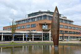
Pijnacker-Nootdorp
| Pijnacker-Nootdorp | |||
|---|---|---|---|
| Municipality | |||
|
Aerial view of Pijnacker | |||
| |||
.svg.png) Location in South Holland | |||
| Coordinates: 52°1′N 4°26′E / 52.017°N 4.433°ECoordinates: 52°1′N 4°26′E / 52.017°N 4.433°E | |||
| Country | Netherlands | ||
| Province | South Holland | ||
| Established | 1 January 2002[1] | ||
| Government[2] | |||
| • Body | Municipal council | ||
| • Mayor | Rik Buddenberg (CDA) | ||
| Area[3] | |||
| • Total | 38.61 km2 (14.91 sq mi) | ||
| • Land | 37.36 km2 (14.42 sq mi) | ||
| • Water | 1.25 km2 (0.48 sq mi) | ||
| Elevation[4] | −2 m (−7 ft) | ||
| Population (May 2014)[5] | |||
| • Total | 51,148 | ||
| • Density | 1,369/km2 (3,550/sq mi) | ||
| Time zone | CET (UTC+1) | ||
| • Summer (DST) | CEST (UTC+2) | ||
| Postcode | 2630–2632, 2640–2645 | ||
| Area code | 015 | ||
| Website |
www | ||


Pijnacker-Nootdorp ([ˈpɛi̯nʔɑkər ˈnoːtdɔrp] population: 51,148 in 2014) is a suburban municipality in the Randstad conurbation in the Netherlands, in the province of South Holland. The municipality covers an area of 38.61 km2 (14.91 sq mi) of which 1.25 km2 (0.48 sq mi) is water.
The municipality of Pijnacker-Nootdorp comprises the following towns, villages and townships: Delfgauw, Nootdorp, Oude Leede, Pijnacker and (parts of) newly built Ypenburg. It is the result of merging the municipalities of Pijnacker and Nootdorp in 2002, with parts being annexed by neighbouring The Hague. It is part of the Haaglanden conurbation centred on The Hague, but it is also close to Delft and Rotterdam.
Nootdorp is connected to The Hague through the Randstadrail public transport system, and also with a tram line.
Topography

Dutch Topographic map of the municipality of Pijnacker-Nootdorp, June 2015
See also
References
- ↑ "Gemeentelijke indeling op 1 januari 2002" [Municipal divisions on 1 January 2002]. cbs.nl (in Dutch). CBS. Retrieved 18 August 2013.
- ↑ "Burgemeester Rik Buddenberg" [Mayor Rik Buddenberg] (in Dutch). Gemeente Pijnacker-Nootdorp. Retrieved 18 August 2013.
- ↑ "Kerncijfers wijken en buurten" [Key figures for neighbourhoods]. CBS Statline (in Dutch). CBS. 2 July 2013. Retrieved 12 March 2014.
- ↑ "Postcodetool for 2641EZ". Actueel Hoogtebestand Nederland (in Dutch). Het Waterschapshuis. Retrieved 18 August 2013.
- ↑ "Bevolkingsontwikkeling; regio per maand" [Population growth; regions per month]. CBS Statline (in Dutch). CBS. 26 June 2014. Retrieved 24 July 2014.
External links
| Wikimedia Commons has media related to Pijnacker-Nootdorp. |
 |
The Hague | Zoetermeer | | |
| |
Lansingerland | |||
| ||||
| | ||||
| Delft | Rotterdam |
