Alblasserdam
| Alblasserdam | |||
|---|---|---|---|
| Municipality | |||
|
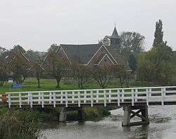
Church in Alblasserdam | |||
| |||
.svg.png) Location in South Holland | |||
| Coordinates: 51°52′N 4°39′E / 51.867°N 4.650°ECoordinates: 51°52′N 4°39′E / 51.867°N 4.650°E | |||
| Country | Netherlands | ||
| Province | South Holland | ||
| Government[1] | |||
| • Body | Municipal council | ||
| • Mayor | Jan Heijkoop (acting) | ||
| Area[2] | |||
| • Total | 10.06 km2 (3.88 sq mi) | ||
| • Land | 8.79 km2 (3.39 sq mi) | ||
| • Water | 1.27 km2 (0.49 sq mi) | ||
| Elevation[3] | 4 m (13 ft) | ||
| Population (May 2014)[4] | |||
| • Total | 19,838 | ||
| • Density | 2,257/km2 (5,850/sq mi) | ||
| Demonym(s) | Alblasserdammer | ||
| Time zone | CET (UTC+1) | ||
| • Summer (DST) | CEST (UTC+2) | ||
| Postcode | 2950–2954 | ||
| Area code | 078 | ||
| Website |
www | ||


Alblasserdam (Dutch: [ɑlˌblɑsərˈdɑm]) is a town and municipality in the western Netherlands, in the province of South Holland. It covers an area of 10.06 km2 (3.88 sq mi), of which 1.27 km2 (0.49 sq mi) is water, and has a population of 19,838 as of 2014. Alblasserdam is officially a part of the Drechtsteden region. A portion of the small village of Kinderdijk, which boasts the largest and most famous concentration of windmills in the Netherlands, is part of Alblasserdam.
Etymology
The name Alblasserdam is derived from its location near the creek Alblas where a dam was built. Inhabitants of Alblasserdam are called Alblasserdammers (singular: Alblasserdammer).
History
13th-19th century
The town of Alblasserdam was first mentioned in the chronicles of Melis Stoke in 1299, but the municipality wasn't formed until 1447. Before that, it was part of Oud-Alblas.
Because of its location on the Noord river, one of the busiest waterways in Western Europe, water has played a major role in Alblasserdam's history. The river was important for its development and makes it an advantageous location for industry. Alblasserdam's strategic location also brought it negative consequences. For example, between 1350 and 1821, the Alblasserwaard polder flooded 32 times.
20th century
During World War I, mayor Simon Berman[5] and the local government of Alblasserdam kept busy with 60 Belgian refugees within the municipal boundaries.[6] An ad-hoc municipal fund for the unemployed was established.[6]
Alblasserdam suffered during the German raid on Rotterdam on May 11, 1940, when its town centre was severely damaged. The historic Kerkstraat (Church Street) and the characteristic dike construction along the river, however, were spared.
The North Sea flood of 1953 also affected a portion of Alblasserdam. The Delta Works program included reinforcements to the dikes and improvement of the locks. Therefore, water no longer poses a direct danger to Alblasserdam.
In 1999 the town celebrated its 700th anniversary.
21st century
Bert Blase served as mayor from 1999 to 2014, when he was appointed as mayor of Vlaardingen. Since then, the mayor of Hendrik-Ido-Ambacht, Jan Heijkoop, also acts as mayor Alblasserdam until the appointment of a new mayor by the Dutch government.[7]
Public transportation
- Waterbus route 1:
- Rotterdam Willemskade - Krimpen aan den IJssel Stormpolder - Ridderkerk De Schans - Alblasserdam Kade - Dordrecht Merwekade.

Sister and twin cities
References
- ↑ "Portefeuilleverdeling" [Task distribution]. Bestuur en Organisatie (in Dutch). Gemeente Alblasserdam. Retrieved 15 June 2013.
- ↑ "Kerncijfers wijken en buurten" [Key figures for neighbourhoods]. CBS Statline (in Dutch). CBS. 2 July 2013. Retrieved 12 March 2014.
- ↑ "Postcodetool for 2951 ED". Actueel Hoogtebestand Nederland (in Dutch). Het Waterschapshuis. Retrieved 16 June 2013.
- ↑ "Bevolkingsontwikkeling; regio per maand" [Population growth; regions per month]. CBS Statline (in Dutch). CBS. 26 June 2014. Retrieved 24 July 2014.
- ↑ "Geinstalleerd" [Installed]. Nieuwe Tilburgsche Courant. 36 (5952). 1914-06-11.
Woensdag is de edelachtb. heer S. Berman als burgemeester van Alblasserdam geïnstalleerd. Door den waarnemenden burgemeester en oudste raadslid werden hartelijke woorden gesproken, waarvoor de burgemeester zijn vriendelijken en warmen dank bracht, terwijl hij dén wensch uitsprak, dat even spoedig een geschikte woning gevonden worde, opdat hij als burgervader in Zijne gemeente kan wonen. Van de gelegenheid tot receptie werd druk gebruik gemaakt. Alhoewel de afhaling niet feestelijk geschiedde, was van verscheidene gebouwen toch de driekleur uitgestoken.
- 1 2 Boersma, Pieter (1939). Alblasserdam's heden en verleden, in honderd opstellen beschreven [Alblasserdam's present and past, described in hundred essays]. Gorinchem: Noorduyn.
Kort na de in functie treding van Burgemeester S. Berman, brak de wereldoorlog uit. Vele nieuwe vraagstukken ontstonden daardoor en het Gemeentebestuur kwam voor uitzonderlijke moeilijkheden te staan. Zoo waren een 60-tal Belgische vluchtelingen ingekwartierd en in verband met de tijdsomstandigheden dorst Burgemeester Berman het aan om des Zondags de herbergen te sluiten. Het was dezen Burgemeester overigens ernst met het eerbiedigen van Gods heilige ordinantiën. Trouw woonde hij de godsdienstoefeningen der Ned. Herv. Kerk bij, aldus der burgerij het goede voorbeeld gevende. Er werd tijdelijk een gemeentelijk werkloozenfonds gesticht.
- ↑ "College van burgemeester en wethouders - Bestuur en Organisatie Alblasserdam".
External links
 Media related to Alblasserdam at Wikimedia Commons
- Official website
 |
Ridderkerk / Noord | | ||
| Hendrik-Ido-Ambacht / Noord | |
Molenwaard | ||
| ||||
| | ||||
| Papendrecht |
