Zuidplas
| Zuidplas | |||
|---|---|---|---|
| Municipality | |||
|
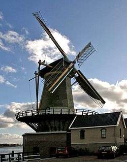
Wind mill "Windlust" in Nieuwerkerk aan den IJssel | |||
| |||
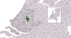 Location in South Holland | |||
| Coordinates: 51°58′N 4°37′E / 51.967°N 4.617°ECoordinates: 51°58′N 4°37′E / 51.967°N 4.617°E | |||
| Country | Netherlands | ||
| Province | South Holland | ||
| Established | 1 January 2010[1] | ||
| Government[2] | |||
| • Body | Municipal council | ||
| • Mayor | Gert-Jan Kats (SGP) | ||
| Area[3] | |||
| • Total | 62.42 km2 (24.10 sq mi) | ||
| • Land | 59.37 km2 (22.92 sq mi) | ||
| • Water | 3.05 km2 (1.18 sq mi) | ||
| Elevation[4] | −6 m (−20 ft) | ||
| Lowest elevation[5] | −6.76 m (−22.18 ft) | ||
| Population (May 2014)[6] | |||
| • Total | 40,838 | ||
| • Density | 688/km2 (1,780/sq mi) | ||
| Time zone | CET (UTC+1) | ||
| • Summer (DST) | CEST (UTC+2) | ||
| Postcode | 2750–2761, 2840–2841, 2910–2914 | ||
| Area code | 0180, 0182, 079 | ||
| Website |
www | ||


Zuidplas[7] is a new municipality by 1 January 2010. Joining of Moordrecht, Nieuwerkerk aan den IJssel and Zevenhuizen-Moerkapelle.
Topography
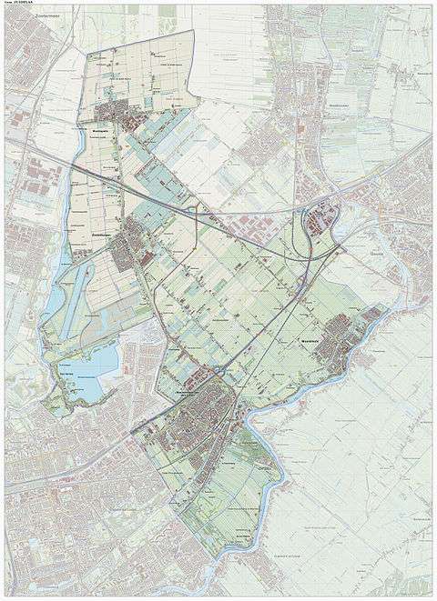
Dutch Topographic map of the municipality of Zuidplas, Sept. 2014.
References
- ↑ "Gemeentelijke indeling op 1 januari 2010" [Municipal divisions on 1 January 2010]. cbs.nl (in Dutch). CBS. Retrieved 31 August 2013.
- ↑ "College van B&W" [Board of mayor and aldermen] (in Dutch). Gemeente Zuidplas. Retrieved 31 August 2013.
- ↑ "Kerncijfers wijken en buurten" [Key figures for neighbourhoods]. CBS Statline (in Dutch). CBS. 2 July 2013. Retrieved 12 March 2014.
- ↑ "Postcodetool for 2914KM". Actueel Hoogtebestand Nederland (in Dutch). Het Waterschapshuis. Retrieved 31 August 2013.
- ↑ "Laagste punt van Nederland" [Lowest point of the Netherlands] (in Dutch). Gemeente Zuidplas. Retrieved 31 August 2013.
- ↑ "Bevolkingsontwikkeling; regio per maand" [Population growth; regions per month]. CBS Statline (in Dutch). CBS. 26 June 2014. Retrieved 24 July 2014.
- ↑ Naam fusie gemeente wordt Zuidplas Archived September 11, 2009, at the Wayback Machine., Gemeente Nieuwerkerk aan den IJssel. Website visited 2 January 2009
External links
 |
Alphen aan den Rijn | Waddinxveen | | |
| Lansingerland | |
Gouwe / Gouda | ||
| ||||
| | ||||
| Rotterdam | Capelle aan den IJssel | Hollandse IJssel / Ouderkerk |

This article is issued from Wikipedia - version of the 11/18/2016. The text is available under the Creative Commons Attribution/Share Alike but additional terms may apply for the media files.