Petite-Vallée, Quebec
| Petite-Vallée | |
|---|---|
| Municipality | |
 | |
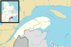
 Location within La Côte-de-Gaspé RCM. | |
 Petite-Vallée Location in eastern Quebec. | |
| Coordinates: 49°13′N 65°02′W / 49.217°N 65.033°WCoordinates: 49°13′N 65°02′W / 49.217°N 65.033°W[1] | |
| Country |
|
| Province |
|
| Region | Gaspésie–Îles-de-la-Madeleine |
| RCM | La Côte-de-Gaspé |
| Constituted | January 1, 1957 |
| Government[2] | |
| • Mayor | Rodrigue Brousseau |
| • Federal riding | Gaspésie—Îles-de-la-Madeleine |
| • Prov. riding | Gaspé |
| Area[2][3] | |
| • Total | 40.80 km2 (15.75 sq mi) |
| • Land | 39.28 km2 (15.17 sq mi) |
| Population (2011)[3] | |
| • Total | 178 |
| • Density | 4.5/km2 (12/sq mi) |
| • Pop 2006-2011 |
|
| • Dwellings | 97 |
| Time zone | EST (UTC−5) |
| • Summer (DST) | EDT (UTC−4) |
| Postal code(s) | G0E 1Y0 |
| Area code(s) | 418 and 581 |
| Highways |
|
Petite-Vallée is a municipality in the Gaspésie-Îles-de-la-Madeleine region of the province of Quebec in Canada.
The municipality was formed in 1957, when it separated from the Township Municipality of Cloridorme. Its name (French for "Little Valley") describes its location in the hollow of a shallow valley and dates back to at least 1754 when it appeared on a map by Jacques-Nicolas Bellin.[1]
Demographics
Population
| Canada census – Petite-Vallée, Quebec community profile | |||
|---|---|---|---|
| 2011 | 2006 | 2001 | |
| Population: | 178 (-28.2% from 2006) | 248 (+14.8% from 2001) | 216 (-3.6% from 1996) |
| Land area: | 39.28 km2 (15.17 sq mi) | 39.28 km2 (15.17 sq mi) | 39.28 km2 (15.17 sq mi) |
| Population density: | 4.5/km2 (12/sq mi) | 6.3/km2 (16/sq mi) | 5.5/km2 (14/sq mi) |
| Median age: | 56.0 (M: 57.0, F: 55.0) | 50.0 (M: 48.5, F: 51.0) | 44.3 (M: 43.2, F: 44.8) |
| Total private dwellings: | 97 | 112 | 96 |
| Median household income: | $.N/A | $.N/A | $.N/A |
| Notes: Income data for this area has been suppressed for data quality or confidentiality reasons. – References: 2011[3] 2006[4] 2001[5] | |||
| Historical Census Data - Petite-Vallée, Quebec[6] | ||||||||||||||||||||||||||
|---|---|---|---|---|---|---|---|---|---|---|---|---|---|---|---|---|---|---|---|---|---|---|---|---|---|---|
|
|
| ||||||||||||||||||||||||
Language
| Canada Census Mother Tongue - Petite-Vallée, Quebec[6] | ||||||||||||||||||
|---|---|---|---|---|---|---|---|---|---|---|---|---|---|---|---|---|---|---|
| Census | Total | French |
English |
French & English |
Other | |||||||||||||
| Year | Responses | Count | Trend | Pop % | Count | Trend | Pop % | Count | Trend | Pop % | Count | Trend | Pop % | |||||
| 2011 |
175 |
175 | |
100.00% | 0 | |
0.00% | 0 | |
0.00% | 0 | |
0.00% | |||||
| 2006 |
260 |
260 | |
100.00% | 0 | |
0.00% | 0 | |
0.00% | 0 | |
0.00% | |||||
| 2001 |
225 |
225 | |
100.00% | 0 | |
0.00% | 0 | |
0.00% | 0 | |
0.00% | |||||
| 1996 |
195 |
195 | n/a | 100.00% | 0 | n/a | 0.00% | 0 | n/a | 0.00% | 0 | n/a | 0.00% | |||||
See also
References
- 1 2 "Petite-Vallée (Municipalité)" (in French). Commission de toponymie du Québec. Retrieved 2011-12-06.
- 1 2 "Petite-Vallée". Répertoire des municipalités (in French). Ministère des Affaires municipales, des Régions et de l'Occupation du territoire. Retrieved 2011-12-06.
- 1 2 3 "Petite-Vallée census profile". 2011 Census data. Statistics Canada. Retrieved 2011-12-06.
- ↑ "2006 Community Profiles". Canada 2006 Census. Statistics Canada. March 30, 2011. Retrieved 2011-12-06.
- ↑ "2001 Community Profiles". Canada 2001 Census. Statistics Canada. February 17, 2012. Retrieved 2011-12-06.
- 1 2 Statistics Canada: 1996, 2001, 2006, 2011 census
 |
Honguedo Strait | | ||
| Grande-Vallée | |
Cloridorme | ||
| ||||
| | ||||
| Cloridorme |
| Cities | |
|---|---|
| Municipalities | |
| Townships | |
| Unorganized Territories | |
| |
This article is issued from Wikipedia - version of the 4/19/2014. The text is available under the Creative Commons Attribution/Share Alike but additional terms may apply for the media files.