Cloridorme, Quebec
| Cloridorme | |
|---|---|
| Township municipality | |
 Location within La Côte-de-Gaspé RCM. | |
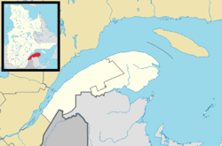 Cloridorme Location in eastern Quebec. | |
| Coordinates: 49°11′N 64°50′W / 49.183°N 64.833°WCoordinates: 49°11′N 64°50′W / 49.183°N 64.833°W[1] | |
| Country |
|
| Province |
|
| Region |
Gaspésie– Îles-de-la-Madeleine |
| RCM | La Côte-de-Gaspé |
| Settled | 1838 |
| Constituted | January 1, 1885 |
| Government[2] | |
| • Mayor | Jocelyne Huet |
| • Federal riding |
Gaspésie— Îles-de-la-Madeleine |
| • Prov. riding | Gaspé |
| Area[2][3] | |
| • Total | 160.60 km2 (62.01 sq mi) |
| • Land | 160.22 km2 (61.86 sq mi) |
| Population (2011)[3] | |
| • Total | 743 |
| • Density | 4.6/km2 (12/sq mi) |
| • Pop 2006-2011 |
|
| • Dwellings | 412 |
| Time zone | EST (UTC−5) |
| • Summer (DST) | EDT (UTC−4) |
| Postal code(s) | G0E 1G0 |
| Area code(s) | 418 and 581 |
| Highways |
|
| Website |
canton-de-cloridorme |
Cloridorme is a township municipality in the Gaspe Peninsula, Quebec, Canada. Cloridorme's economy is centered on fishing. Its population, according to the 2006 Canadian Census was 764.[4] The township stretches for 16 kilometres (10 mi) along the Gulf of Saint Lawrence and includes Cloridorme Bay where the Little and Great Cloridorme Rivers have their mouths.
In addition to the village of Cloridorme itself, the township's territory also includes the communities of Cloridorme-Ouest, Petite-Anse, Pointe-à-la-Frégate, and Saint-Yvon.
The name Cloridorme is of uncertain origin. It is believed that it was named after an early settler from the early 19th century named Cloridan Côté, originally from Saint-Thomas-de-Montmagny. But this is unlikely since the name had been in use since the 18th century. A map of 1755 shows the plural form "Les Cloridormes", which had changed to "Les Chlorydormes" by the 19th century and remained in use until the early 20th century.[1]
History
The area was first settled in 1838 by people from Montmagny. In 1853, a mission was set up, called Sainte-Cécile-de-Cloridorme. In 1871, the geographic township was formed, the following year the post office opened, and the year after that, the mission became a parish. In 1885, the Township Municipality of Cloridorme was established.[1]
In 1957, the township lost a portion of its territory when Petite-Vallée became a separate incorporated municipality.[5]
Demographics
Population
| Canada census – Cloridorme, Quebec community profile | |||
|---|---|---|---|
| 2011 | 2006 | 2001 | |
| Population: | 743 (-2.7% from 2006) | 764 (-16.7% from 2001) | 917 (-15.4% from 1996) |
| Land area: | 160.22 km2 (61.86 sq mi) | 160.22 km2 (61.86 sq mi) | 160.22 km2 (61.86 sq mi) |
| Population density: | 4.6/km2 (12/sq mi) | 4.8/km2 (12/sq mi) | 5.7/km2 (15/sq mi) |
| Median age: | 55.0 (M: 53.9, F: 55.5) | 51.4 (M: 51.2, F: 51.8) | 45.5 (M: 44.8, F: 46.1) |
| Total private dwellings: | 412 | 382 | 402 |
| Median household income: | $36,768 | $36,436 | $28,824 |
| References: 2011[3] 2006[6] 2001[7] | |||
| Historical Census Data - Cloridorme, Quebec[8] | ||||||||||||||||||||||||||
|---|---|---|---|---|---|---|---|---|---|---|---|---|---|---|---|---|---|---|---|---|---|---|---|---|---|---|
|
|
| ||||||||||||||||||||||||
Language
| Canada Census Mother Tongue - Cloridorme, Quebec[8] | ||||||||||||||||||
|---|---|---|---|---|---|---|---|---|---|---|---|---|---|---|---|---|---|---|
| Census | Total | French |
English |
French & English |
Other | |||||||||||||
| Year | Responses | Count | Trend | Pop % | Count | Trend | Pop % | Count | Trend | Pop % | Count | Trend | Pop % | |||||
| 2011 |
740 |
740 | |
100.0% | 0 | |
0.0% | 0 | |
0.0% | 0 | |
0.0% | |||||
| 2006 |
765 |
755 | |
98.69% | 10 | |
1.31% | 0 | |
0.0% | 0 | |
0.0% | |||||
| 2001 |
905 |
905 | |
97.26% | 0 | |
0.0% | 0 | |
0.0% | 0 | |
0.0% | |||||
| 1996 |
1,090 |
1,090 | n/a | 100.0% | 0 | n/a | 0.0% | 0 | n/a | 0.0% | 0 | n/a | 0.0% | |||||
See also
References
- 1 2 3 "Cloridorme (Municipalité de canton)" (in French). Commission de toponymie du Québec. Retrieved 2011-12-05.
- 1 2 "Cloridorme". Répertoire des municipalités (in French). Ministère des Affaires municipales, des Régions et de l'Occupation du territoire. Retrieved 2011-12-05.
- 1 2 3 "Cloridorme census profile". 2011 Census data. Statistics Canada. Retrieved 2011-12-05.
- ↑ "Cloridorme community profile". 2006 Census data. Statistics Canada. Retrieved 2011-12-05.
- ↑ "Petite-Vallée (Municipalité)" (in French). Commission de toponymie du Québec. Retrieved 2011-12-06.
- ↑ "2006 Community Profiles". Canada 2006 Census. Statistics Canada. March 30, 2011. Retrieved 2011-12-05.
- ↑ "2001 Community Profiles". Canada 2001 Census. Statistics Canada. February 17, 2012. Retrieved 2011-12-05.
- 1 2 Statistics Canada: 1996, 2001, 2006, 2011 census
External links
 |
Petite-Vallée | Honguedo Strait | | |
| Grande-Vallée | |
Rivière-Saint-Jean | ||
| ||||
| | ||||
| Rivière-Saint-Jean |
| Cities | |
|---|---|
| Municipalities | |
| Townships | |
| Unorganized Territories | |
| |