Sagamok Anishnawbek First Nation
| Sagamok | |
|---|---|
| Indian reserve | |
| Sagamok Indian Reserve | |
|
Council building | |
 Sagamok | |
| Coordinates: 46°10′N 82°13′W / 46.167°N 82.217°WCoordinates: 46°10′N 82°13′W / 46.167°N 82.217°W | |
| Country |
|
| Province |
|
| District | Algoma |
| First Nation | Sagamok Anishnawbek |
| Government | |
| • Chief | Paul Eshkakogan |
| Area[1] | |
| • Land | 98.72 km2 (38.12 sq mi) |
| Population (2011)[1] | |
| • Total | 1,036 |
| • Density | 10.5/km2 (27/sq mi) |
| Website | www.sagamok.ca |

The Sagamok Anishnawbek First Nation, also known as Many Rivers Joining-Human Beings,[2] is a First Nations band government located in Ontario, Canada. Sagamok's culture and language is Anishinabek and is made up of the Ojibwe, Odawa and Pottawatomi bands. The Sagamok occupy the Sagamok reserve approximately 120 kilometres west of Sudbury, Ontario, and have a population of approximately 1400.[3]
In the early years of Canada's development, the French relied on Sagamok's strategic location to trade with the local Anishnaabe people of that time.[2] The French base of operations was the nearby Fort La Cloche.
See also
External links
References
- 1 2 "Sagamok census profile". 2011 Census of Population. Statistics Canada. Retrieved 20 June 2015.
- 1 2 http://www.circletrail.com/misc/ourpartners.php
- ↑ Wadden, Marie (2009). Where the Pavement Ends. Douglas & McIntyre. p. 190. ISBN 978-1-55365-461-2.
 |
Sables-Spanish Rivers | | ||
| Spanish | |
Unorganized South East Algoma | ||
| ||||
| | ||||
| North Channel |
| Cities | 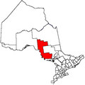 | |
|---|---|---|
| Towns | ||
| Townships | ||
| Villages | ||
| First Nations | ||
| Indian reserves | ||
| Local services boards | ||
| Unorganized areas | ||
| ||
This article is issued from Wikipedia - version of the 10/11/2016. The text is available under the Creative Commons Attribution/Share Alike but additional terms may apply for the media files.