Ohio State Route 44
| ||||
|---|---|---|---|---|
|
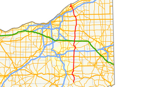
Route of SR 44 highlighted in red | ||||
| Route information | ||||
| Maintained by ODOT | ||||
| Length: | 81.23 mi[1] (130.73 km) | |||
| Existed: | 1924 – present | |||
| Major junctions | ||||
| South end: |
| |||
|
| ||||
| North end: | CR 518 at Headlands Beach State Park, in Painesville Township | |||
| Location | ||||
| Counties: | Stark, Portage, Geauga, Lake | |||
| Highway system | ||||
| ||||

State Route 44 (SR 44) is a north–south state highway in the northeastern portion of Ohio, a U.S. state. It runs from a southern terminus at State Route 43 in Waynesburg to a northern terminus at the entrance to Headlands Beach State Park near Painesville. spans from Painesville Township in the north to Waynesburg in the south. Various sections of SR 44 are named for individuals.[2]
Major junctions
| County | Location | mi | km | Exit | Destinations | Notes |
|---|---|---|---|---|---|---|
| Stark | Sandy Township | 0.00 | 0.00 | |||
| Osnaburg Township | 7.84 | 12.62 | Southern end of US 30 concurrency | |||
| East Canton | 8.68 | 13.97 | Northern end of US 30 concurrency | |||
| 8.84 | 14.23 | |||||
| Louisville | 12.74 | 20.50 | ||||
| Nimishillen Township | 14.28– 14.52 | 22.98– 23.37 | Interchange | |||
| Nimishillen–Marlboro township line | 17.19 | 27.66 | Western terminus of SR 173 | |||
| Marlboro Township | 20.69 | 33.30 | ||||
| Portage | Randolph Township | 26.10 | 42.00 | |||
| Rootstown Township | 31.52– 31.70 | 50.73– 51.02 | Exit 38 (I-76); southern end of SR 5 concurrency | |||
| 31.97 | 51.45 | SR 44C / CR 74 (South Prospect Street) – Ravenna | Northbound exit / southbound entrance only; southern terminus of unsigned SR 44C | |||
| Ravenna Township | 34.98– 35.39 | 56.29– 56.95 | Interchange; northern end of SR 5 concurrency; southern end of SR 14 concurrency | |||
| 35.73 | 57.50 | |||||
| Ravenna | 37.30 | 60.03 | ||||
| Ravenna Township | 38.10 | 61.32 | Northern end of SR 14 concurrency | |||
| Shalersville Township | 42.37 | 68.19 | ||||
| 42.81– 43.07 | 68.90– 69.31 | Exit 193 (Ohio Tpk.) | ||||
| Mantua Township | 47.40 | 76.28 | ||||
| Geauga | Auburn Township | 52.50– 52.59 | 84.49– 84.64 | Exit 29 (US 422) | ||
| Newbury Township | 58.85 | 94.71 | ||||
| Munson Township | 63.12 | 101.58 | ||||
| Chardon | 66.55 | 107.10 | Southern end of US 6 concurrency | |||
| 66.80 | 107.50 | Northern end of US 6 concurrency | ||||
| Lake | Concord Township | 73.65– 73.89 | 118.53– 118.91 | Exit 200 (I-90) | ||
| Southern end of freeway | ||||||
| 75.35– 75.96 | 121.26– 122.25 | 75 | ||||
| Painesville | 77.00 | 123.92 | 76 | Southbound exit; northbound entrance | ||
| Painesville Township | 77.56– 78.22 | 124.82– 125.88 | 77 | Southern end of SR 2 concurrency; exit 221 (SR 2) | ||
| Mentor | 78.68– 78.83 | 126.62– 126.86 | 220 | Northern end of SR 2 concurrency | ||
| Northern end of freeway | ||||||
| 79.40– 79.68 | 127.78– 128.23 | 79 | Interchange | |||
| Painesville Township | 81.23 | 130.73 | CR 518 (Headlands Road) / Headlands Beach State Park entrance | |||
1.000 mi = 1.609 km; 1.000 km = 0.621 mi
| ||||||
SR 44C
State Route 44C (SR 44C) is the 0.19-mile (0.31 km) approach of former SR 44 to the State Route 44/State Route 5 interchange in Rootstown Township, just north of Interstate 76.[3]
References
- ↑ "DESTAPE". Ohio Department of Transportation. July 3, 2014. Retrieved October 1, 2014.
- ↑ Ohio Revised Code Chapter 5533
- ↑ Ohio Department of Transportation. "Technical Services Straight Line Diagrams: SR 44-C" (PDF). Retrieved January 5, 2014.
This article is issued from Wikipedia - version of the 11/25/2016. The text is available under the Creative Commons Attribution/Share Alike but additional terms may apply for the media files.