Interstate 76 in Ohio
| ||||
|---|---|---|---|---|
_map.svg.png) | ||||
| Route information | ||||
| Maintained by Ohio DOT and OTC | ||||
| Length: | 81.65 mi[1] (131.40 km) | |||
| Existed: | 1956 – present | |||
| Major junctions | ||||
| West end: |
| |||
|
| ||||
| East end: |
| |||
| Highway system | ||||
| ||||

In the U.S. state of Ohio, Interstate 76 (I-76) runs for 82 miles (132 km) from Interstate 71 south of Cleveland to the Pennsylvania state line south of Youngstown. Once numbered Interstate 80S, Interstate 76 now comprises the easternmost leg of the Ohio Turnpike.
Route description
The western terminus of Interstate 76 is at an interchange with Interstate 71 east of Lodi, cosigned with U.S. Route 224. U.S. 224 continues west from that point as a regular road. From the interchange with I-71, I-76 crosses rural eastern Medina County and the southeastern Summit County cities of Barberton and Norton for 18 miles (29 km), cosigned with U.S. 224. The eastern terminus of the concurrency with U.S. 224 is in southwestern Akron, at an interchange with Interstate 277, the southern bypass of Akron. Between mile markers 18 and 20, I-76 runs north-south as part of a section known as the Kenmore leg, before returning to an east-west alignment.[2] The route runs concurrently with Interstate 77 for approximately 3 miles (4.8 km) in central Akron, between mile markers 20 and 23, with eastbound traffic joining southbound I-77 traffic. The eastern end of the concurrency with I-77 is at an area known as the central interchange, with southbound I-77 traffic exiting towards Canton. The interchange also serves as the southern end of State Route 8.[3]
Between the Akron and Youngstown areas, Interstate 76 passes through rural areas of southern Portage County near Kent and Ravenna, and western Mahoning County. West of Youngstown in Jackson Township, it intersects with Interstate 80 and the Ohio Turnpike in a double trumpet interchange. Interstate 76 eastbound traffic exits the freeway alignment to join the Ohio Turnpike, with westbound traffic exiting the toll road. I-76 eastbound travelers who remain on the freeway alignment transfer to Interstate 80 towards New York City via the Keystone Shortway, while westbound traffic remains on the turnpike as part of I-80 towards Cleveland. Between the interchange with I-80 and the Pennsylvania state line, Interstate 76 is part of the Ohio Turnpike in a southeast-northwest alignment for 21 miles (34 km) and connects with the Pennsylvania Turnpike at the Pennsylvania–Ohio state line. Though I-76 does not pass through the city of Youngstown, access is provided via exits to I-80, I-680, and State Route 7. As of 2016, the toll to travel the Interstate 76 portion of the Ohio Turnpike is $1.75. Motorists who use E-ZPass pay a discounted rate of $1.[4]
History
Exit list
| County | Location | mi | km | Exit | Destinations | Notes | |
|---|---|---|---|---|---|---|---|
| Medina | Westfield Township | 0.00 | 0.00 | Continuation beyond I-71; west end of US 224 overlap | |||
| 1 | Signed as exits 1A (south) and 1B (north) westbound; western terminus; I-71 exits 209A-B | ||||||
| Seville | 2.32 | 3.73 | 2 | ||||
| Wadsworth | 7.72 | 12.42 | 7 | ||||
| 9.76 | 15.71 | 9 | |||||
| 11.71 | 18.85 | 11 | |||||
| Summit | Norton | 13.32 | 21.44 | 13 | Signed as exits 13A (south) and 13B (north) | ||
| 14.65 | 23.58 | 14 | Cleveland–Massillon Road | ||||
| 16.19 | 26.06 | 16 | Barber Road | ||||
| Barberton | 17.53 | 28.21 | 17A | State Street | Eastbound exit and westbound entrance | ||
| 17.83 | 28.69 | 17B | Signed as exit 17 westbound | ||||
| Akron | 18.62 | 29.97 | 18 | East end of US 224 overlap. I-277 exit 1. | |||
| 19.04 | 30.64 | 19 | Battles Avenue, Kenmore Boulevard | ||||
| 20.45 | 32.91 | 20 | West end of I-77 overlap | ||||
| 20.79 | 33.46 | 21A | East Avenue | Westbound exit and eastbound entrance | |||
| 21.59 | 34.75 | 21B | Lakeshore Boulevard, Bowery Street | Eastbound exit and entrance | |||
| 21.73 | 34.97 | 21C | Eastbound exit and westbound entrance | ||||
| 21.77 | 35.04 | Westbound exit and eastbound entrance | |||||
| 22.39 | 36.03 | 22A | Main Street, Broadway Street – Downtown | ||||
| 22.79 | 36.68 | 22B | Wolf Ledges, Grant Street | ||||
| 23.57 | 37.93 | 23 | East end of I-77 overlap; signed as exits 23A (south) and 23B (north) | ||||
| 23.83 | 38.35 | 24A | Inman Street, Johnston Street | Westbound only exit | |||
| 24.34 | 39.17 | 24B | Arlington Street | Westbound exit and eastbound entrance | |||
| 24.71 | 39.77 | 24 | Arlington Street, Kelly Avenue | Eastbound exit and westbound entrance | |||
| 25.00 | 40.23 | 25A | Signed as exit 25 westbound | ||||
| 25.67 | 41.31 | 25B | Brittain Road | Eastbound exit and westbound entrance | |||
| 26.11 | 42.02 | 26 | Former SR 526 | ||||
| Springfield Township | 27.35 | 44.02 | 27 | ||||
| Tallmadge | 29.00 | 46.67 | 29 | ||||
| Portage | Brimfield Township | 31.31 | 50.39 | 31 | CR 18 (Tallmadge Road) | ||
| 33.04 | 53.17 | 33 | |||||
| Rootstown Township | 38.53 | 62.01 | 38 | Signed as exits 38A (south) and 38B (north) eastbound | |||
| Edinburg Township | 43.07 | 69.31 | 43 | ||||
| Palmyra Township | 48.58 | 78.18 | 48 | ||||
| Mahoning | Milton Township | 54.04 | 86.97 | 54 | |||
| Jackson Township | 57.25 | 92.13 | 57 | ||||
| 59.85 | 96.32 | — | Left exits | ||||
| Eastbound entrance only | |||||||
| — | Ohio Tpk. exit 218 | ||||||
| Overlap with Ohio Turnpike | |||||||
| Springfield Township | 82.12 | 132.16 | Continuation into Pennsylvania | ||||
1.000 mi = 1.609 km; 1.000 km = 0.621 mi
| |||||||
Interstate 76 / US 224 Alt
| |
|---|---|
| Location: | Summit County |
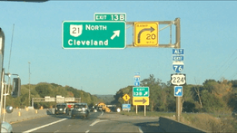
Interstate 76 / US 224 Alt is the designation of a route in Summit County. The route follows SR 21 northbound from I-76 in Norton, then follows I-77 southbound in Copley Township. The route terminates at I-76 in Akron. Signage exists along the route but it is not recognized in the Ohio Department of Transportation's records.
See also
 Ohio portal
 U.S. Roads portal
References
- ↑ "Route Log- Main Routes of the Eisenhower National System of Interstate and Defense Highways - Table 1". Retrieved 1 October 2014.
- ↑ Armon, Rick (July 16, 2015). "ODOT to reopen Kenmore leg of I-76 early Monday". Akron Beacon Journal. Retrieved October 10, 2016.
- ↑ Staff report (August 2, 2016). "Akron lane closures postponed at central interchange". Akron Beacon Journal. Retrieved October 10, 2016.
- ↑ "Fare calculator". Ohio Turnpike and Infrastructure Commission. 2016. Retrieved October 10, 2016. In calculator, use "218 - Niles–Youngstown" for the entrance and "239 - Eastgate" for the exit
| Previous state: Terminus |
Ohio | Next state: Pennsylvania |